New research shows that lower-quality public housing in the United States is located in areas with high flood risk.
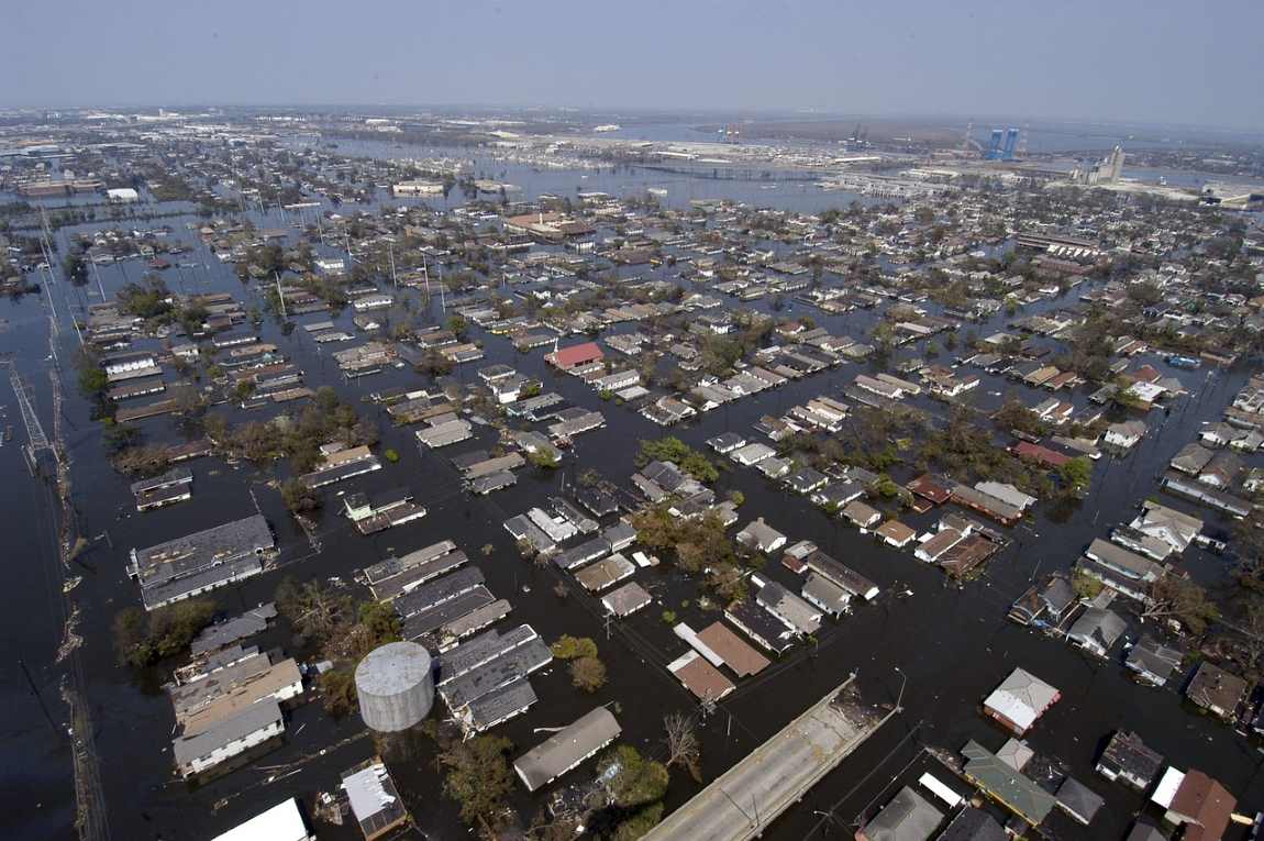
AUSTIN, TX, USA – Hurricane Helene highlighted the increasing intensity of extreme weather events and the catastrophic flooding they can bring. A new study finds that many Americans residing in lower-quality public housing face a high risk of experiencing flood-related damages as their homes are disproportionately located in areas of high flood risk.
A study by scientists from the Ohio State University and Texas A&M University has combined HUD’s physical inspection scores of public housing units across the country (from 2013-2020) with flood maps and risk indices from the Federal Emergency Management Agency (FEMA). Also included in the analysis is sociodemographic data — including race, income, age, and housing tenure — from the American Community Survey (ACS).
Preliminary findings suggest that lower-quality public housing structures (with lower inspection scores) are more likely to be located in a FEMA flood zone and in areas with higher flood risk as defined by FEMA’s National Risk Index. They are also more likely to be home to higher percentages of people of color.
Kelsea Best, assistant professor of Urban Climate Resilience and Adaptation Disparities in Ohio State University’s College of Engineering, will present the team’s research in December at the annual Society for Risk Analysis meeting in Austin, Texas.
“Our results reveal compounding vulnerabilities to flooding faced by residents of public housing across the U.S.,” says Best. “Those public housing residents with the least ability to recover are also more likely to experience flood events and incur significant damage.”
According to FEMA, a flood zone is any land that is susceptible to being flooded by water from any source, including rain, snow, coastal storms, storm surges and overflows of dams and other water systems. FEMA maintains flood maps that show how likely it is for an area to flood.
Any place with a 1 percent chance or higher chance of experiencing a flood each year is considered to have a high risk and is designated as a Special Flood Hazard Area (SFHA). Properties with government-backed mortgages in these designated high-risk areas are required to have flood insurance through the National Flood Insurance Program (NFIP).
Best points out that the aftermath of Hurricane Helene showed that catastrophic flooding can also happen outside of FEMA-designated floodplains. “The vast majority of damaged properties in places like Asheville, North Carolina, due to Hurricane Helene fell outside the FEMA flood zones,” says Best.
There is also evidence that low income people in mobile homes were severely impacted by the recent flooding events.
With climate change leading to more extreme weather and frequent flooding, the authors argue that future mitigation efforts should prioritize public housing located in areas at risk of flooding.
***
Kelsea Best is presenting this research on Monday, December 9, from 3:30 pm, at the JW Marriot Austin, Texas.
About SRA
The Society for Risk Analysis is a multidisciplinary, interdisciplinary, scholarly, international society that provides an open forum for all those interested in risk analysis. SRA was established in 1980. Since 1982, it has continuously published Risk Analysis: An International Journal, the leading scholarly journal in the field. For more information, visit www.sra.org.
Article Source:
Press Release/Material by Society for Risk Analysis
Featured image credit: Pixabay