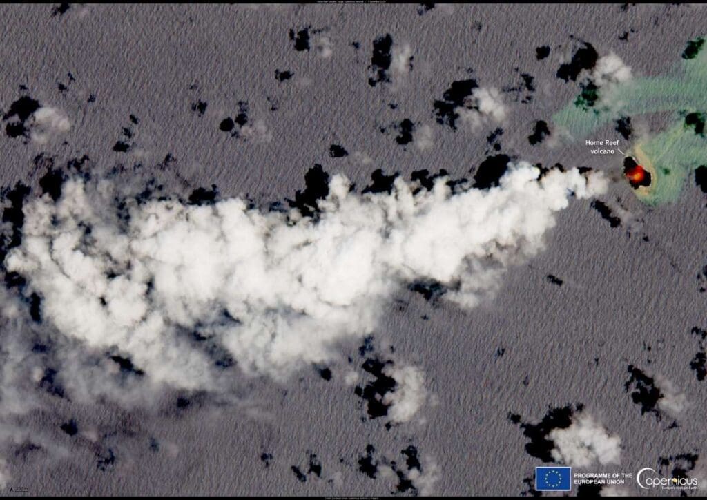
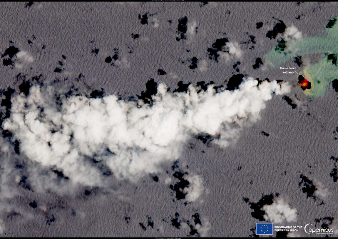
A new eruption has begun at the Home Reef volcano in Tonga on 7 December 2024, marking the second eruptive period at the site this year. Located in the Tonga Archipelago, Home Reef is known for its cyclical eruptions, which can last from several days to weeks, posing significant risks to surrounding regions.
The eruption was identified through satellite data from the European Union’s Copernicus Sentinel-2 satellites. A strong thermal anomaly was detected on the same day the eruption began, indicating elevated volcanic activity. The satellite imagery also revealed a plume of volcanic material extending horizontally over 8 kilometers from the volcano. These observations highlight the scale of the eruption and its potential to affect nearby communities.

The Home Reef volcano, while not constantly active, has a history of producing hazardous events, including tsunamis, ashfall, and pyroclastic flows. The January 2022 eruption caused extensive damage to nearby islands, and authorities have expressed concerns about similar hazards during this latest eruption.
This marks the second eruption from Home Reef in 2024, following a period of activity between June and July. The ongoing monitoring of volcanic activity in the region is essential for mitigating risks and preparing for any further developments. As the eruption continues, authorities and scientists will closely monitor the situation to assess its impact on the surrounding islands and the broader Pacific region.
The Copernicus Sentinel-2 satellites are a vital tool in global volcanic monitoring, offering valuable insights into volcanic hazards and their potential effects on local populations and ecosystems. Their observations help improve the accuracy of predictions and enhance preparedness for natural disasters, ultimately saving lives and reducing damage in vulnerable areas.
Featured image credit: European Union, Copernicus Sentinel-2 imagery


