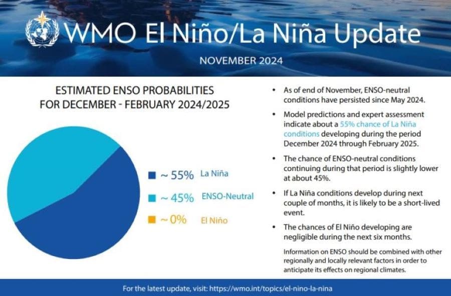
The World Meteorological Organization (WMO) has forecast a 55% likelihood of La Niña conditions developing between December 2024 and February 2025. However, this event is expected to be relatively weak and short-lived, with a return to neutral conditions likely during February-April 2025.
These findings come from the latest updates by the WMO’s Global Producing Centres of Long-Range Forecasts.
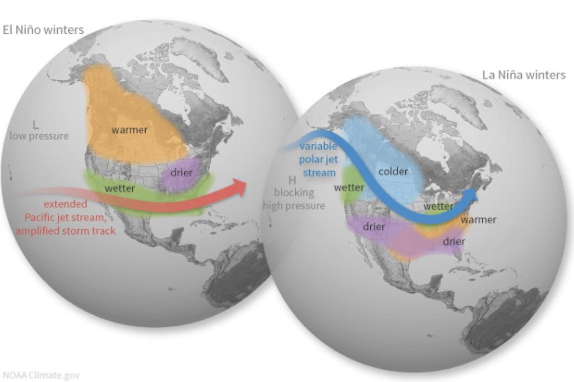
La Niña refers to the large-scale cooling of sea surface temperatures in the central and eastern equatorial Pacific Ocean, typically lasting several months and impacting global climate patterns during its duration. This phenomenon is often accompanied by shifts in tropical atmospheric circulation, such as winds, pressure patterns, and rainfall distribution. Its impacts on global climate typically contrast with those of El Niño, especially in tropical regions.
Nevertheless, La Niña’s potential cooling effect occurs within the broader context of human-induced climate change, which continues to raise global temperatures and exacerbate extreme weather events.
WMO Secretary-General Celeste Saulo emphasized this interplay, stating: “The year 2024 started out with El Niño and is on track to be the hottest on record. Even if a La Niña event does emerge, its short-term cooling impact will be insufficient to counterbalance the warming effect of record heat-trapping greenhouse gases in the atmosphere.”

Since May, ENSO-neutral conditions have persisted, with sea surface temperatures in the central and eastern Pacific remaining slightly below average. However, the slow development of La Niña can partly be attributed to strong westerly wind anomalies observed between September and early November 2024, which are generally unfavorable for its formation. While this cooling aligns with La Niña patterns, it has not yet reached thresholds typically associated with the phenomenon. The slower development may partly stem from strong westerly wind anomalies observed between September and early November 2024, which are generally unfavorable for La Niña formation.
The ongoing climate crisis has rendered many extreme weather events increasingly common, even outside ENSO phases. “Even in the absence of El Niño or La Niña conditions since May, we have witnessed an extraordinary series of extreme weather events, including record-breaking rainfall and flooding which have unfortunately become the new norm in our changing climate,” Saulo added.
Global seasonal climate update highlights warming trends
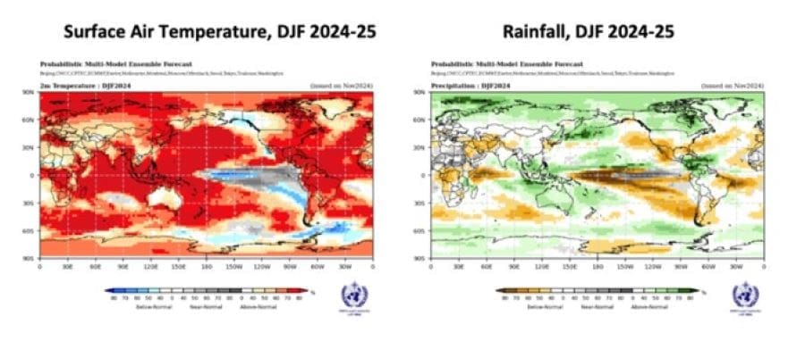
Beyond ENSO influences, WMO’s Global Seasonal Climate Updates (GSCU) incorporate other major climate variability drivers such as the North Atlantic Oscillation, the Arctic Oscillation, and the Indian Ocean Dipole. The latest GSCU suggests widespread above-normal sea surface temperatures in nearly all ocean basins, apart from the near-equatorial eastern Pacific Ocean, where weak La Niña conditions may emerge. This warming is projected to lead to above-average land temperatures globally over the coming months.

Rainfall predictions for December 2024 to February 2025 align with typical La Niña patterns, with enhanced positive east-to-west sea surface temperature gradients influencing precipitation distributions. Probabilistic forecasts highlight regions with the highest likelihood of above-normal, below-normal, or near-normal rainfall during this period, based on a 1993-2009 baseline.
Seasonal climate forecasts, such as those provided by the WMO, are vital tools for informing climate-sensitive sectors and supporting early warning systems. These forecasts enable governments, the United Nations, and other stakeholders to protect lives and livelihoods by anticipating and adapting to climatic variations.
WMO’s Regional Climate Centres and National Meteorological and Hydrological Services will continue to monitor ENSO conditions closely in the coming months, ensuring that timely updates guide decision-making and preparedness efforts.
Article Source:
Press Release/Material by World Meteorological Organization
Featured image credit: NOAA


