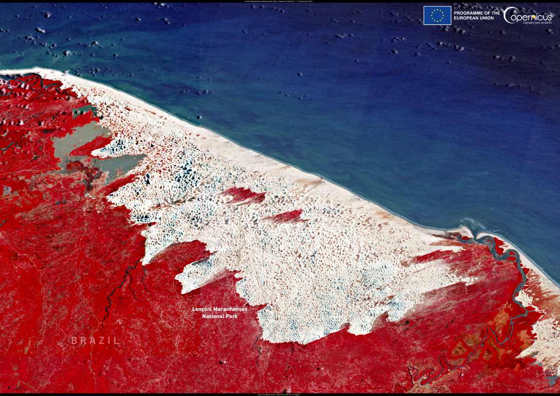
Located in northeastern Brazil, Lençóis Maranhenses National Park presents an extraordinary landscape of sweeping sand dunes and crystalline lagoons. Spanning more than 155,000 hectares, this UNESCO World Heritage site is unlike any other, offering a unique combination of desert and water features that continuously shift with the changing seasons. Over half of the park’s area is covered by sand dunes, and the striking lagoons are formed by rainwater collecting in the depressions between the dunes, creating an almost surreal visual contrast.
The lagoons, which vary in size and shape, are especially prominent during the rainy season, providing a refreshing sight of vibrant, clear water against the stark white sand. This natural phenomenon has made Lençóis Maranhenses a destination for eco-tourism, where visitors can hike across the dunes, swim in the lagoons, or simply take in the vast, unspoiled beauty of the area.
The park is also home to a rich diversity of wildlife. Migratory birds, including herons and flamingos, find sanctuary in the lagoons, while native plant species thrive in the unique conditions. These natural features not only offer opportunities for tourism but also serve as important ecosystems for a variety of species.

An image captured on 15 September 2024 by the Copernicus Sentinel-2 satellite highlights the stunning contrast between the white sands and turquoise lagoons. Copernicus Sentinel satellite data plays a crucial role in monitoring global ecosystems like those of Lençóis Maranhenses. This satellite imagery helps inform conservation strategies, providing valuable insights into the park’s health and supporting sustainable tourism efforts aimed at preserving its fragile environment.
As the world increasingly looks for ways to protect unique natural landscapes, Lençóis Maranhenses stands as a reminder of the delicate balance between tourism and conservation. Its dunes and lagoons offer not only a glimpse into nature’s raw beauty but also a model for how technology can aid in protecting these fragile, dynamic ecosystems.
Featured image credit: European Union, Copernicus Sentinel-2 imagery