Dealurile Homoroadelor, a serene expanse of rolling hills in central Romania, shines as a beacon of biodiversity and environmental protection. This Natura 2000 site, spanning 367 square kilometers, is a vital part of the European Union’s network of protected areas. Its designation helps safeguard rare and threatened species while promoting sustainable land use and environmental stewardship.
The region’s mosaic of forests, pastures, and lakes hosts an impressive array of wildlife. Among its treasures are 48 bird species, including majestic eagles, thriving in an environment carefully managed to balance conservation with human activity.

The vivid hues of autumn, captured in this Sentinel-2 satellite image from October 26, 2024, highlight the ecological richness of this area, showcasing the natural transitions that define its seasonal beauty.
The Copernicus Sentinel satellites play a crucial role in monitoring ecosystems like Dealurile Homoroadelor. The open data they provide supports global efforts to preserve biodiversity, offering scientists and policymakers invaluable tools for tracking environmental changes and developing conservation strategies.
This image serves as a reminder of the importance of protecting such regions, not just for their ecological value but also for the benefits they bring to local and global communities.
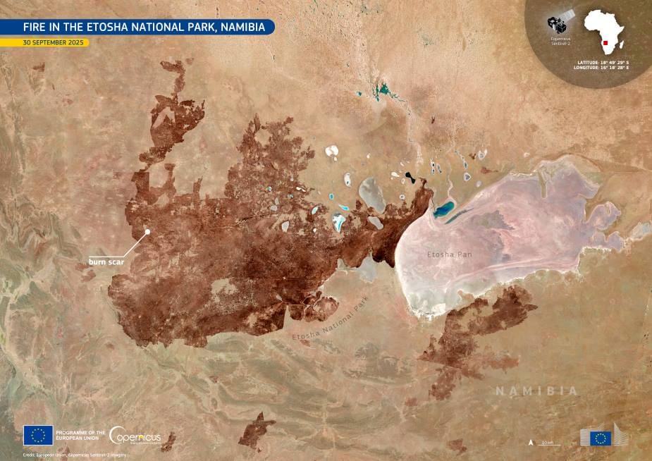
Featured image credit: European Union, Copernicus Sentinel-2 imagery