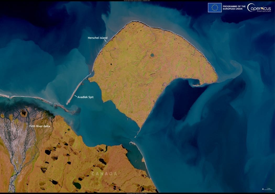
This image, captured by a Copernicus Sentinel-2 satellite on 2 September 2024, highlights the dynamic Arctic coastline of Canada’s Yukon territory, where the Beaufort Sea meets the land. The image features Herschel Island (Qikiqtaruk), Avadlek Spit, and the Firth River delta — areas shaped by the forces of coastal erosion and sediment transport.
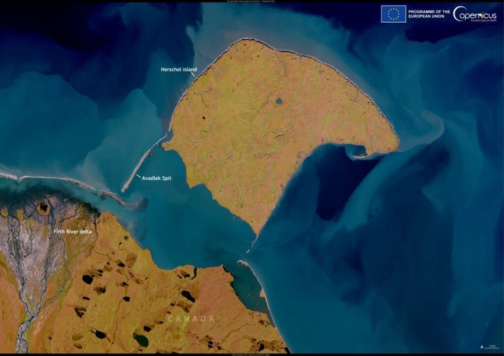
Satellite image: Herschel Island (Qikiqtaruk), Canada (s.coastal erosion, Arctic)
Herschel Island (Qikiqtaruk), Canada. Credit: European Union, Copernicus Sentinel-2 imagery

Swirling sediment patterns in the sea reveal the movement of material carried by river outflows, tidal currents, and the ongoing erosion of Arctic shores. Coastal retreat is a growing concern in the region, with scientists reporting in July 2024 that rising sea levels and thawing permafrost are causing sections of Herschel Island to erode rapidly. In response, historic whaling-era buildings were relocated inland to prevent their loss to the encroaching sea.

Copernicus Sentinel-2 satellite data plays a key role in tracking sediment movement, monitoring shoreline changes, and assessing climate-driven impacts in the Arctic, supporting conservation efforts and long-term adaptation planning.

Featured image credit: European Union, Copernicus Sentinel-2 imagery

Satellite Image: The Giza Plateau, Egypt
Image of the day: The Giza PlateauNews

Image of the day: The Giza Plateau

Rising from the edge of the Sahara Desert, the Giza Plateau holds some of humanity’s most enduring monuments. Situated on the western fringes of Greater…
Muser NewsDeskMuser NewsDeskAugust 14, 2025 Full article
Hourglass with Earth inside with an glacier melting above - global warming concept
Inside the political struggle at the IPCC that will determine the next six years of climate scienceClimate

Inside the political struggle at the IPCC that will determine the next six years of climate science

Hannah Hughes | The Conversation The UN’s climate science advisory group, the Intergovernmental Panel on Climate Change (IPCC), is currently meeting in Bulgaria to decide on a timeline…
SourceSourceJuly 30, 2024 Full article
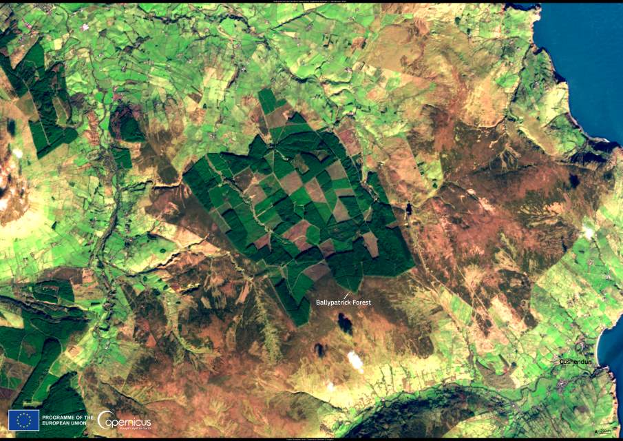
Satellite image: Wicklow Mountains National Park, Ireland
Image of the day: Wicklow Mountains National ParkNews

Image of the day: Wicklow Mountains National Park

Covering nearly 23,000 hectares, Wicklow Mountains National Park is Ireland’s largest national park and the only one in the east. Located just south of Dublin,…
Muser NewsDeskMuser NewsDeskFebruary 22, 2025 Full article