Nea Potidea, a coastal village in northern Greece, sits at the entrance of the Kassandra peninsula in Halkidiki. Known for its sandy beaches and relaxed seaside atmosphere, the village also holds deep historical roots. Built near the ancient city of Potidaea, Nea Potidea preserves a connection to its classical past, with remnants of old fortifications still visible today. Potidaea was originally founded by settlers from Corinth in the 7th century BC and later reconstructed by Cassander of Macedon, adding layers of cultural heritage to the area.
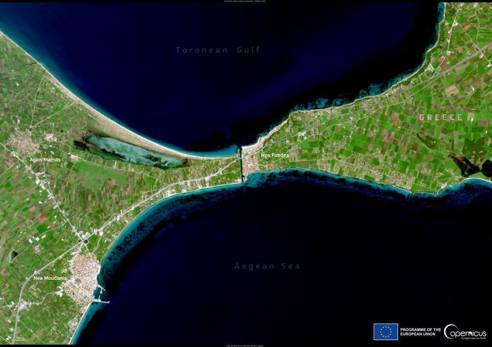
The Copernicus Sentinel-2 satellite captured this striking view of Nea Potidea and its surrounding landscape on 28 March 2025. In the center of the image, the Nea Potidea canal stands out, linking the Thermaic Gulf on the west side with the Toronean Gulf to the east. The canal, approximately 1,250 metres long, separates the Kassandra peninsula from the mainland. Historical records suggest that the canal’s origins date back to between the 4th and 1st century BC, reflecting the engineering ambitions of the region’s ancient inhabitants.

Today, Nea Potidea is a popular destination for travelers seeking both cultural exploration and seaside leisure. Visitors can walk along the village’s waterfront, explore archaeological sites, and experience the vibrant life of local tavernas, all while surrounded by the Aegean’s coastal beauty. Despite its development as a modern tourist spot, the village continues to preserve and showcase the layers of history that shaped it over centuries.
The Copernicus Sentinel missions, operated by the European Space Agency, provide detailed and frequent Earth observations that are crucial for monitoring such culturally significant locations. Through high-resolution imagery, satellites help track environmental changes, coastal dynamics, and the impact of human activities on heritage sites like Nea Potidea. This ongoing surveillance contributes to better management and preservation strategies for areas that hold historical, environmental, and cultural value.
The Sentinel-2 image highlights the unique geography of Nea Potidea and its strategic location between two gulfs. It also emphasizes how ancient infrastructure continues to influence the landscape today. The clear view of the canal serves as a reminder of the region’s long history of connecting people, trade, and cultures across the Aegean Sea.
As coastal communities face growing challenges from environmental pressures, including erosion and climate change, continuous monitoring efforts become increasingly important. Sentinel data not only enhances scientific understanding but also supports efforts to protect cultural landmarks that are vulnerable to these evolving threats.
Nea Potidea’s blend of historical depth and natural beauty makes it a significant point of interest both on the ground and from space. The village’s story, captured through the lens of modern satellite technology, connects ancient achievements with contemporary efforts to understand and protect the world’s cultural landscapes.
Featured image credit: European Union, Copernicus Sentinel-2 imagery


