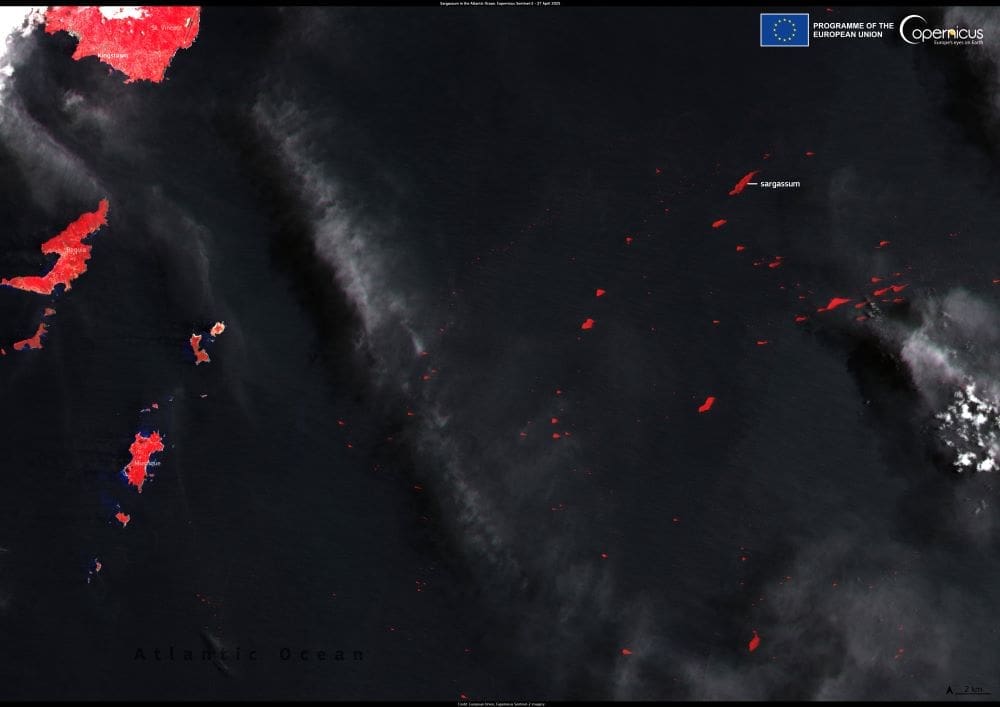
On April 27, 2025, the Copernicus Sentinel-2 satellite captured a striking image of extensive Sargassum mats drifting near the Grenadine islands of Mustique and Bequia. This visual snapshot underscores the escalating Sargassum crisis affecting the Caribbean Sea and adjacent Atlantic regions.
Understanding the Sargassum phenomenon
Sargassum is a genus of brown macroalgae that typically thrives in the nutrient-rich waters of the Sargasso Sea. While these floating seaweed mats provide essential habitats for various marine organisms, their unprecedented proliferation since 2011 has raised ecological and economic concerns. Factors contributing to this surge include altered ocean currents, increased sea surface temperatures, and nutrient influxes from major rivers like the Amazon and Congo.
Environmental and socioeconomic impacts
The excessive accumulation of Sargassum along coastlines poses significant challenges. Ecologically, dense Sargassum mats can smother coral reefs and seagrass beds, disrupting marine ecosystems. Onshore, decomposing Sargassum emits hydrogen sulfide gas, leading to foul odors and potential health risks. These conditions adversely affect tourism, fisheries, and local economies dependent on coastal resources.

To address this growing issue, the Copernicus Marine Service has initiated the Sargassum Operational Detection Algorithms (SODA) project. Led by Collecte Localisation Satellites (CLS) in collaboration with Hygeos and Mercator Ocean International, SODA aims to enhance the detection and monitoring of Sargassum blooms using satellite data. By integrating observations from multiple satellites, including Sentinel-2, Sentinel-3, MODIS, and GOES-16, SODA provides high-resolution, near-real-time data on Sargassum distribution and movement.
These advancements enable more accurate forecasting of Sargassum drift patterns, allowing coastal communities to implement timely mitigation strategies. By anticipating Sargassum landings, authorities can better manage beach clean-ups, protect marine habitats, and minimize economic disruptions.
As climate change continues to influence oceanic conditions, the frequency and intensity of Sargassum blooms are expected to rise. Ongoing research and technological innovations, such as those spearheaded by the SODA project, are crucial for developing adaptive management approaches. By leveraging satellite data and collaborative efforts, stakeholders can work towards mitigating the adverse effects of Sargassum invasions on both the environment and coastal economies.
Featured image credit: European Union, Copernicus Sentinel-2 imagery


