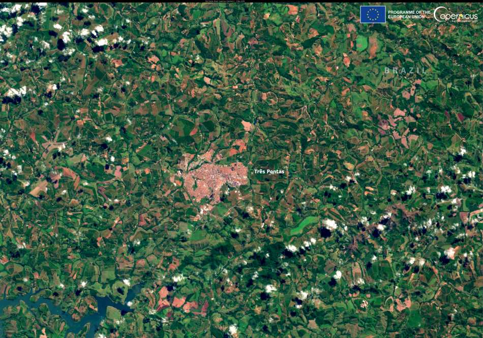
Três Pontas, located in Brazil’s state of Minas Gerais, is more than just a picturesque town – it’s one of the country’s most vital coffee-producing areas. Set in the heart of the South of Minas region, this landscape is defined by its mild climate, fertile soils, and rolling hills, creating ideal conditions for growing arabica coffee. With more than 400,000 hectares under cultivation, the region boasts the highest density of coffee plants per square metre in Brazil.
Coffee farming here supports thousands of livelihoods and supplies international markets with a product deeply tied to Brazilian identity and global demand. But that tradition is facing serious pressure from a changing climate. Unpredictable heatwaves, droughts, and prolonged dry seasons have started to threaten yields and push up global coffee prices. As farmers cope with increasingly hostile weather conditions, the role of technology in supporting agriculture is growing rapidly.

In the image, the city is encircled by dark green agricultural plots – rows of coffee plants that thrive in this high-altitude terrain. Satellite imagery like this provides a powerful tool for monitoring changes in land use and crop health over time. With each pass, the Sentinel-2 satellite delivers high-resolution data that helps researchers detect early signs of stress in vegetation, assess water availability, and track shifts in planting patterns.
These insights are vital. Heat and drought linked to climate change have already begun to reduce Brazil’s coffee output, influencing prices worldwide. As one of the top exporters globally, what happens in Três Pontas and similar regions directly impacts what consumers pay for coffee in supermarkets and cafés.
Organizations such as Copernicus are now central to helping countries adapt. The European Union’s Earth observation programme delivers a steady stream of data that supports more resilient agricultural practices. By detecting anomalies in vegetation or soil moisture levels, farmers and policymakers can act sooner to protect crops, manage irrigation, and even shift planting strategies.
For growers in Minas Gerais, this kind of intelligence can mean the difference between a profitable harvest and a failed one. And for the rest of the world, it’s a reminder of how climate volatility is touching even the most iconic commodities.
The coffee fields of Três Pontas continue to tell a story of tradition, productivity, and adaptation. As climate patterns shift and environmental stress grows, satellite monitoring is becoming an essential part of ensuring that this story doesn’t end in crisis. With the help of Copernicus and global data-sharing efforts, there is hope that Brazil’s coffee belt can continue to thrive – even under the weight of a warming world.
Featured image credit: European Union, Copernicus Sentinel-2 imagery


