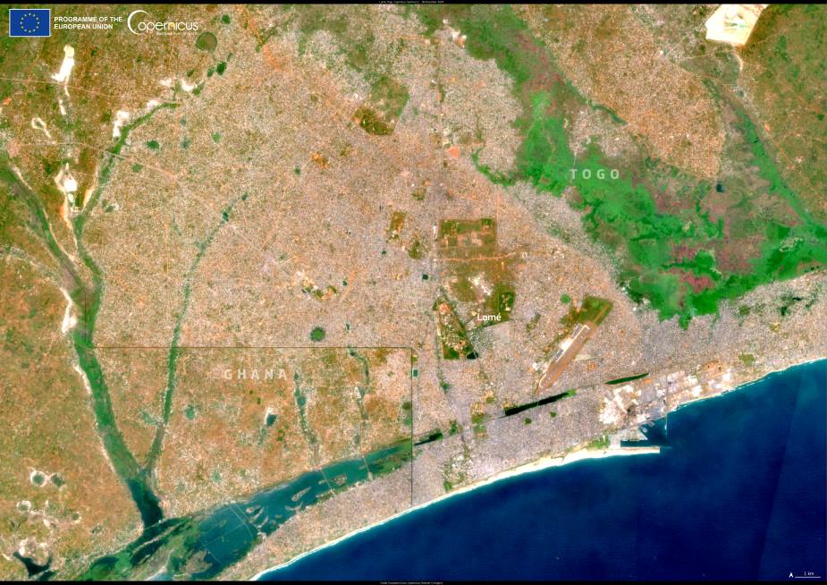
Lomé, the capital of Togo, stretches along the Gulf of Guinea in the country’s far southwest, where West Africa’s Atlantic coastline meets the Ghanaian border. As Togo’s largest city and primary economic center, Lomé serves as the seat of government, a major industrial zone, and the country’s main port for exporting commodities including coffee, cocoa, copra, and palm oil kernels.
This image, acquired by one of the Copernicus Sentinel-2 satellites on 18 December 2024, captures the expanding urban footprint of Lomé and its direct connection to the Volta Region of Ghana. The international border appears as a distinct straight line, separating densely built-up areas on either side. Urban sprawl in both countries follows a continuous pattern across the border, underscoring how cities in the region have grown into one another without regard for administrative boundaries.

The satellite view also shows Lomé’s coastal setting, where development extends from the port area inland, bordered to the north by smaller towns and agricultural zones. The city’s rapid growth poses challenges for land use planning and environmental management, particularly where infrastructure and services must keep pace with expanding settlements.
Sentinel-2 data from the Copernicus programme play a key role in documenting such patterns, supporting local and national authorities in urban planning, land use monitoring, and managing shared environments. For border regions like this one between Togo and Ghana, high-resolution Earth observation imagery also contributes to cross-border cooperation on sustainable development, disaster preparedness, and resource management.
Featured image credit: European Union, Copernicus Sentinel-2 imagery


