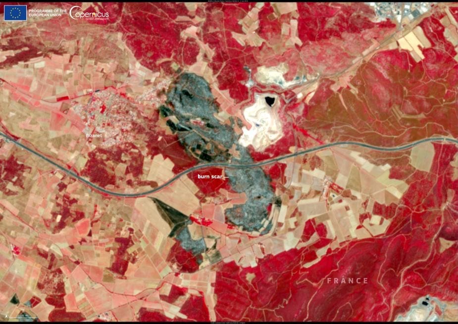
A wildfire near the town of Bizanet in southern France scorched around 400 hectares of land after erupting on 29 June 2025. Fueled by dry vegetation and intense heat following a European heatwave, the blaze spread quickly through the Aude department, prompting evacuations and the closure of the A61 motorway.
Authorities deployed more than 600 firefighters to contain the fire, which was brought under control the next day. Emergency services worked throughout the night to protect homes and limit further spread under challenging weather conditions.

This image, captured by the Copernicus Sentinel-2 satellite on 2 July 2025, reveals the dark burn scar left behind in the landscape near Bizanet. The satellite’s high-resolution imagery allows for detailed observation of wildfire damage, offering a valuable tool for emergency response teams and environmental monitoring agencies.
Open data from the Copernicus Sentinel satellites plays a key role in mapping wildfire impacts and helping authorities evaluate environmental damage, plan recovery efforts, and improve preparedness in a warming climate.
Featured image credit: European Union, Copernicus Sentinel-2 imagery


