The mangrove forests of northern Australia take center stage in this satellite image, released to mark the International Day for the Conservation of the Mangrove Ecosystem on 26 July. Taken by a Copernicus Sentinel-2 satellite on 14 July 2025, the image shows part of the Cobourg Peninsula, where dense green patches of mangroves hug the tropical coastline.
Mangroves are crucial to global biodiversity, but their role stretches far beyond wildlife habitat. These unique coastal forests absorb large amounts of carbon, protect shorelines from erosion and storms, and support fisheries that feed millions. Yet they remain vulnerable to deforestation, pollution, and the pressures of climate change.

The Cobourg Peninsula – stretching across 220,000 hectares in the Northern Territory – is one of the planet’s most biologically rich mangrove areas. It hosts over 800 plant species, 64 types of coral, and more than 400 species of marine invertebrates. In 1974, it was designated as Australia’s first Ramsar Site, and notably, the first such wetland site to be recognised globally under the Ramsar Convention. The designation acknowledges not only its ecological importance but also its deep cultural connections, particularly for Indigenous communities.
The Copernicus Sentinel-2 satellite image highlights the mosaic of ecosystems that make up the peninsula, including intertidal zones, seagrasses, and sprawling mangrove forests. The European Union’s Copernicus programme provides high-resolution imagery like this to monitor and assess the health of mangrove regions around the world, helping scientists and policymakers track changes and guide conservation efforts.
As the world marks the international day dedicated to mangroves, the Cobourg Peninsula stands as a vivid reminder of their enduring value – and the need to safeguard them for generations to come.
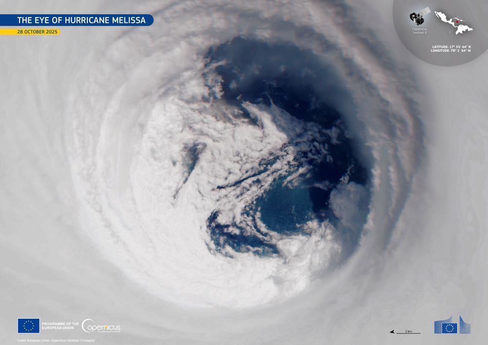
Featured image credit: European Union, Copernicus Sentinel-2 imagery