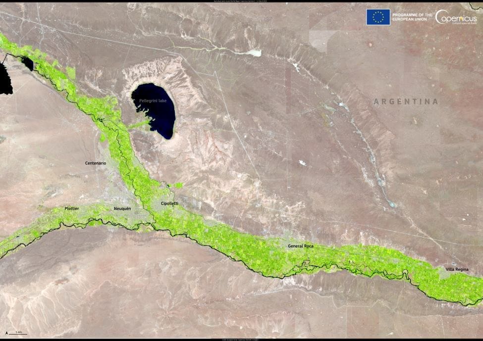
A striking contrast unfolds in northern Patagonia, where the arid plains of the Patagonian Desert give way to the vibrant green belt of the Alto Valle of the Río Negro. This fertile ribbon, captured in a false-colour image from the Copernicus Sentinel-2 satellite on 12 March 2025, appears as a vivid green swath cutting through an otherwise dry and sparsely vegetated landscape.

The Alto Valle is one of Argentina’s most productive agricultural regions, made possible by the Río Negro River’s irrigation system. Despite the harsh semi-desert surroundings, this narrow corridor supports vast orchards of apples, pears, and stone fruits, along with vineyards and vegetable farms. The image reveals the striking boundary between cultivated land and the surrounding natural terrain, underscoring the importance of water in transforming desert into farmland.
Sentinel-2’s multispectral sensors are designed to detect changes in vegetation and land use with remarkable clarity. The satellite’s data plays a vital role in monitoring crop health, enabling farmers and policymakers to respond to environmental changes and promote sustainable agricultural practices in regions like this, where every drop of water counts.
Featured image credit: European Union, Copernicus Sentinel-2 imagery


