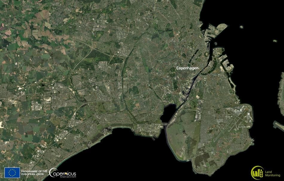
Copenhagen, the capital of Denmark, spans the islands of Zealand and Amager, connected by bridges and surrounded by the Øresund strait. The city has grown from a medieval fishing village into a thriving European capital with about 667,000 residents in the municipality and roughly 1.4 million in the wider urban area, while maintaining an ambitious goal to become the world’s first carbon-neutral capital by 2025. From above, its bike lanes, urban parks, and green roofs form a visible patchwork of sustainable planning.
Amager Island, southeast of the city centre, is Denmark’s most densely populated island and home to Copenhagen Airport, one of the busiest in Northern Europe. Yet, alongside its urban and industrial zones, Amager also shelters the Amager Nature Park, a sprawling reserve of wetlands, meadows, and coastal areas that support numerous red-listed and EU-protected species. This coexistence of transport infrastructure and wildlife habitat reflects the city’s strategy of integrating conservation with development.

Copenhagen’s coastal position has shaped its history as a trading hub, fortified harbour, and cultural crossroads. Today, it is also linked to Malmö, Sweden, via the Øresund Bridge – a combined rail and motorway link that appears as a faint line from high-resolution satellite imagery.
The image was produced using the Very High Resolution European Image Mosaic for the 2021 reference year, part of the Copernicus Land Monitoring Service. This true-colour mosaic merges data from multiple optical sensors with spatial resolutions between 2 and 4 metres, creating a detailed portrait of Europe’s varied landscapes.
Featured image credit: European Union, Copernicus Land Monitoring Service Data


