Stretching for nearly 486 kilometers (302 mi) across Guatemala, the Motagua River connects the country’s western highlands with the Caribbean Sea. As one of Central America’s most important waterways, it has shaped landscapes, supported livelihoods, and carried goods and people for centuries. Today, the river continues to provide essential resources while facing growing environmental challenges that threaten its long-term health.
The river begins in the central highlands, where tributaries from the Sierra de los Cuchumatanes and Sierra de Chuacús converge. As it flows eastward, it gathers strength from rivers such as the Chixoy and Río Grande before reaching the Gulf of Honduras. Along its course, the Motagua crosses diverse terrain – from rugged mountains to fertile plains – and forms part of the border between Guatemala and Honduras in its lower reaches.
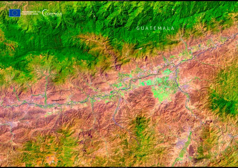
This false-colour Copernicus Sentinel-2 image, acquired on 9 March 2024, highlights the Motagua River winding through fertile land. Data from Sentinel satellites are central to monitoring waterways worldwide, providing insights into their ecological condition and helping guide conservation measures.

The Motagua has been central to Guatemala’s history. For the ancient Maya, it served as both a transportation route and a source of water for settlements. The valley’s rich jade deposits made it a hub of mining and trade, with artisans crafting ceremonial objects that remain among the culture’s most distinctive artifacts. At Quiriguá, a UNESCO World Heritage Site on the river’s banks, towering stone monuments testify to the river’s importance in Maya civilization.
During the Spanish colonial period, the river maintained its role as a trade corridor linking inland towns to coastal ports. In modern times, it remains critical to agriculture, fisheries, and industry. The fertile plains along its course produce bananas, sugarcane, coffee, and vegetables, sustaining local communities and contributing to international exports. Hydroelectric projects and industrial facilities also depend on its waters, underscoring its role in national development.
Yet the river’s value has come at a cost. Agricultural runoff, untreated wastewater, and industrial discharge have polluted large stretches, while deforestation in the watershed has led to erosion and sediment buildup. Plastic waste carried downstream is a major concern, with large volumes reaching the Caribbean Sea and affecting marine ecosystems. These pressures place both local livelihoods and biodiversity at risk.
Efforts to restore and protect the Motagua are underway. Community groups, government agencies, and international partners are promoting waste management, reforestation, and water treatment initiatives. Cross-border cooperation is especially important, since pollution flows into Honduran waters as well. Long-term solutions may depend on stricter environmental regulations, sustainable farming practices, and greater investment in infrastructure. Eco-tourism has also been suggested as a way to generate income while preserving the river’s natural and cultural heritage.
The Motagua River remains a lifeline for Guatemala, both as a vital natural resource and as a thread that ties together its past and present. Protecting it will determine how well it continues to support the communities, ecosystems, and histories it has nurtured for thousands of years.
Featured image credit: European Union, Copernicus Sentinel-2 imagery


