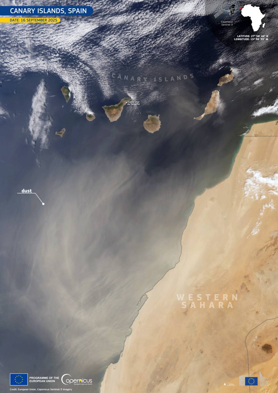
A Saharan dust haze sweeping across the Canary Islands in mid-September 2025 brought poor air quality, rising temperatures, and heightened health risks to the archipelago. Spain’s State Meteorological Agency (AEMET) issued an orange alert for suspended dust and high temperatures, while wildfire warnings remained in place across the islands.
As seen in a Copernicus Sentinel-3 image from 16 September, a thick veil of dust was carried westward under easterly winds tied to a high-pressure system over western Africa. The haze reduced visibility across the islands and prolonged poor air conditions.
While calima events are not new to this region, recent studies confirm that between 2020 and 2022 the Canary Islands saw their most intense Saharan dust intrusions on record. During those years, PM10 concentrations surged beyond the upper detection limits of air quality monitoring equipment.

Experts link the increasing frequency and severity of these episodes to shifts in meteorological patterns – such as stronger, more persistent anticyclones – and prolonged drought in both the Sahara and the Canary Islands, which leave soils exposed and more easily lofted by wind. Once dust is airborne, the lack of rainfall means it lingers longer in the atmosphere, worsening air quality.
Health agencies warn that fine particles carried in calima can aggravate respiratory and cardiovascular issues, particularly in children, older adults, and people with asthma. To reduce risk, officials recommend limiting outdoor activity during heavy dust periods, using certified masks such as FFP2 or FFP3, keeping windows and doors closed, staying hydrated, and protecting eyes and skin from irritation. Drivers are advised to take extra precautions as visibility can fall sharply.
The Copernicus Atmosphere Monitoring Service (CAMS) contributes to managing such events by tracking dust transport in near real time, forecasting air quality, and providing data to public health and environmental authorities. These insights help residents and decision-makers in the Canary Islands respond effectively during calima episodes and prepare for their expected increase in the future.
Featured image credit: European Union, Copernicus Sentinel-3 imagery