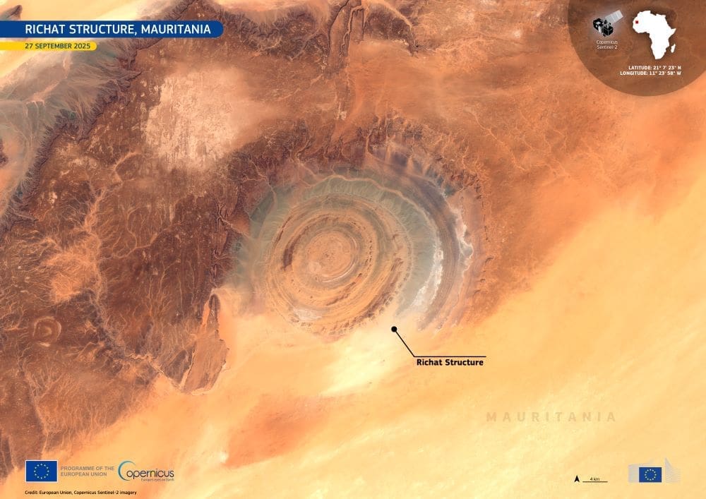
The Richat Structure in Mauritania’s Sahara Desert is one of Earth’s most recognisable geological formations, easily visible from space for its near-perfect circular shape. Measuring about 40 kilometres across, the formation, often called the “Eye of the Sahara”, features a series of concentric rings made up of exposed sedimentary rock.
Located in central Mauritania, the Richat Structure was once thought to be the result of a meteorite impact. However, scientists now understand it as a deeply eroded geological dome created by uplift and long-term erosion over millions of years. Its circular layers reveal different rock types, offering valuable insights into the geological history of the African continent.

This Copernicus Sentinel-2 image, acquired on 27 September 2025, captures the structure’s distinct circular pattern in the middle of the Sahara Desert.
Because of its distinctive ringed appearance against an otherwise featureless desert, the Richat Structure has served as a visual landmark for astronauts.
The Copernicus Sentinel satellites are crucial for observing Earth’s remote and often inaccessible regions. By capturing high-resolution imagery, they provide essential data that help scientists monitor environmental changes, study geological activity, and better understand natural processes shaping the planet’s surface.
Featured image credit: European Union, Copernicus Sentinel-2 imagery


