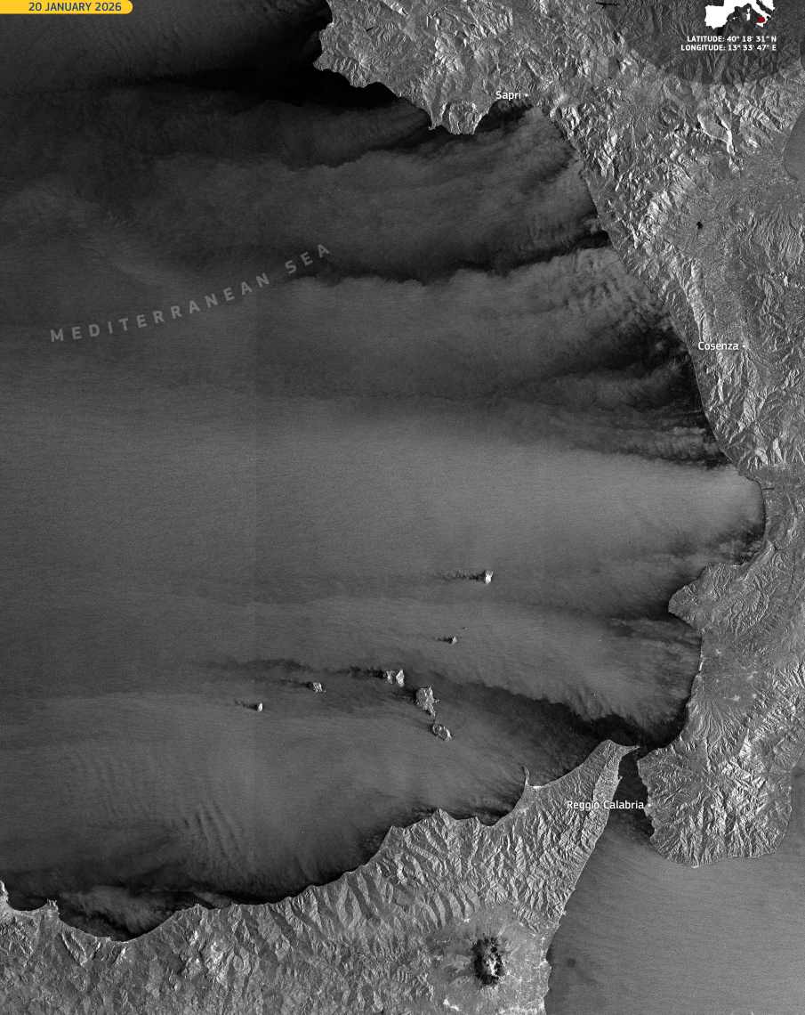
Wind patterns left by Storm Harry are etched across the surface of the southern Tyrrhenian Sea in this satellite view of coastal waters off southern Italy. As the Mediterranean storm moved through the region in mid-January, strong winds interacted with coastlines and island terrain, producing visible contrasts between sheltered zones and exposed open waters.
Near the coasts of northern Sicily and southern mainland Italy, the sea surface appears relatively smooth, reflecting areas partly shielded by mountainous topography. Farther offshore, rougher textures point to sustained gale-force winds. Around the Aeolian Islands, airflow is disrupted by the islands themselves, forming wakes, turbulence, and elongated streaks that trail downwind and reveal the complex structure of the storm at sea.

These features are captured in a Copernicus Sentinel-1 image acquired on 20 January 2026 at 05:04 UTC. Radar measurements of sea surface roughness allow wind-driven structures to be observed in all weather conditions, day and night. Such data support the assessment of storm impacts, the planning of marine operations, and the modelling of wind behaviour during extreme Mediterranean weather events.
On land, Storm Harry caused widespread disruption across southern Italy and nearby islands. Coastal areas in Calabria, Sicily, and Sardinia experienced flooding, landslides, and damage to roads and buildings, while ferry connections to smaller islands were suspended. Emergency services responded to more than 1,600 incidents across the three regions.
The strongest impacts were reported in eastern Sicily and parts of Calabria, where waves reached nearly 10 metres and rainfall totals were extreme, including nearly 570 mm recorded in 72 hours in San Sostene.
Featured image credit: European Union, Copernicus Sentinel-1 imagery