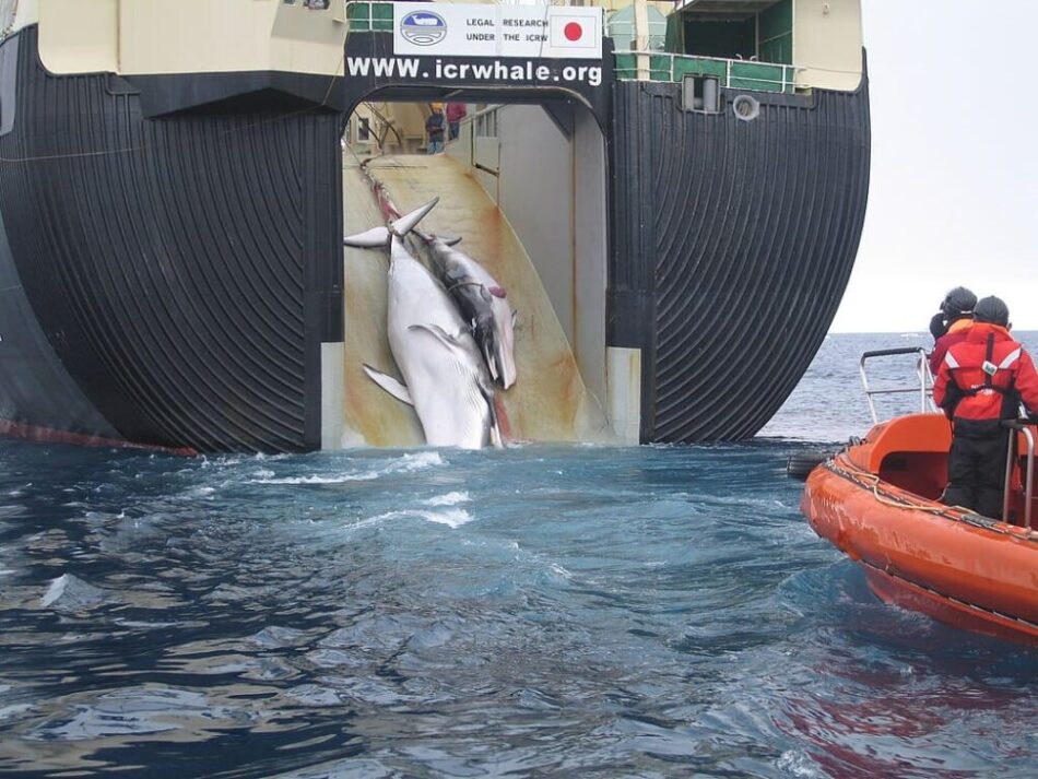
Extending along the coasts of the Netherlands, Germany and Denmark, the Wadden Sea – a UNESCO World Heritage site – forms the world’s largest continuous intertidal system. Twice-daily tidal cycles expose extensive mudflats before submerging them again, redistributing sediments and nutrients across the region. Monitoring these processes is central to understanding habitat conditions for migratory birds, fish nurseries and benthic communities, as well as the broader stability of the coastline.
This image, acquired on 19 January 2026 by Copernicus Sentinel-3A, focuses on the Danish and German sector of the Wadden Sea. From orbit, suspended sediments stirred by tides and river discharge appear in intense reds and oranges near the coast. Offshore, the colours transition toward yellows and blues as particle concentrations decrease. Tidal channels cut through shallow waters in branching forms, while inland agricultural land, wetlands and urban areas appear in natural tones. The scene illustrates how coastal dynamics – often fragmented at ground level – can be observed synoptically across national boundaries.

The observations were made by the Ocean and Land Colour Instrument, OLCI, one of the core sensors aboard Sentinel-3A. Measuring reflected sunlight in 21 spectral bands from the visible to the near-infrared, OLCI enables quantitative assessment of suspended matter, chlorophyll concentration and other indicators of water quality. Its design ensures continuity with earlier European ocean-colour missions, allowing present measurements to be compared with long-term datasets. With a native spatial resolution of about 300 m and regular onboard calibration, the instrument provides stable records suited to detecting both seasonal variability and gradual environmental change.
Sentinel-3A was launched on 16 February 2016, followed by Sentinel-3B on 25 April 2018. Both satellites operate as multi-instrument platforms focused on ocean surface topography and land and sea surface temperature. In addition to OLCI, each carries the Sea and Land Surface Temperature Radiometer, a Synthetic Aperture Radar altimeter and a Microwave Radiometer. Together, these instruments combine optical, thermal and radar measurements, supporting applications that range from sea-level monitoring and marine ecosystem assessment to coastal management and climate research.
In regions such as the Wadden Sea, this integrated approach allows scientists to link sediment transport and biological productivity with temperature patterns and sea-level variability. Over time, the continuity of these measurements strengthens the ability to distinguish short-term fluctuations from longer-term trends associated with climate change.
Released as Sentinel-3A marks ten years in orbit, the image reflects a decade of sustained observation. Its value lies not only in the visual record, but in the calibrated measurements that underpin scientific analysis of coastal systems.
Featured image credit: European Union, Copernicus Sentinel-3 imagery