A fast-moving wildfire broke out on 1 July 2025 in the Segarra region of Catalonia, Spain, amid extreme winds and dry conditions. The fire spread rapidly through farmland and forest, burning an estimated 5,000 hectares across several municipalities.
Winds reaching 125 km/h pushed flames through the countryside with little warning. Authorities ordered lockdowns for nearly 20,000 residents, and at least two people died near the town of Coscó. Local officials described it as one of the worst wildfires in the area in recent memory.
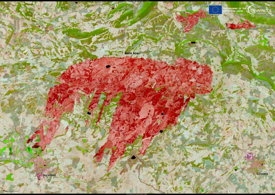
This Copernicus Sentinel-2 image, taken on 2 July 2025, shows the aftermath of the fire near the towns of Agramunt and Guissona. The dark areas in the satellite image mark the burn scar – land stripped of vegetation and darkened by soot – cutting across the rolling hills of Segarra.

The wildfire, referred to as the ‘Torrefeta i Florejacs fire’ after one of the affected municipalities, ignited during a period of high fire risk in northeastern Spain. Temperatures soared across the region in the days leading up to the event, and the strong winds helped ignite and drive multiple fire fronts simultaneously.
Open-access satellite data from the Copernicus Sentinel programme plays a central role in tracking such events across Europe. High-resolution imagery like this supports emergency response teams, helps assess damage, and contributes to understanding wildfire behavior in changing climate conditions.
At the national level, Spain’s civil protection authorities launched a coordinated response involving regional firefighters, aerial units, and the military emergency unit. In the aftermath, local communities are now assessing losses and preparing for recovery.
Featured image credit: European Union, Copernicus Sentinel-2 imagery


