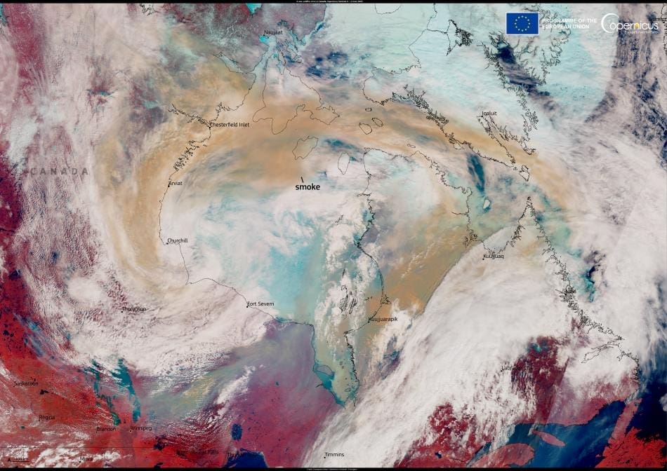
Summary:
A study published in Earth has identified the unusual combination of environmental factors that primed Manitoba for the extreme wildfires of May 2025. Led by Hossein Bonakdari, Associate Professor at the University of Ottawa’s Faculty of Engineering, the research examined how concurrent anomalies in climate and vegetation created highly flammable conditions in the province’s boreal landscapes.
The fires burned about 8,667 square kilometers, claimed lives, and forced nearly 1,000 people from their homes. Using satellite data, the study tracked April–May anomalies in snow cover, precipitation, temperature, vegetation indices, and soil moisture. Results show that a reduced snowpack and prolonged rainfall deficits left soil moisture among the driest on record, which in turn stressed vegetation and reduced its greenness. This “compound anomaly” effect – where multiple moderate stresses occur together – can elevate fire risk beyond what individual thresholds might detect.
According to Bonakdari, the findings demonstrate the value of integrating climate and biosphere indicators into wildfire risk monitoring. The study suggests that such combined data could enhance early warning systems, helping vulnerable boreal regions adapt to the intensifying fire seasons expected under climate change.

What really fueled the Manitoba Wildfires in 2025? New study breaks it down
The research, published in the journal Earth and led by Hossein Bonakdari, Associate Professor at the University of Ottawa’s Faculty of Engineering, explores how anomalies in climate and vegetation indices preconditioned the landscape for these catastrophic fires.

In early May, extreme wildfires ravaged approximately 8,667 square kilometers of land, claiming lives and forcing the evacuation of nearly 1,000 residents. The study highlights that the wildfires were exacerbated by a combination of unseasonably warm temperatures, prolonged drought, and stressed vegetation.
“Our findings indicate that multiple environmental anomalies converged to create a highly flammable landscape,” Professor Bonakdari explains. “This disaster underscores the urgent need for enhanced wildfire preparedness and monitoring of climatic trends.”
Satellite data reveals hidden fire risk factors
The research used satellite data to track things like how much snow remained on the ground, how dry the soil was, and how green (or not) the landscape looked before the fires hit. The study found that significant rainfall deficits and reduced snowpack severely diminished soil moisture, leading to decreased vegetative greenness prior to ignition.
Soil moisture for early 2025 was among the driest in historical records, contributing to cumulative vegetation stress. The study emphasizes the importance of integrating climate and biosphere anomalies into wildfire risk monitoring, particularly in boreal regions vulnerable to climate change.
“This demonstrates how moderate anomalies, occurring simultaneously, can elevate fire risk to levels that individual indicators might not highlight. This is called a synergistic interaction of climate anomalies – moderate but simultaneous stresses that together set the stage for extreme fires,” Professor Bonakdari adds.
The research highlighted the rapid spread of fire, contrasting with previous years and indicating a shift in fire dynamics due to climate stressors. It advocates using satellite-derived data to better understand fire risk and improve operational assessments.
The findings serve as a crucial reminder of the increasing vulnerability of boreal ecosystems to wildfire activity and the necessity for proactive measures in a changing climate.
Professor Bonakdari concludes: “As we face more frequent and severe fire seasons, it is imperative that we adapt our strategies to better anticipate and manage wildfire outbreaks.”
Journal Reference:
Amiri, A., Gumiere, S., & Bonakdari, H., ‘A Lens on Fire Risk Drivers: The Role of Climate and Vegetation Index Anomalies in the May 2025 Manitoba Wildfires’, Earth 6 (3), 88 (2025). DOI: 10.3390/earth6030088
Article Source:
Press Release/Material by University of Ottawa
Featured image credit: European Union, Copernicus Sentinel-3 imagery


