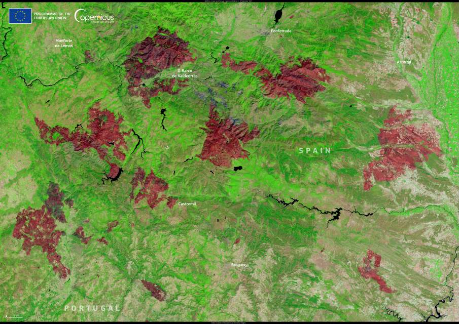
In early September 2025, the landscape along the border between Spain and Portugal bore the marks of a series of wildfires that swept through natural parks and rural areas in late August. The fires affected several regions, with some of the most severe damage concentrated around the municipalities of Castromil, O Barco de Valdeorras, and Bragança.
This false-colour image, captured by one of the Copernicus Sentinel-2 satellites on 5 September 2025, shows large burn scars in reddish-brown tones across the affected areas, where vegetation has been stripped away by fire. The fires crossed provincial and national boundaries, burning through shrubland and forests along the frontier between Galicia and León.

Local authorities reported that one of the largest blazes started in northern Portugal and spread rapidly into Spanish territory, reaching Castromil in the comarca of Sanabria. According to Ángel Sánchez, the regional technical director of firefighting, the fire was brought under partial control after destroying an estimated 400 hectares. Efforts involved up to 14 aerial firefighting units from Zamora, supported by ground crews and machinery on both sides of the border.
The Junta de Castilla y León’s territorial delegate in Zamora, Fernando Prada, said both recent fires in Castromil were “allegedly intentional and pose serious danger to people and their property”. Strong southerly winds gusting over 40 km/h worsened conditions and forced the temporary confinement of residents as the flames approached the village.
The Copernicus Sentinel-2 satellites provide high-resolution optical data that help track changes in land cover. Such observations are crucial for assessing post-fire damage, planning forest recovery, and supporting civil protection efforts in the aftermath of wildfires.
Featured image credit: European Union, Copernicus Sentinel-2 imagery


