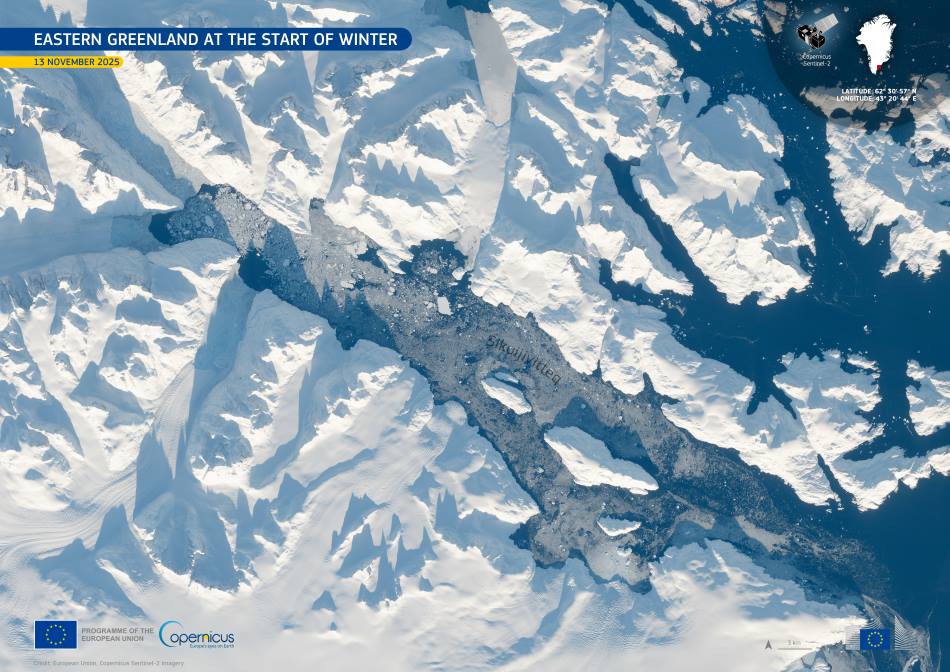
Eastern Greenland enters a period of rapid seasonal transition each November, as the approach of winter brings weaker sunlight and falling temperatures across the high latitudes. These early changes shape both the coastline and the surrounding waters, where the first traces of sea ice begin to appear. Low-angle sunlight at this time of year casts long, slanting shadows that reveal the sharp relief of the mountains and fjords stretching toward the North Atlantic.
Sikuijivitteq, a fjord on the eastern coast, is among the locations where the winter shift becomes visible before the onset of deeper cold. Thin layers of newly formed ice start to spread across its sheltered waters, accompanied by scattered pieces of pack ice drifting in from offshore. This gradual buildup plays a significant role in the Arctic climate system, influencing how heat escapes from the ocean and signalling the start of the seasonal cycle that will dominate the region for months.
Recent assessments of the Greenland Ice Sheet show how these early winter processes relate to wider changes across the island. Monitoring results released at the end of the summer melt season indicate that the ice sheet has now lost mass for the 29th consecutive year. Around 100 billion tonnes of ice flowed into the ocean over the past year through meltwater and calving, adding to nearly three decades of net loss. Researchers note that, if the trend continues into next year, the ice sheet will have experienced 30 straight years of decline – a timescale that marks a clear, long-term shift rather than natural variability.

The Copernicus Sentinel-2 image, acquired on 13 November 2025, captures this moment when the landscape still shows patches of open water while the first winter structures take shape along the coast. The soft illumination characteristic of the season adds depth to the rugged topography, emphasising the contours of ridges, valleys, and ice-covered sections of shoreline without fully plunging the region into the persistent dimness of the polar night.
Sentinel-2, together with radar observations from Sentinel-1, provides continuous coverage of these remote areas, supporting efforts to track the expansion of sea ice and monitor its evolution throughout the winter. These missions supply essential information for understanding how Arctic environments respond to shifting climate conditions and how the early stages of ice formation affect ecosystems across the region.
Featured image credit: European Union, Copernicus Sentinel-2 imagery


