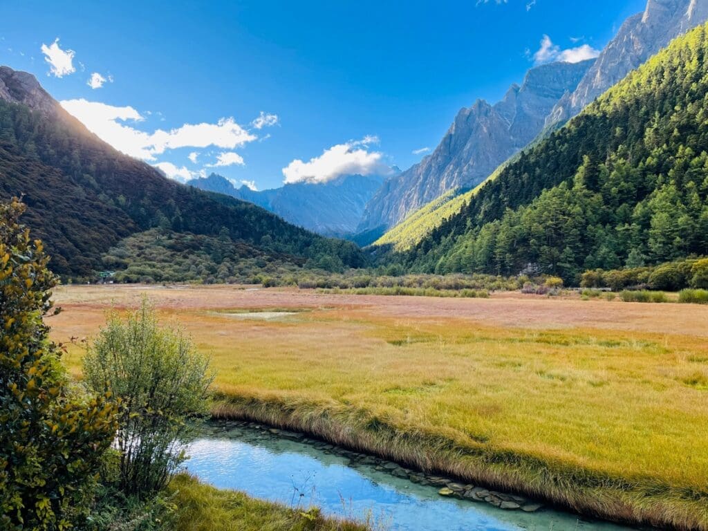
The Lubāna Wetland Complex in eastern Latvia forms the country’s largest inland wetland, a broad landscape of lakes, marshes, forests and grasslands that plays an important role for biodiversity and water regulation in the Baltic region.
Covering about 51,351 hectares, the Lubāna Wetland Complex includes Lake Lubāns – the largest lake in Latvia – together with surrounding bogs, fens, alluvial grasslands, wet forests and fishponds. This mix of habitats creates one of the most extensive inland wetland landscapes in the country and supports a wide range of plant and animal life.
The protected territory is managed as the Lubāna mitrājs Nature Reserve and is also part of the European Union’s Natura 2000 network. The area is recognised for its ecological importance both nationally and internationally.
Wetland ecosystems and biodiversity
The site was designated a Wetland of International Importance under the Ramsar Convention on 27 March 2003. The complex contains 22 protected habitat types of European importance and supports characteristic wetland plant communities.
Large numbers of birds depend on the area throughout the year. Around 26,000 waterfowl are regularly recorded, and rare species such as the short-eared owl (Asio flammeus) and the marsh sandpiper (Tringa stagnatilis) occur in the wetland.
Peat-forming bogs and marshes within the complex also store significant amounts of carbon, while floodplain habitats help regulate water levels and reduce flood risk in surrounding areas. The landscape is used for scientific research, recreation and traditional activities such as fishing.
However, the ecosystem has been affected by human modification. Canalisation and river regulation have altered natural water flows in parts of the wetland and remain among the main pressures identified for the site.
The landscape structure

This visualisation uses the CLCplus Backbone 2023 dataset from the Copernicus Land Monitoring Service (CLMS), which provides land cover information across Europe at a spatial resolution of 10 metres.
The map highlights the variety of surfaces across the Lubāna Wetland Complex. Needle-leaved and broadleaved forests appear in green tones, low-growing woody vegetation in brown, permanent herbaceous cover in light green, and water bodies in blue.
The CLCplus Backbone product maps land cover across Europe using 11 land-cover classes, allowing scientists and environmental agencies to monitor landscapes consistently across the continent. Such satellite-based data supports environmental monitoring and helps guide conservation and management efforts in protected ecosystems such as wetlands.
Featured image credit: European Union, Copernicus Land Monitoring Service