
World sees second hottest May as Europe faces ‘new normal’: EU monitor Full article
World sees second hottest May as Europe faces ‘new normal’: EU monitor

Image of the day: A changing planet through the lens of satellites Full article
Image of the day: A changing planet through the lens of satellites

EU monitor says sea temperatures near all-time highs as El Niño looms
Full article
EU monitor says sea temperatures near all-time highs as El Niño looms

Image of the day: Monaco’s Mediterranean coastline
Full article
Image of the day: Monaco’s Mediterranean coastline
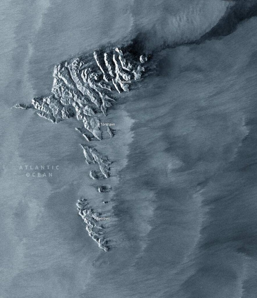
Image of the day: Faroe Islands and wind patterns in the North Atlantic
Full article
Image of the day: Faroe Islands and wind patterns in the North Atlantic
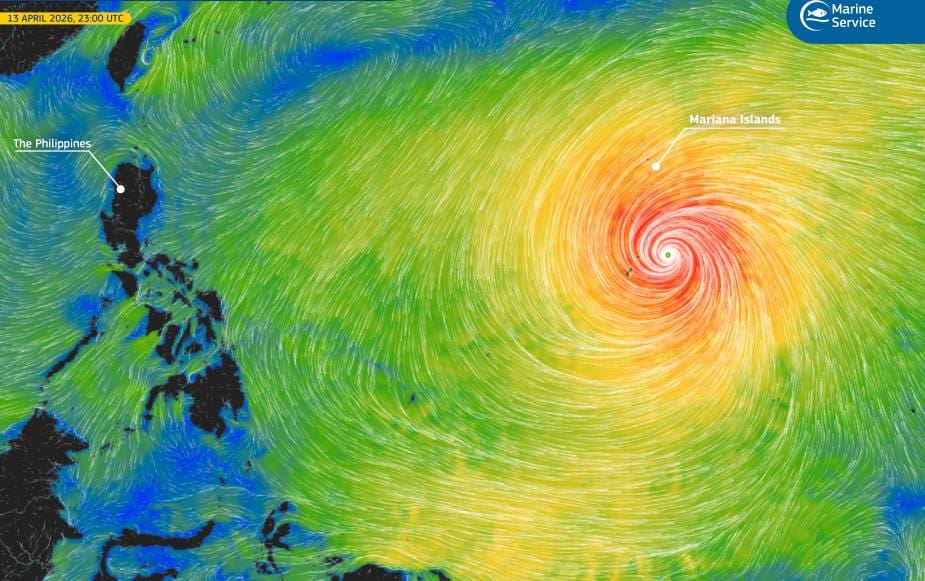
Image of the day: Super Typhoon Sinlaku near the Mariana Islands
Full article
Image of the day: Super Typhoon Sinlaku near the Mariana Islands
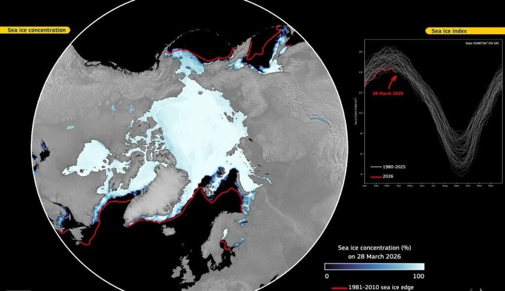
Image of the day: Arctic sea ice remains at record low levels in March 2026
Full article
Image of the day: Arctic sea ice remains at record low levels in March 2026
Ocean temperatures near record high in March: EU monitor
Full article
Ocean temperatures near record high in March: EU monitor
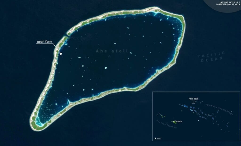
Image of the day: Pearl farming patterns in Ahe Atoll lagoon
Full article
Image of the day: Pearl farming patterns in Ahe Atoll lagoon
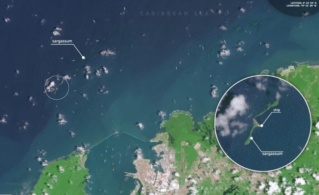
Image of the day: Sargassum streaks near Colón, Panama
Full article
Image of the day: Sargassum streaks near Colón, Panama
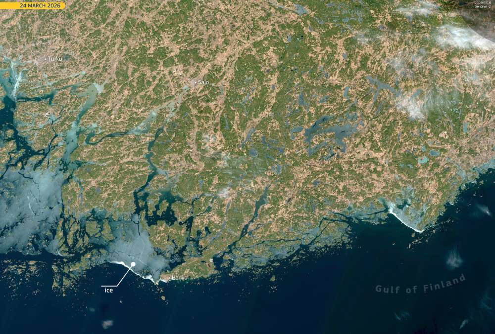
Image of the day: Ice retreat begins in the Gulf of Finland
Full article
Image of the day: Ice retreat begins in the Gulf of Finland
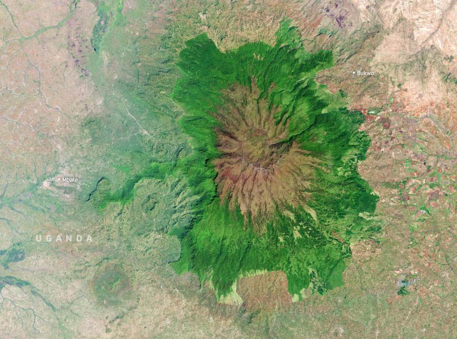
Image of the day: Mount Elgon’s caldera and forested slopes
Full article
Image of the day: Mount Elgon’s caldera and forested slopes
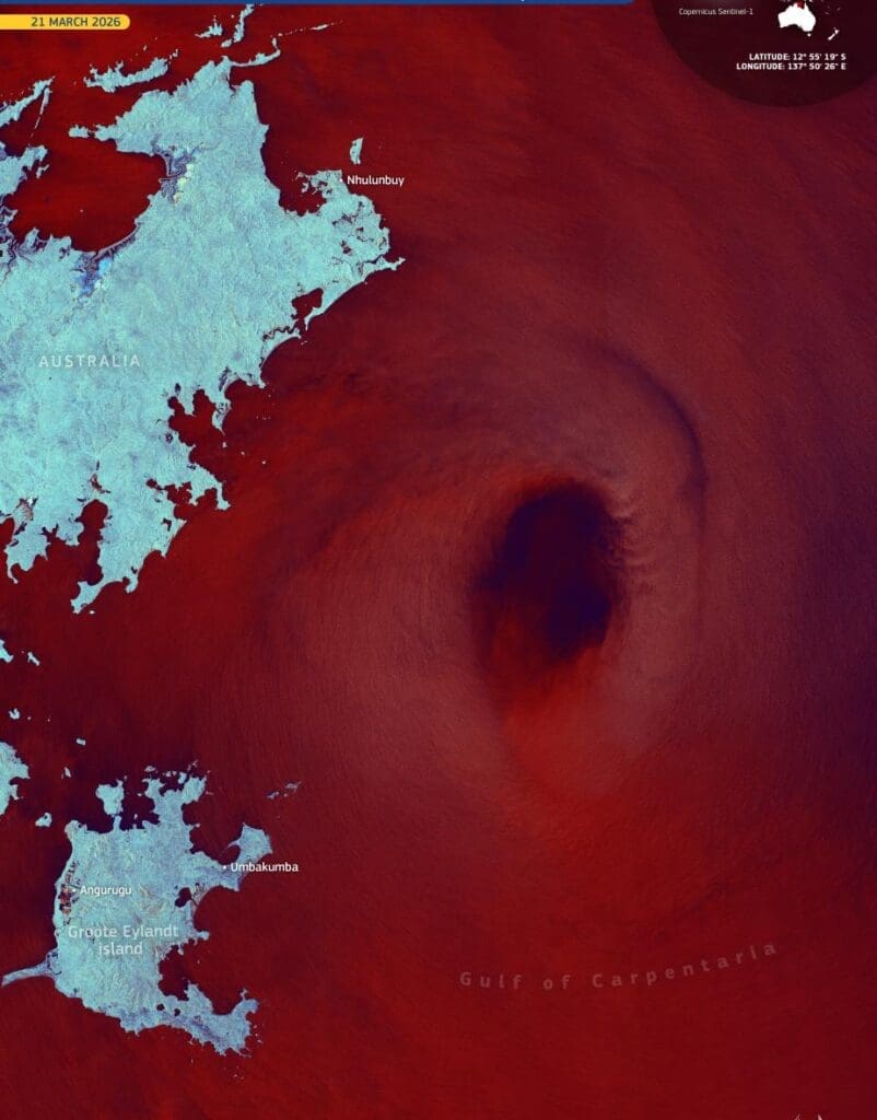
Image of the day: Cyclone Narelle crosses Australia and rebuilds over the Gulf
Full article
Image of the day: Cyclone Narelle crosses Australia and rebuilds over the Gulf
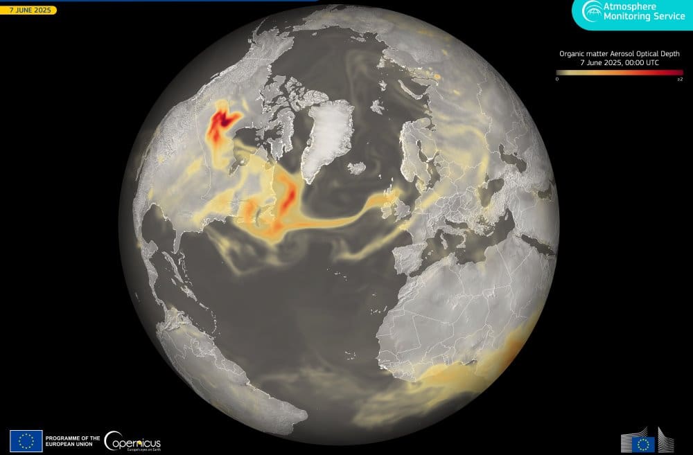
Image of the day: Canadian wildfire smoke crossed the Atlantic in 2025
Full article
Image of the day: Canadian wildfire smoke crossed the Atlantic in 2025
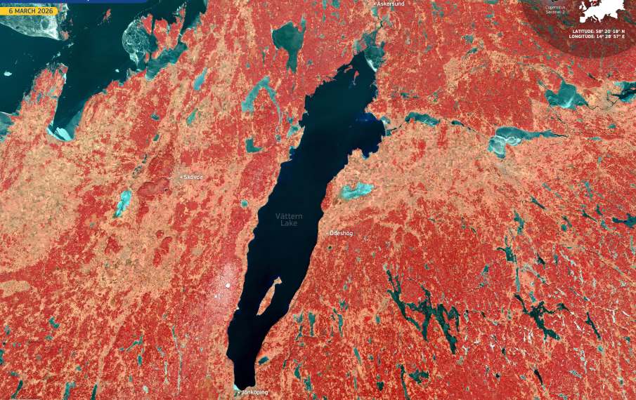
Image of the day: Lake Vättern on World Water Day
Full article
Image of the day: Lake Vättern on World Water Day
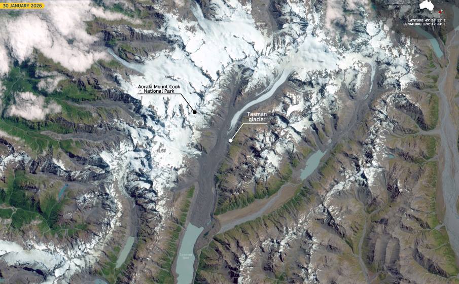
Image of the day: Tasman Glacier on World Day for Glaciers
Full article
Image of the day: Tasman Glacier on World Day for Glaciers
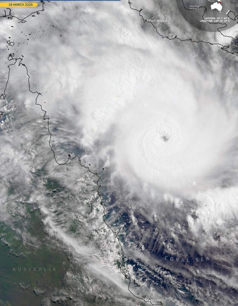
Image of the day: Cyclone Narelle before landfall in Cape York, Australia
Full article
Image of the day: Cyclone Narelle before landfall in Cape York, Australia
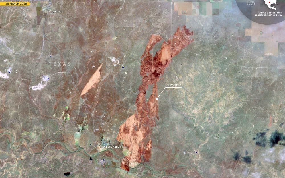
Image of the day: Wildfires sweep across the Texas Panhandle in March 2026
Full article
Image of the day: Wildfires sweep across the Texas Panhandle in March 2026
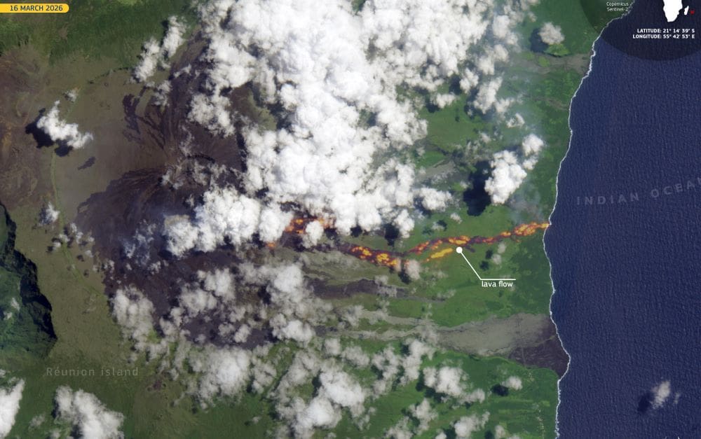
Image of the day: Lava reaches the Indian Ocean on Réunion Island
Full article
Image of the day: Lava reaches the Indian Ocean on Réunion Island
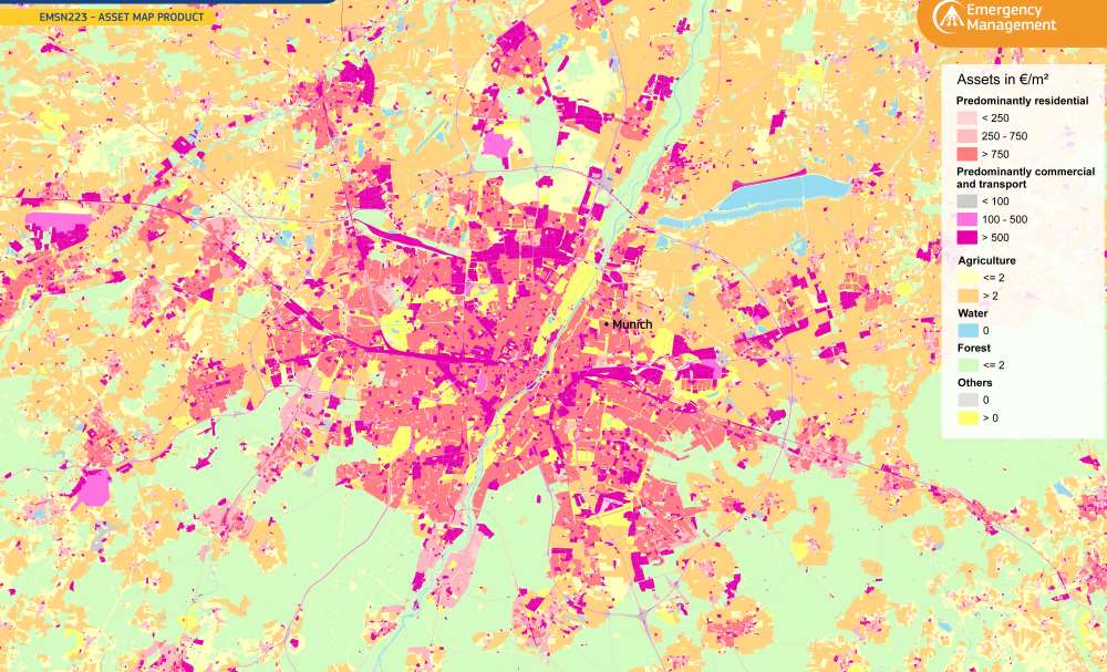
Image of the day: 2025 Munich Asset Map
Full article
Image of the day: 2025 Munich Asset Map
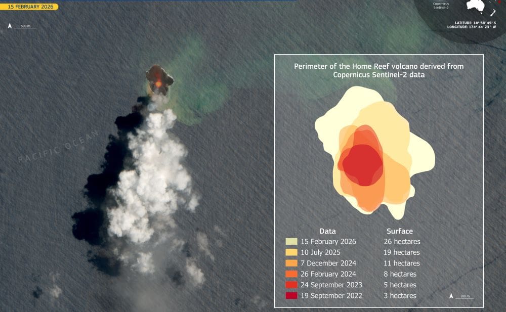
Image of the day: Home Reef volcano in Tonga grows a new island
Full article
Image of the day: Home Reef volcano in Tonga grows a new island
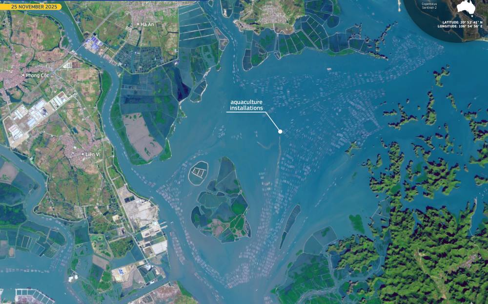
Image of the day: Aquaculture farms across Hạ Long Bay, Vietnam
Full article
Image of the day: Aquaculture farms across Hạ Long Bay, Vietnam
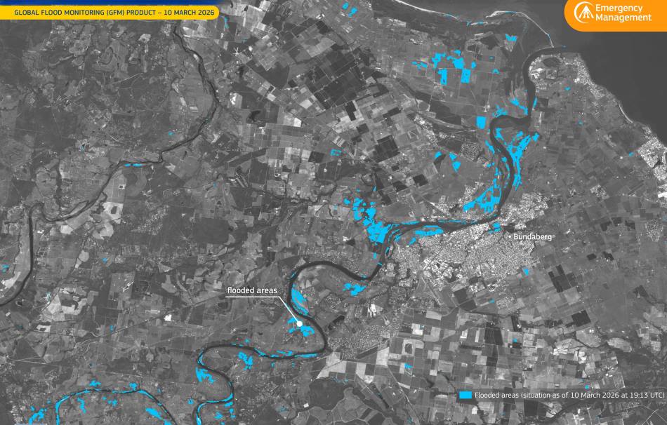
Image of the day: Burnett River flooding near Bundaberg, Australia
Full article
Image of the day: Burnett River flooding near Bundaberg, Australia

Image of the day: Early spring around Stockholm captured from space
Full article
