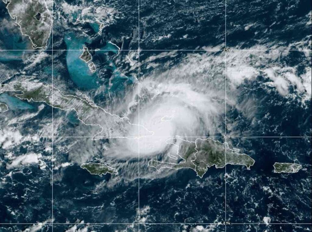
Heavy rainfall and river flooding affected parts of northern and eastern Australia in early March 2026 after persistent wet weather linked to a monsoon trough and tropical weather systems moving across the region. Rivers rose rapidly across parts of Queensland and the Northern Territory after several days of intense rainfall, prompting emergency warnings and rescue operations as communities faced rising water levels.
Flood conditions were reported across large areas of northern Australia. More than 90 river monitoring stations across the country recorded moderate or major flood levels during the event. In some locations rainfall totals exceeded 100 mm in a single day, while already saturated catchments increased the risk of rivers overflowing their banks. The flooding disrupted roads and infrastructure and led to evacuations in several communities.
In Queensland, one of the most affected areas was the Burnett River basin around the coastal city of Bundaberg. Authorities issued emergency alerts urging residents in parts of Bundaberg North, East, South and Central to leave before evacuation routes were cut by floodwaters. Evacuation centres were opened as the river continued to rise and road closures were reported across the region. At one point about 197 people were staying in evacuation centres while emergency services monitored river levels.
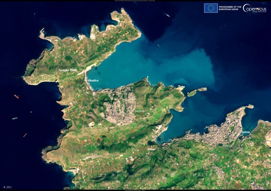
Flooded areas near Bundaberg

This satellite visualisation shows flooded areas near Bundaberg on 10 March 2026 at 19:13 UTC. The flooded zones are marked in blue using data from the Global Flood Monitoring product of the Copernicus Emergency Management Service (CEMS). The system uses radar observations from the Copernicus Sentinel-1 satellite to detect water on the Earth’s surface and map the extent of floods worldwide.
In Bundaberg, the Burnett River peaked at about 7.4 m, exceeding the major flood threshold and inundating parts of the city and surrounding areas. Around 240 homes were flooded and about 120 businesses were affected, while roughly 2,000 properties lost power during the event as floodwaters spread across low-lying parts of the region.
Radar satellites such as Sentinel-1 can observe the Earth through cloud cover and during the night, allowing floodwaters to be mapped even during severe weather. The Copernicus Global Flood Monitoring (GFM) system, which produced the flood map shown for 10 March 2026 at 19:13 UTC, provides near-real-time information that helps authorities track flooding and support emergency response during extreme weather events.
Featured image credit: European Union, Copernicus Emergency Management Service