
Image of the day: Ganges River in eastern India Full article
Image of the day: Ganges River in eastern India

Image of the day: Gothenburg toward climate neutrality
Full article
Image of the day: Gothenburg toward climate neutrality

Image of the day: Floodwaters spread across Cagayan Valley, the Philippines
Full article
Image of the day: Floodwaters spread across Cagayan Valley, the Philippines

Image of the day: Nisyros island’s volcanic landscape
Full article
Image of the day: Nisyros island’s volcanic landscape
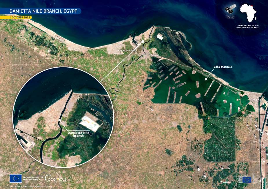
Image of the day: Nile Delta’s Damietta reach unfolds
Full article
Image of the day: Nile Delta’s Damietta reach unfolds
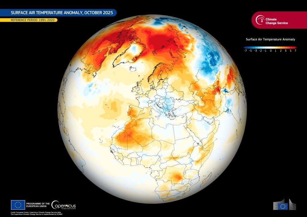
Image of the day: October 2025 stands among the warmest on record
Full article
Image of the day: October 2025 stands among the warmest on record

Image of the day: Belém, Brazil hosts COP30
Full article
Image of the day: Belém, Brazil hosts COP30
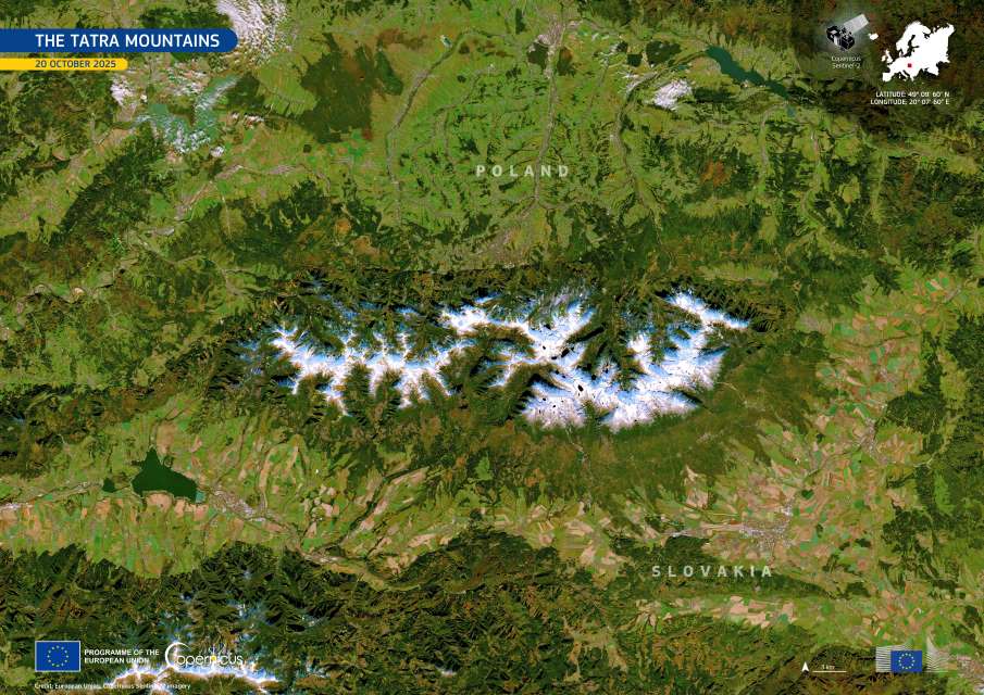
Image of the day: The Tatra Mountains
Full article
Image of the day: The Tatra Mountains
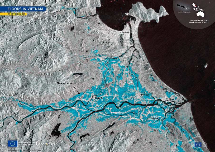
Image of the day: October’s floods in Vietnam
Full article
Image of the day: October’s floods in Vietnam

Image of the day: Copernicus Sentinel-1D joins Europe’s radar fleet
Full article
Image of the day: Copernicus Sentinel-1D joins Europe’s radar fleet
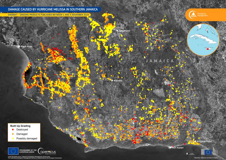
Image of the day: Hurricane Melissa’s devastation mapped by Copernicus EMS
Full article
Image of the day: Hurricane Melissa’s devastation mapped by Copernicus EMS
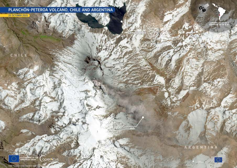
Image of the day: Ash plume from Planchón-Peteroa volcano drifts into Argentina
Full article
Image of the day: Ash plume from Planchón-Peteroa volcano drifts into Argentina
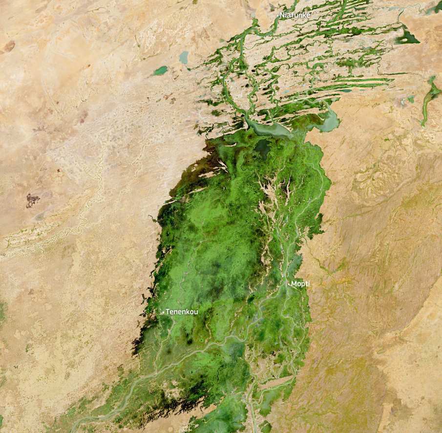
Image of the day: Patterns of water and sand in Mali’s Inland Delta
Full article
Image of the day: Patterns of water and sand in Mali’s Inland Delta
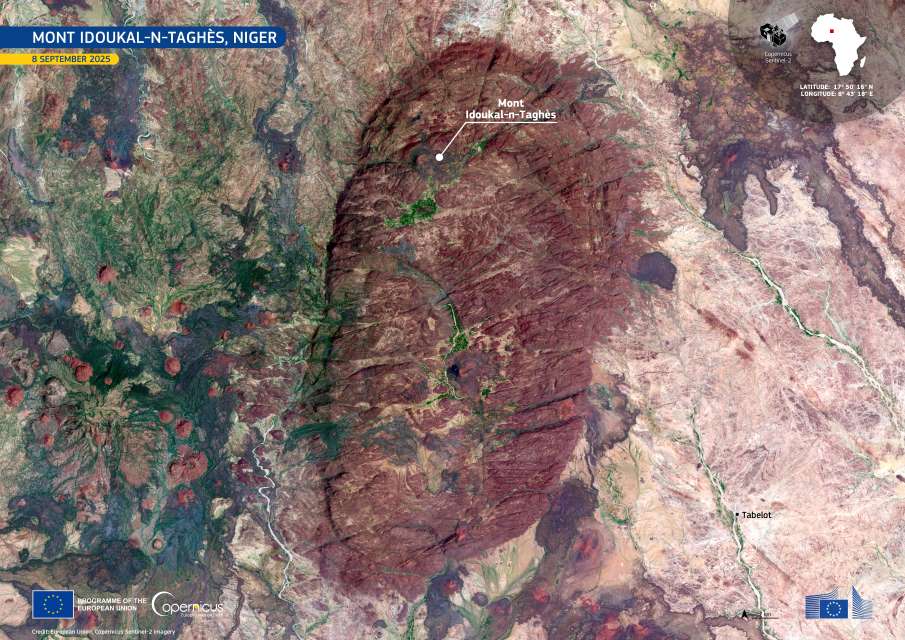
Image of the day: The volcanic heights of Mont Idoukal-n-Taghès in Niger
Full article
Image of the day: The volcanic heights of Mont Idoukal-n-Taghès in Niger
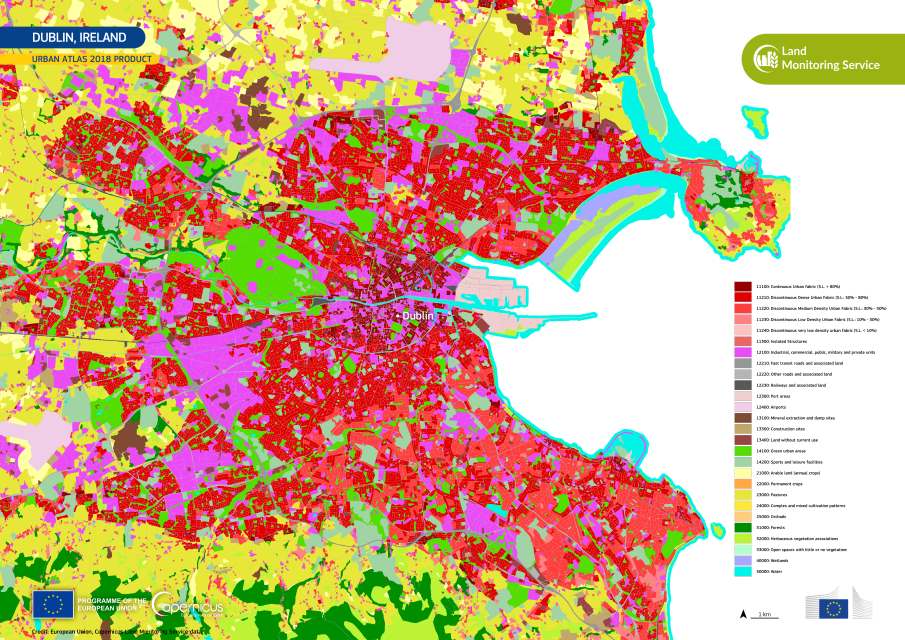
Image of the day: Dublin’s urban landscape captured for World Cities Day
Full article
Image of the day: Dublin’s urban landscape captured for World Cities Day
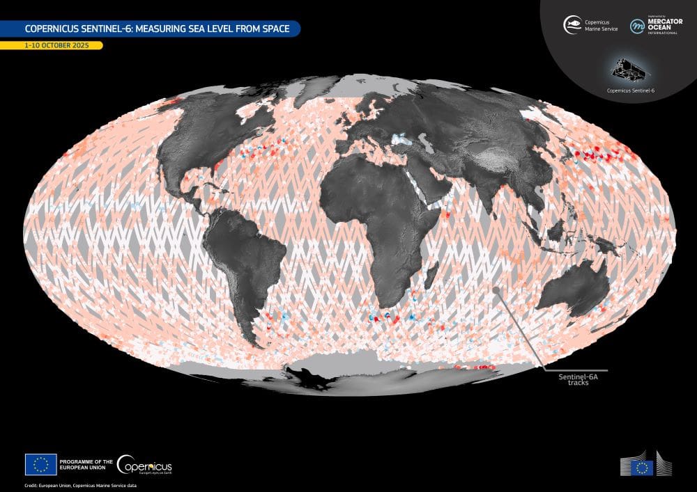
Image of the day: Tracking global sea levels with Copernicus Sentinel-6
Full article
Image of the day: Tracking global sea levels with Copernicus Sentinel-6
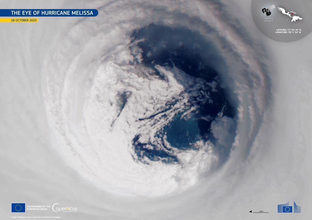
Image of the day: Sentinel-2 captures the eye of Hurricane Melissa near Jamaica
Full article
Image of the day: Sentinel-2 captures the eye of Hurricane Melissa near Jamaica
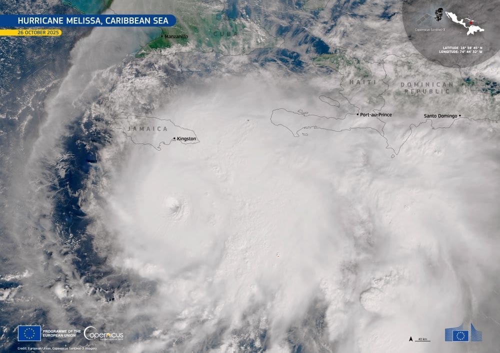
Image of the day: The Eye of Hurricane Melissa South of Jamaica
Full article
Image of the day: The Eye of Hurricane Melissa South of Jamaica
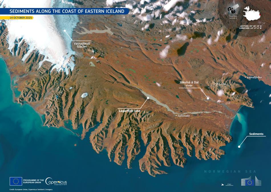
Image of the day: Sediment plume from Iceland’s glacial river
Full article
Image of the day: Sediment plume from Iceland’s glacial river
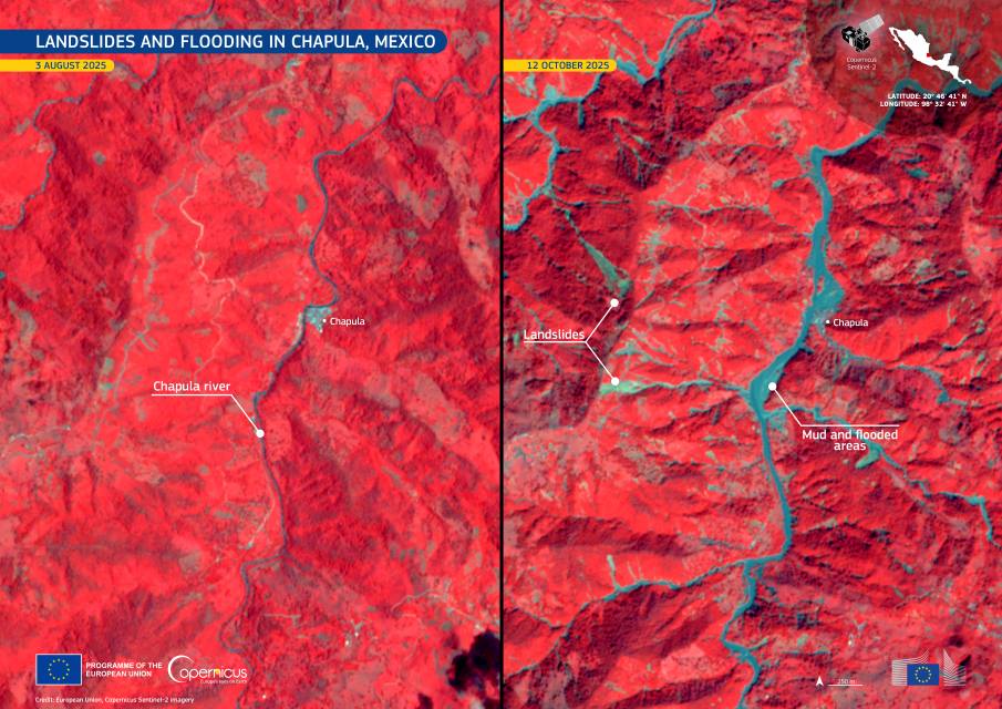
Image of the day: Floods and landslides devastate central Mexico
Full article
Image of the day: Floods and landslides devastate central Mexico
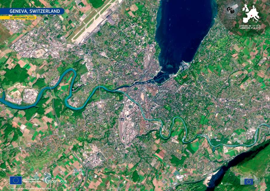
Image of the day: Geneva from above
Full article
Image of the day: Geneva from above
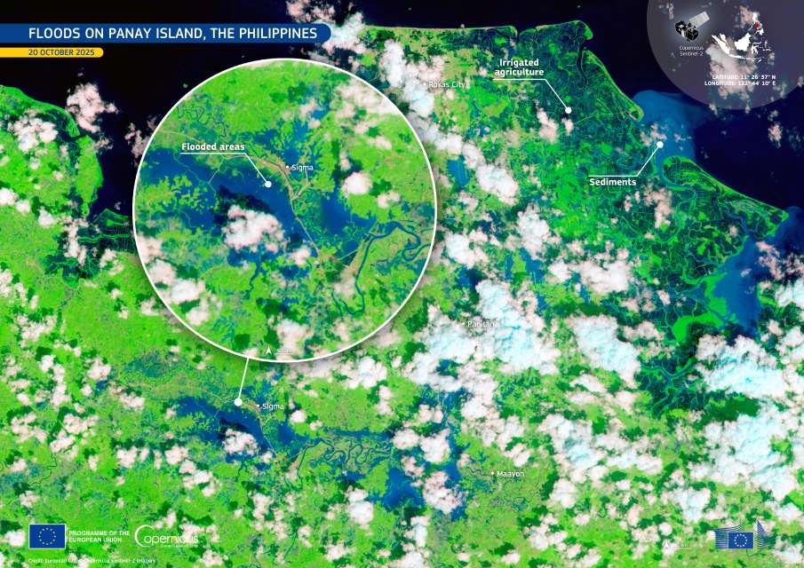
Image of the day: Panay floods after Ramil deluge
Full article
Image of the day: Panay floods after Ramil deluge
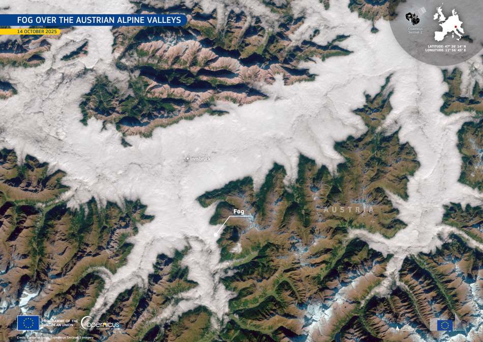
Image of the day: Autumn fog drapes Austria’s alpine valleys
Full article
Image of the day: Autumn fog drapes Austria’s alpine valleys

Image of the day: Seasonal colour shift in Italy’s Apennine forests
Full article