
Image of the day: Morocco’s landscape transforms after heavy rainfall Full article
Image of the day: Morocco’s landscape transforms after heavy rainfall

Image of the day: Antarctic sea ice continues its decline in 2025
Full article
Image of the day: Antarctic sea ice continues its decline in 2025

Image of the day: Flooding in Spain after Storm Martinho
Full article
Image of the day: Flooding in Spain after Storm Martinho

Image of the day: Dublin seen by Copernicus Sentinel-1C
Full article
Image of the day: Dublin seen by Copernicus Sentinel-1C
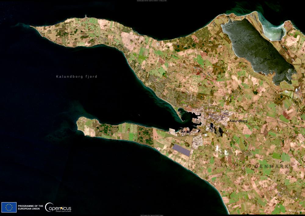
Image of the day: Denmark’s Kalundborg Fjord
Full article
Image of the day: Denmark’s Kalundborg Fjord
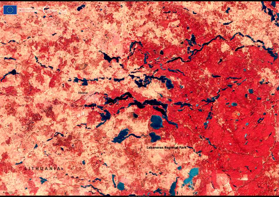
Image of the Day: Labanoras Regional Park’s freshwater tapestry
Full article
Image of the Day: Labanoras Regional Park’s freshwater tapestry
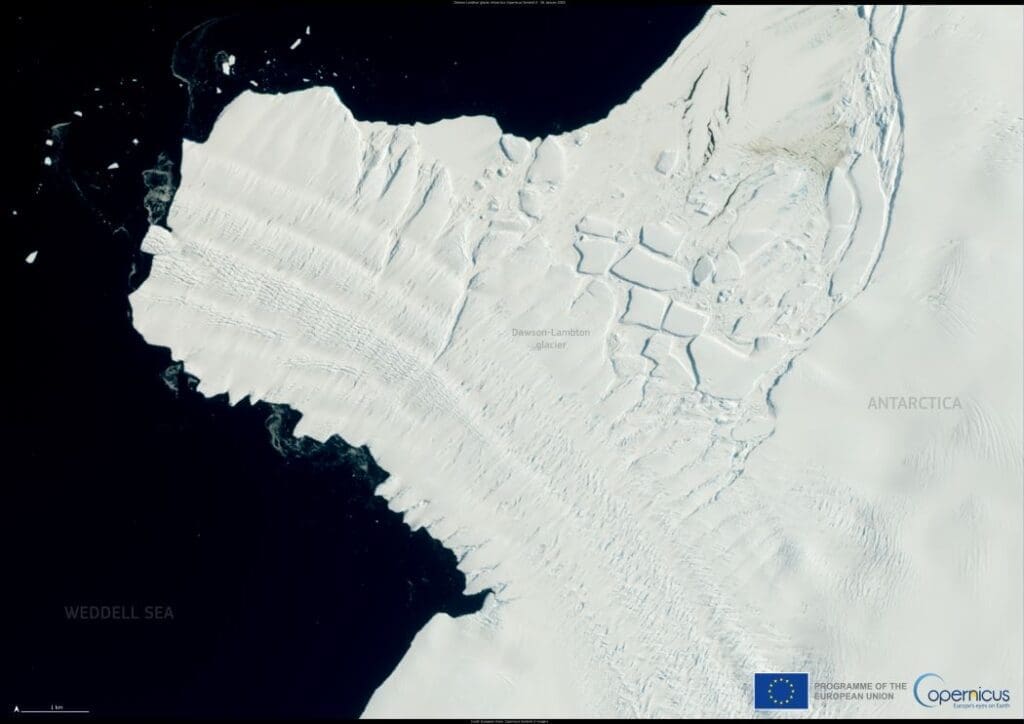
Image of the day: World Day for Glaciers highlights global ice loss
Full article
Image of the day: World Day for Glaciers highlights global ice loss
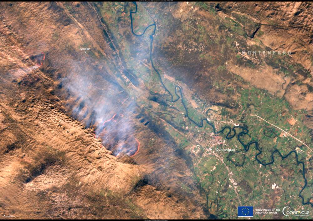
Image of the day: Wildfire spreads across Mount Garač, Montenegro
Full article
Image of the day: Wildfire spreads across Mount Garač, Montenegro
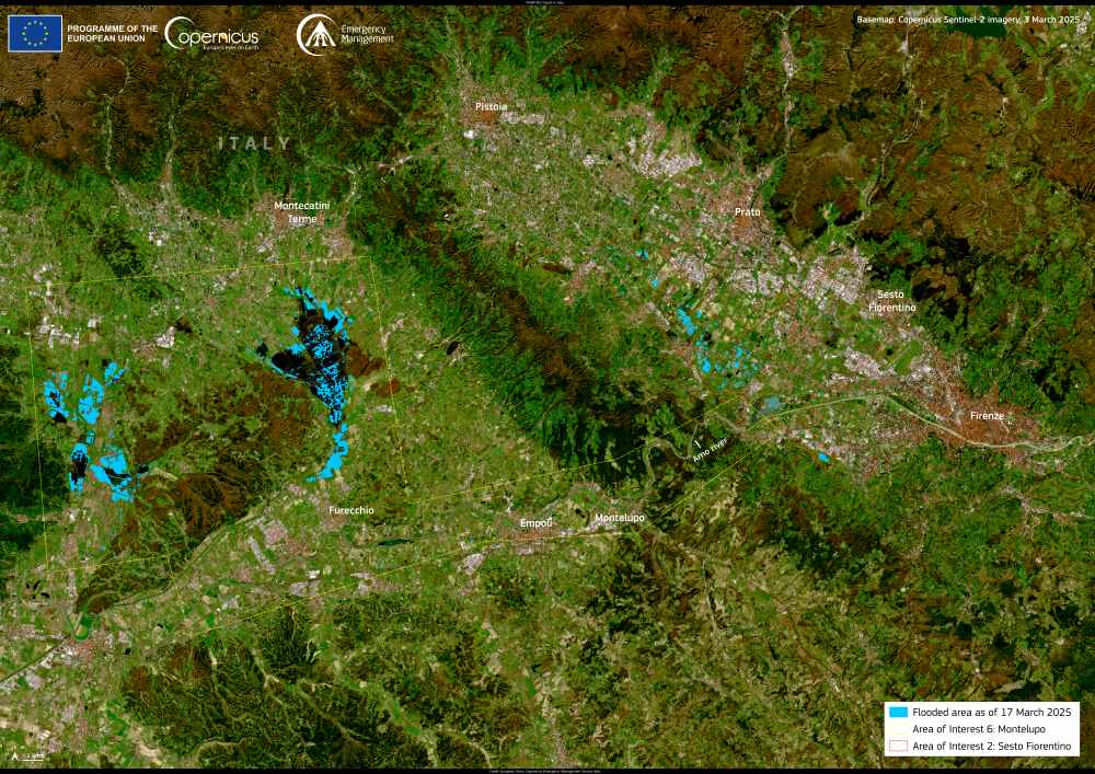
Image of the day: Flooding and landslides strike Italy
Full article
Image of the day: Flooding and landslides strike Italy
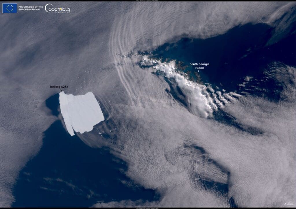
Image of the day: Massive iceberg A23a stalls near South Georgia Island
Full article
Image of the day: Massive iceberg A23a stalls near South Georgia Island
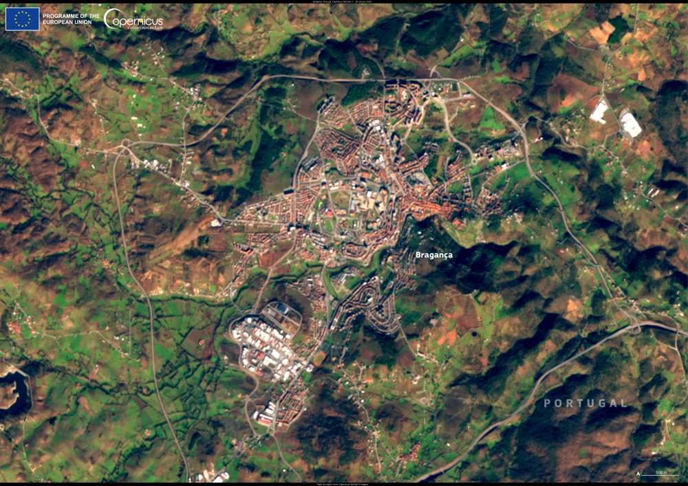
Image of the day: Bragança, a medieval gem in Portugal’s northeast
Full article
Image of the day: Bragança, a medieval gem in Portugal’s northeast
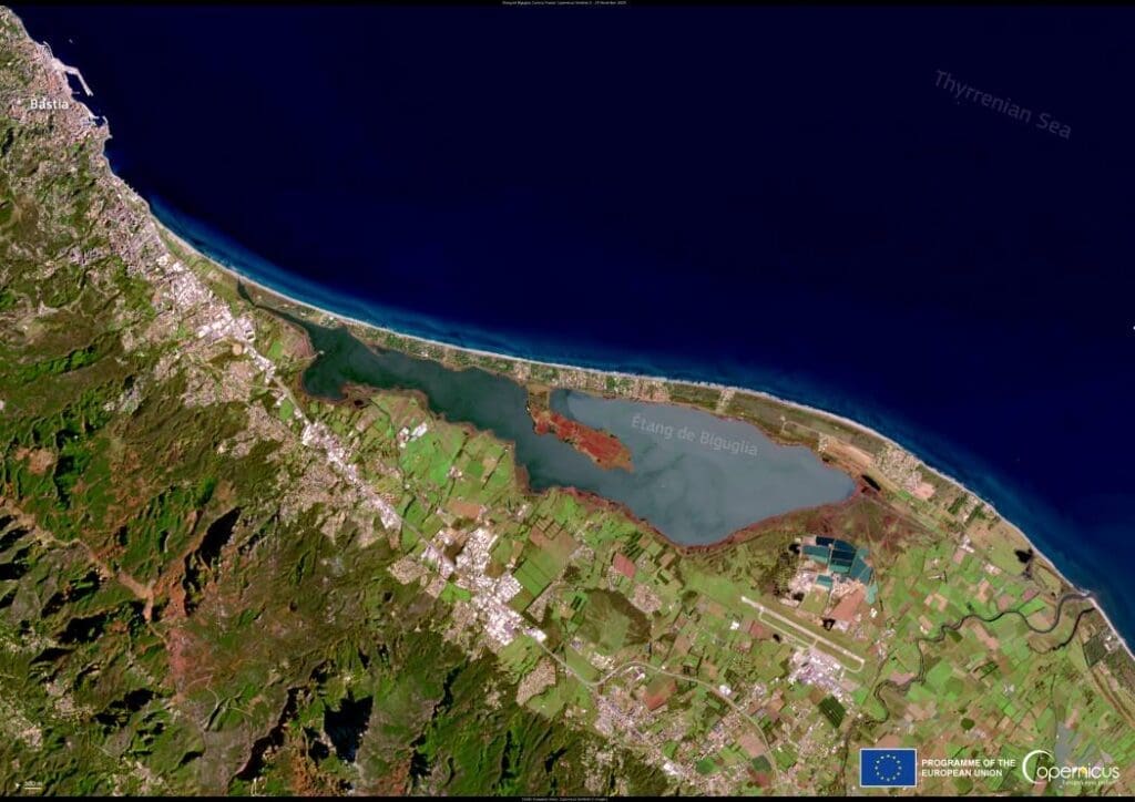
Image of the day: Étang de Biguglia, Corsica
Full article
Image of the day: Étang de Biguglia, Corsica
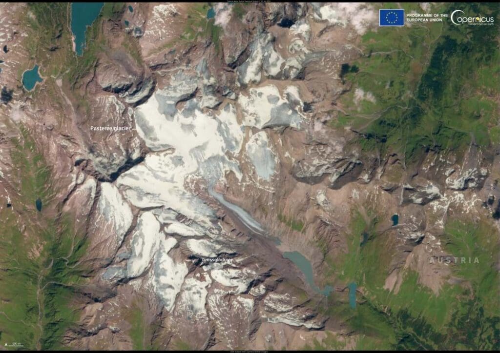
Image of the day: Austria’s Pasterze Glacier and its retreating ice
Full article
Image of the day: Austria’s Pasterze Glacier and its retreating ice
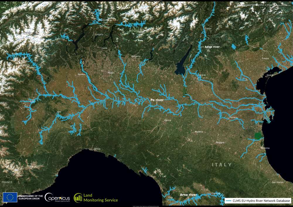
Image of the day: A view of the Po River
Full article
Image of the day: A view of the Po River
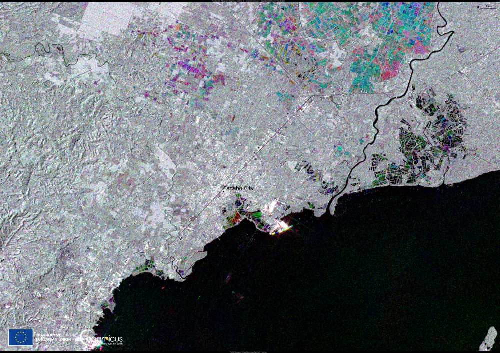
Image of the day: Panabo City, the Philippines
Full article
Image of the day: Panabo City, the Philippines
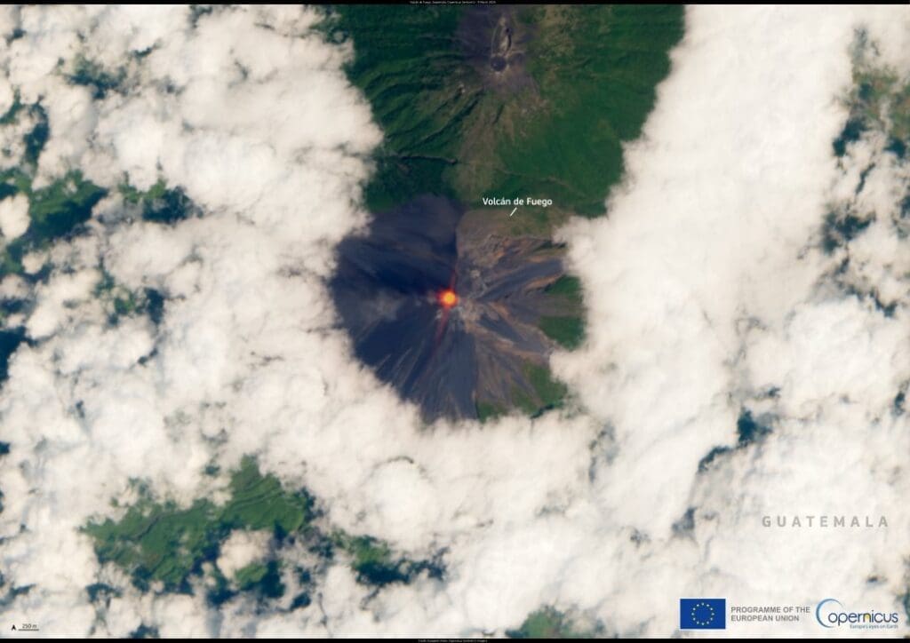
Image of the day: Guatemala’s Fuego Volcano erupts
Full article
Image of the day: Guatemala’s Fuego Volcano erupts
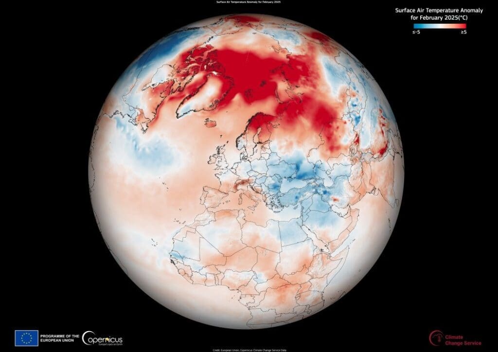
Image of the day: February 2025 was the third warmest on record
Full article
Image of the day: February 2025 was the third warmest on record
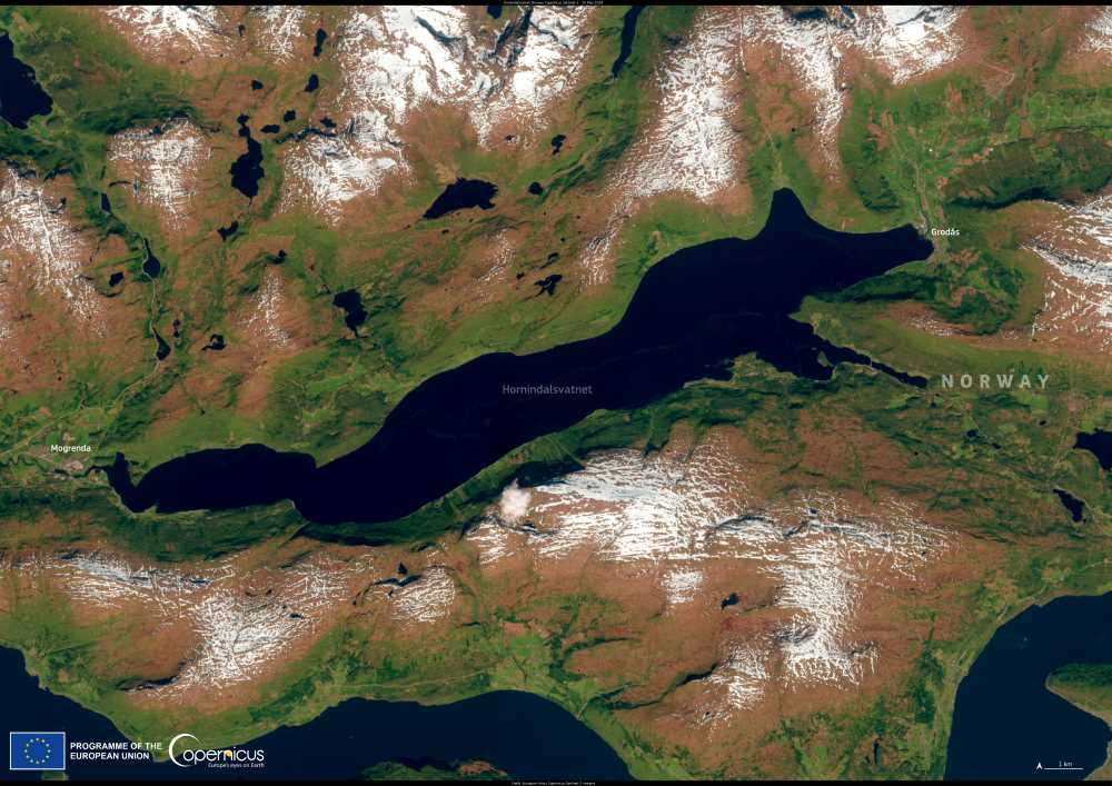
Image of the day: Hornindalsvatnet, Norway
Full article
Image of the day: Hornindalsvatnet, Norway
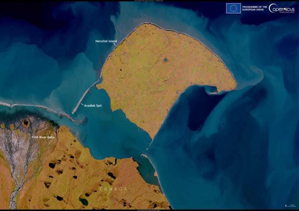
Image of the day: Shifting Arctic shores along Canada’s Yukon coast
Full article
Image of the day: Shifting Arctic shores along Canada’s Yukon coast
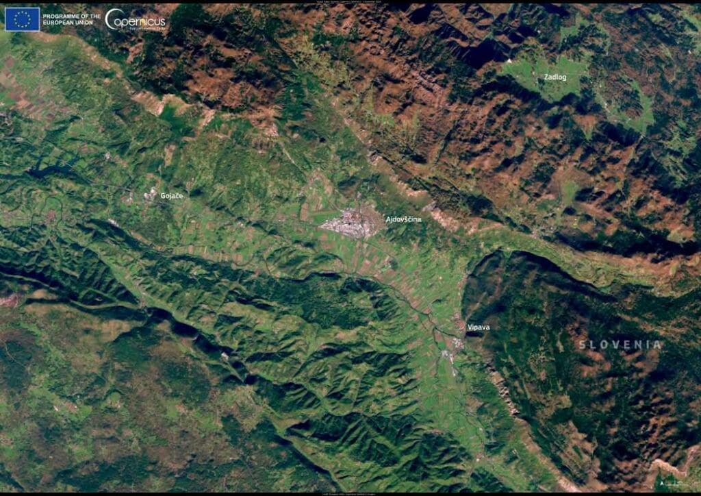
Image of the day: Agricultural landscapes of Vipava Valley, Slovenia
Full article
Image of the day: Agricultural landscapes of Vipava Valley, Slovenia
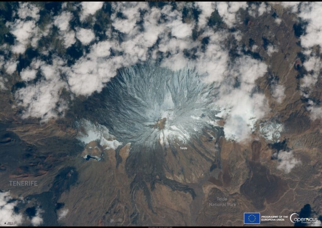
Image of the day: Snow blankets Mount Teide
Full article
Image of the day: Snow blankets Mount Teide
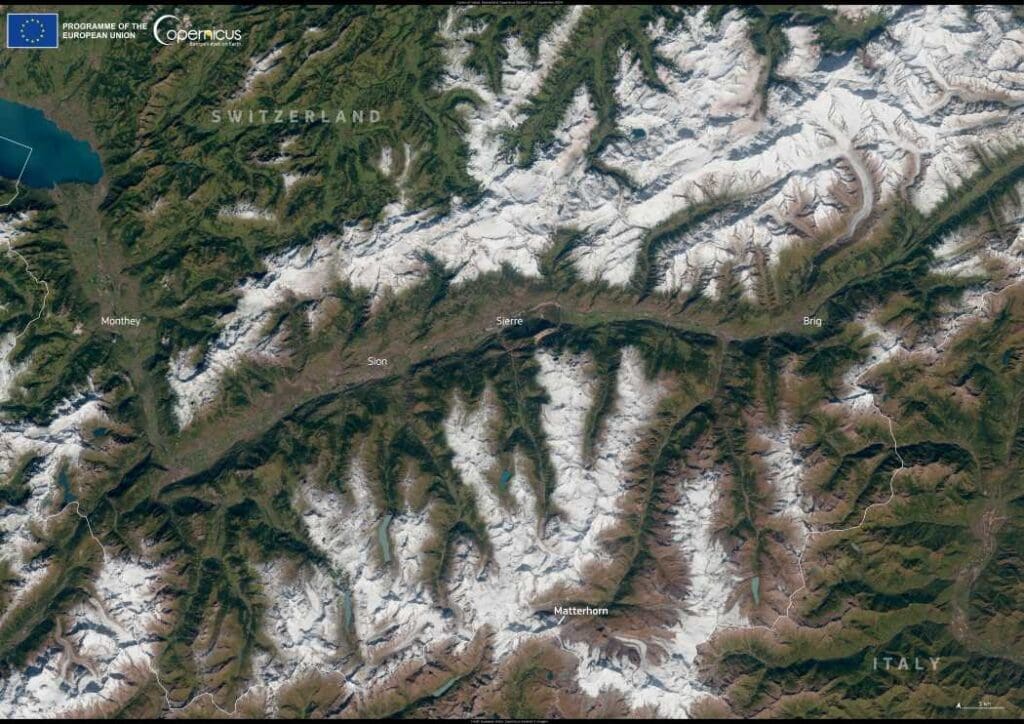
Image of the day: Valais, Switzerland
Full article
Image of the day: Valais, Switzerland
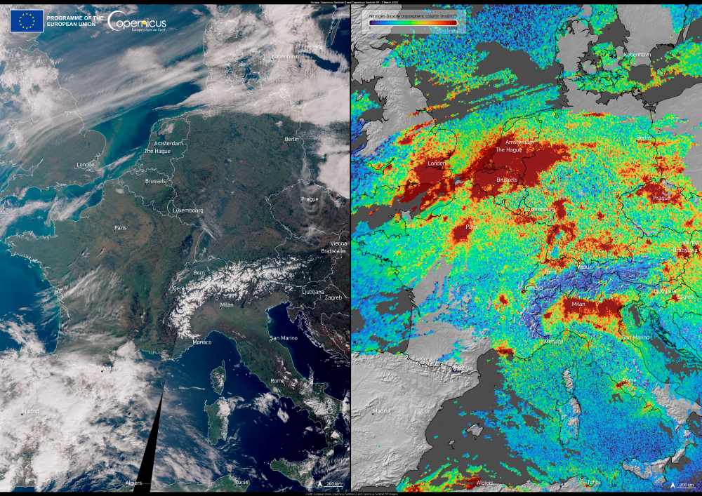
Image of the day: Air quality over Europe in early March 2025
Full article
Image of the day: Air quality over Europe in early March 2025
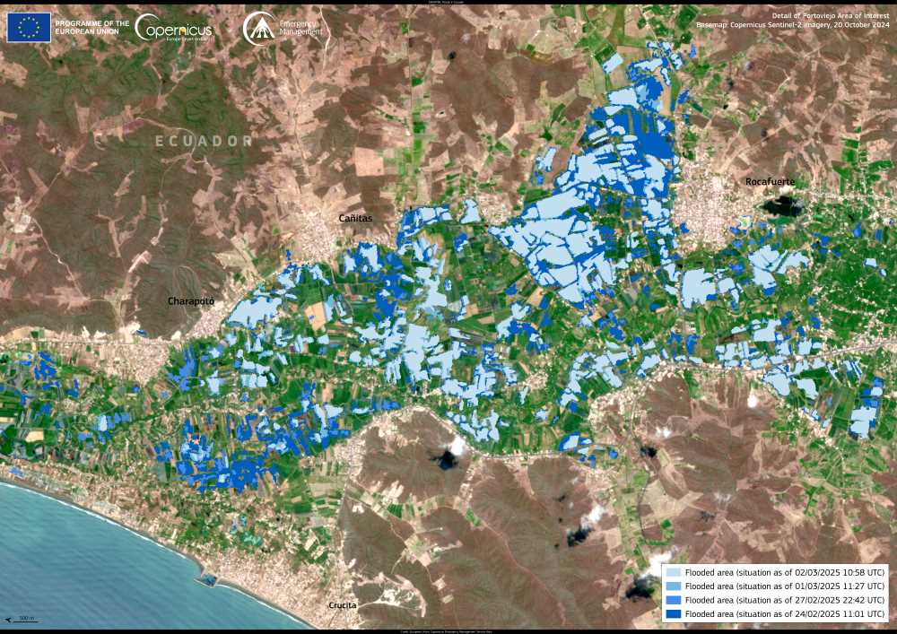
Image of the day: Flooding in Ecuador
Full article