
Image of the day: Germany’s renewable energy revolution Full article
Image of the day: Germany’s renewable energy revolution

Image of the day: Malta’s commitment to bird conservation
Full article
Image of the day: Malta’s commitment to bird conservation

Image of the day: Cyprus transforms its infrastructure for growth
Full article
Image of the day: Cyprus transforms its infrastructure for growth

Image of the day: Lava fountains light up Kilauea volcano in Hawaii
Full article
Image of the day: Lava fountains light up Kilauea volcano in Hawaii
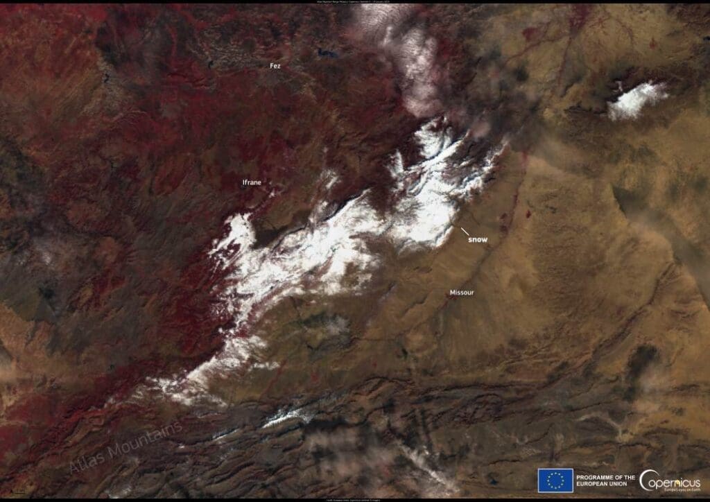
Image of the day: Snowfall in the Atlas Mountains
Full article
Image of the day: Snowfall in the Atlas Mountains

Climate Science Digest: January 21, 2025
Full article
Climate Science Digest: January 21, 2025
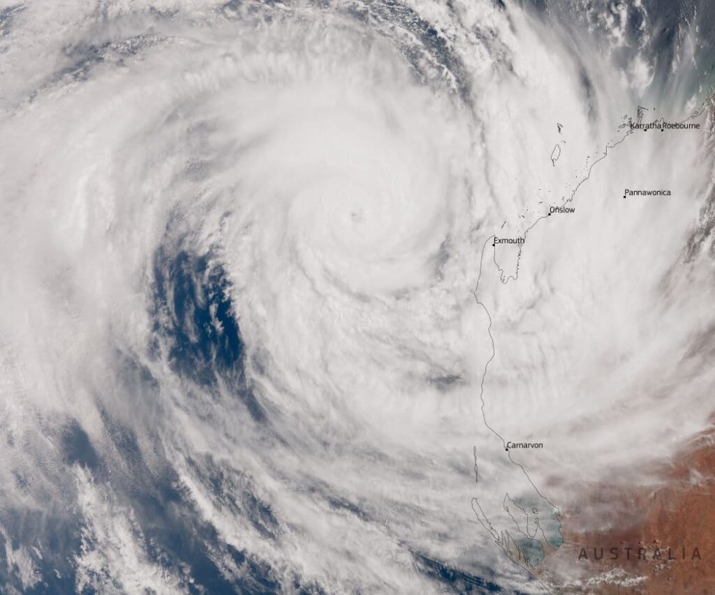
Image of the day: Tropical Cyclone Sean
Full article
Image of the day: Tropical Cyclone Sean
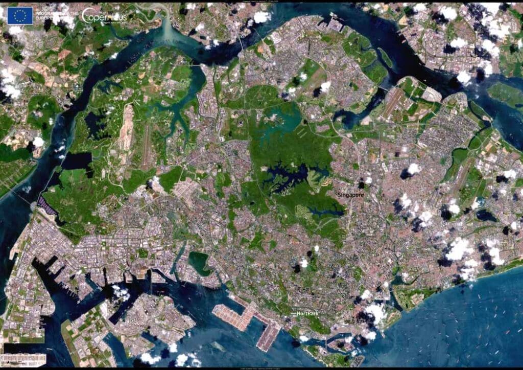
Image of the day: Singapore’s healing gardens
Full article
Image of the day: Singapore’s healing gardens
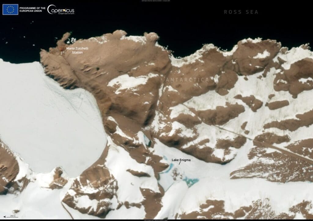
Image of the day: The mystery beneath Lake Enigma, Antarctica
Full article
Image of the day: The mystery beneath Lake Enigma, Antarctica
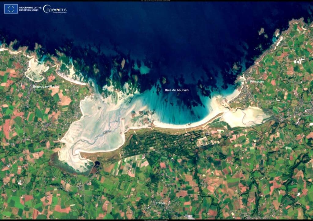
Image of the day: Baie de Goulven, France
Full article
Image of the day: Baie de Goulven, France
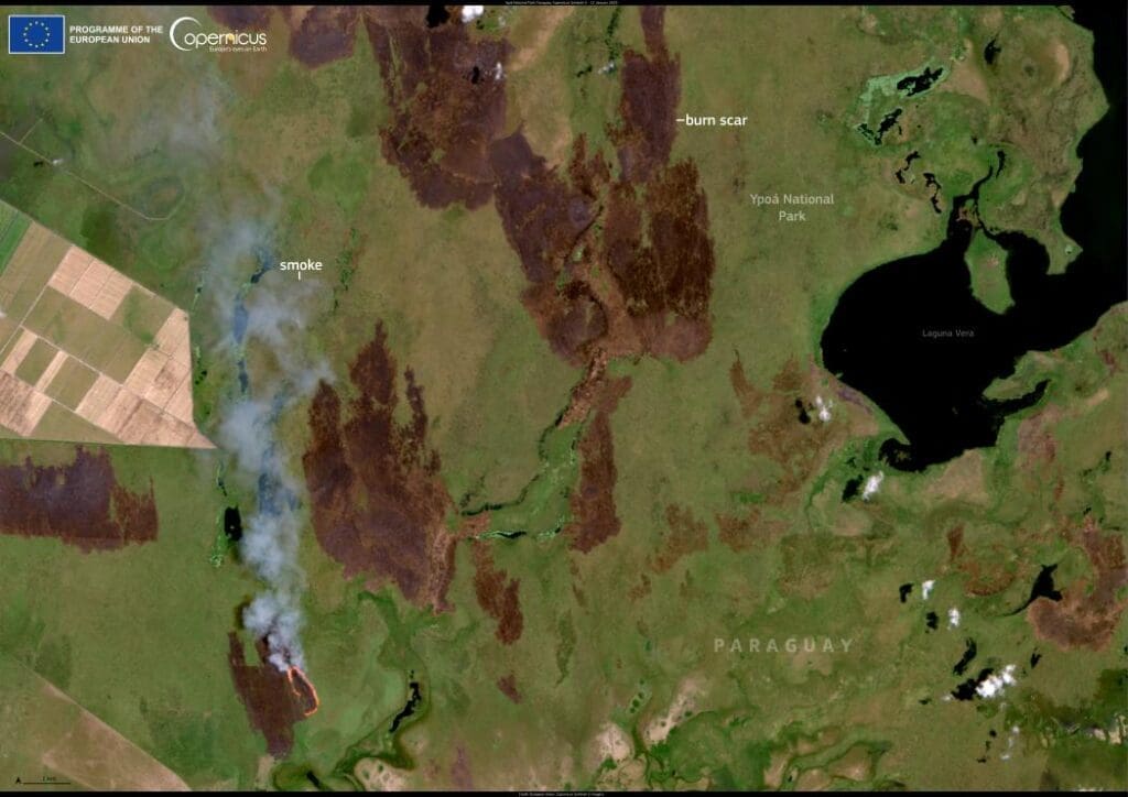
Image of the Day: Wildfires ravage Ypoá National Park, Paraguay
Full article
Image of the Day: Wildfires ravage Ypoá National Park, Paraguay
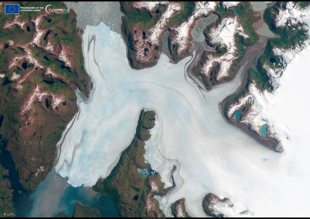
Image of the day: Pio XI glacier defies global retreat trends
Full article
Image of the day: Pio XI glacier defies global retreat trends
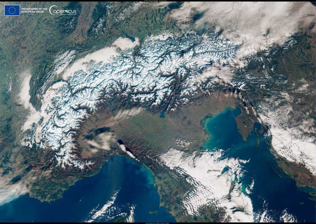
Image of the day: Snow blankets Alps, matching historical averages
Full article
Image of the day: Snow blankets Alps, matching historical averages
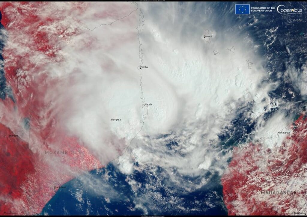
Image of the day: Cyclone Dikeledi
Full article
Image of the day: Cyclone Dikeledi
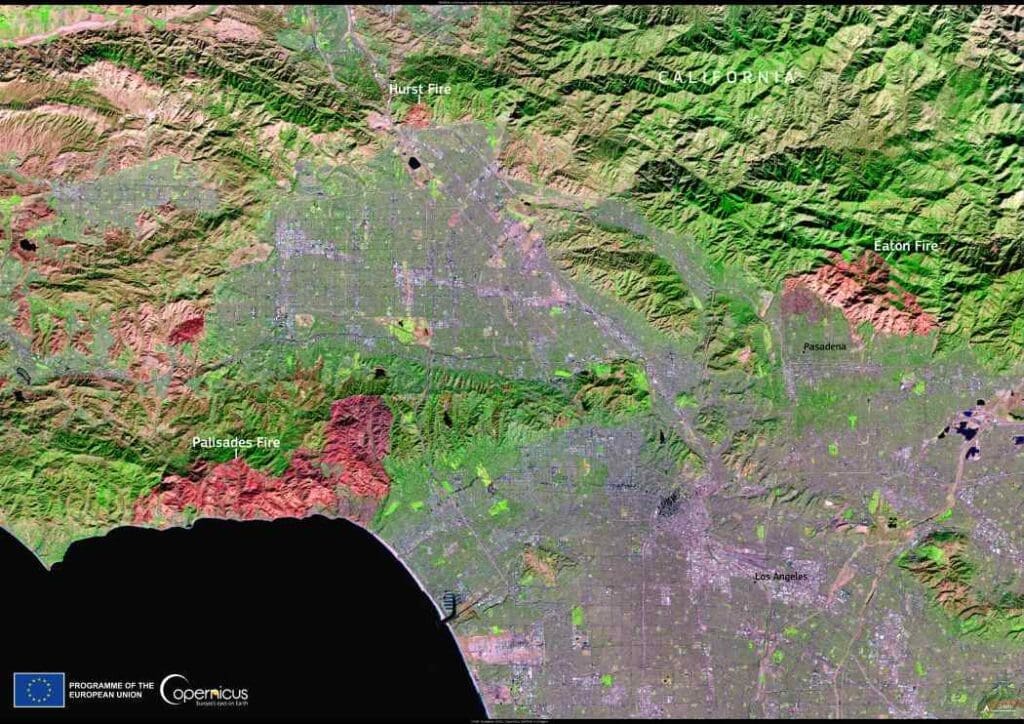
Image of the day: Los Angeles wildfires leave vast scars visible from space
Full article
Image of the day: Los Angeles wildfires leave vast scars visible from space
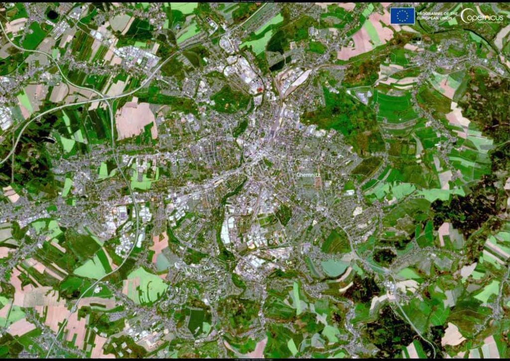
Image of the day: Chemnitz, Germany
Full article
Image of the day: Chemnitz, Germany
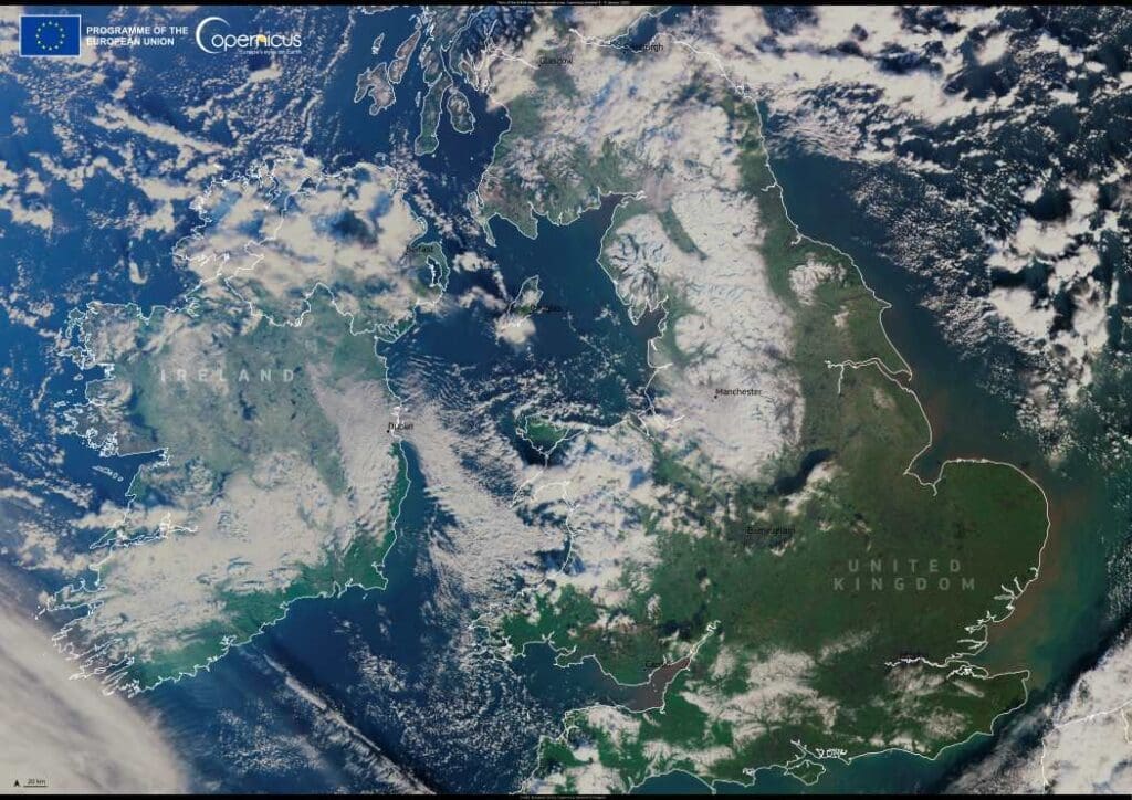
Image of the day: Snow blankets the British Isles
Full article
Image of the day: Snow blankets the British Isles
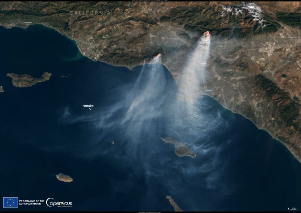
Image of the day: Wildfires engulf Los Angeles
Full article
Image of the day: Wildfires engulf Los Angeles
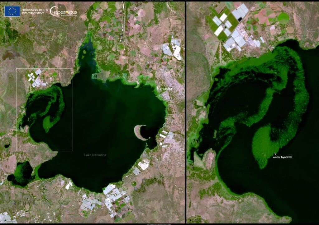
Image of the day: Invasive water hyacinth blankets Lake Naivasha
Full article
Image of the day: Invasive water hyacinth blankets Lake Naivasha
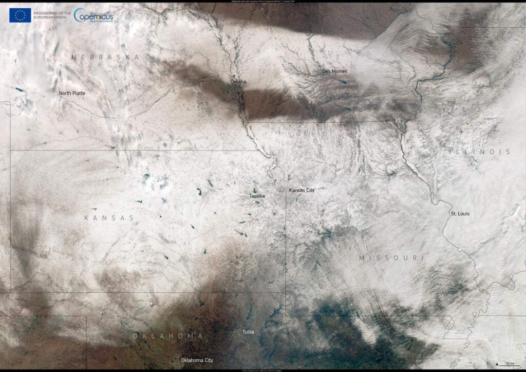
Image of the day: Winter storm blankets the Midwest, US
Full article
Image of the day: Winter storm blankets the Midwest, US
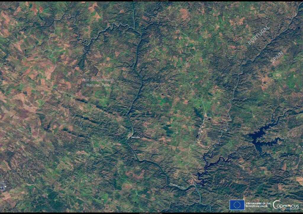
Image of the day: Iberian lynx recovery in Portugal’s Vale do Guadiana
Full article
Image of the day: Iberian lynx recovery in Portugal’s Vale do Guadiana
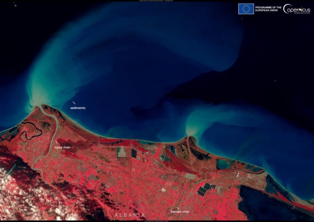
Image of the day: Sediment discharge in the Adriatic Sea
Full article
Image of the day: Sediment discharge in the Adriatic Sea
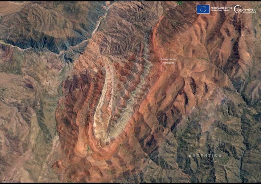
Image of the day: A kaleidoscope in Argentina’s Andes
Full article
Image of the day: A kaleidoscope in Argentina’s Andes
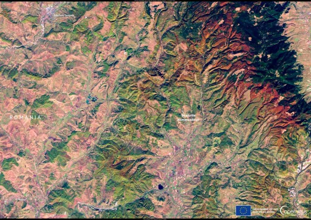
Image of the day: Autumn hues of Dealurile Homoroadelor
Full article