
Image of the day: Flooding in Aceh after Cyclone Senyar Full article
Image of the day: Flooding in Aceh after Cyclone Senyar

Image of the day: Cluj-Napoca from above during a season of reflection
Full article
Image of the day: Cluj-Napoca from above during a season of reflection

Image of the day: Colours and contours of the Bolivian Altiplano
Full article
Image of the day: Colours and contours of the Bolivian Altiplano

Image of the day: Colours shaped by the Huelva estuary
Full article
Image of the day: Colours shaped by the Huelva estuary
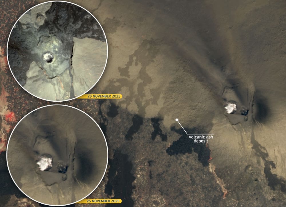
Image of the day: New crater revealed at Hayli Gubbi volcano
Full article
Image of the day: New crater revealed at Hayli Gubbi volcano
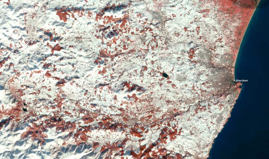
Image of the day: Winter storm swept across north-east Scotland
Full article
Image of the day: Winter storm swept across north-east Scotland
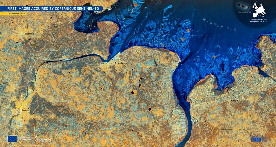
Image of the day: Radar view of northern Germany from Sentinel-1D
Full article
Image of the day: Radar view of northern Germany from Sentinel-1D
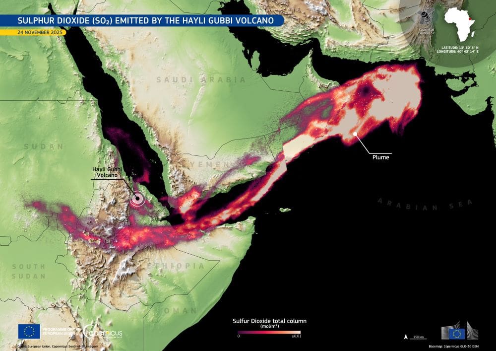
Image of the day: Sulfur dioxide plume from Ethiopia’s Hayli Gubbi eruption
Full article
Image of the day: Sulfur dioxide plume from Ethiopia’s Hayli Gubbi eruption
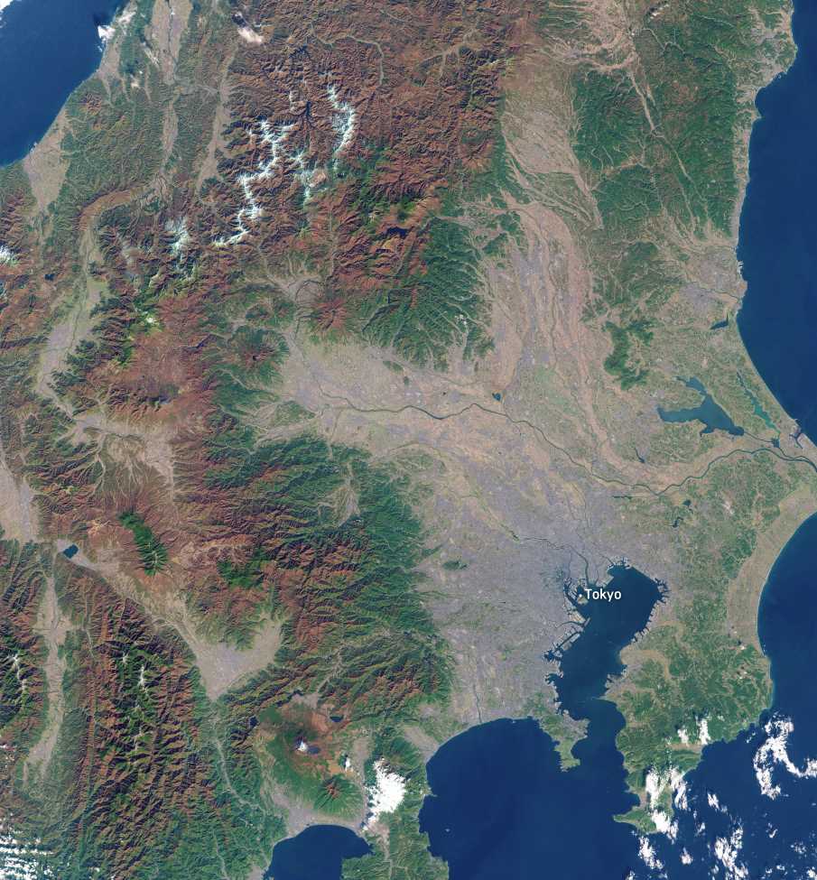
Image of the day: Autumn foliage blankets Honshu Island
Full article
Image of the day: Autumn foliage blankets Honshu Island
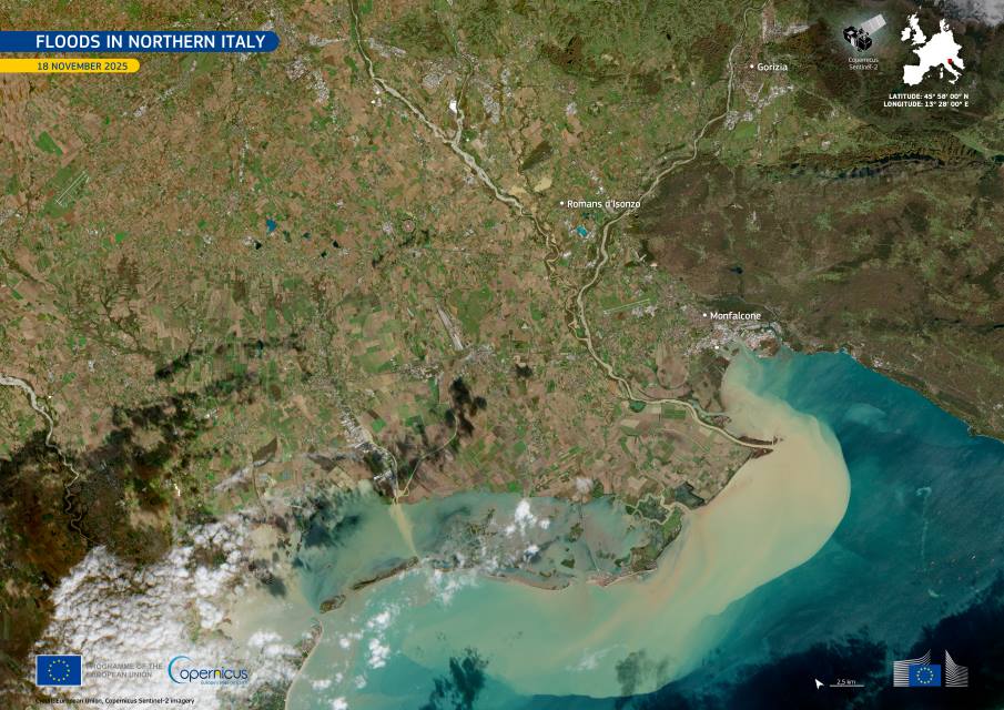
Image of the day: Floods sweeping across northern Italy
Full article
Image of the day: Floods sweeping across northern Italy
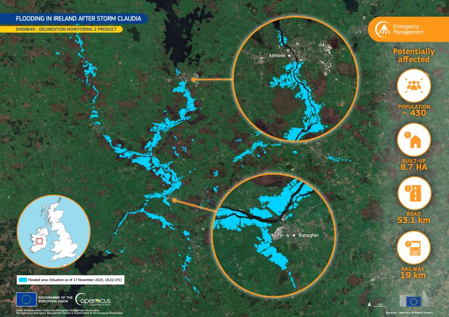
Image of the day: Severe flooding across Ireland after Storm Claudia
Full article
Image of the day: Severe flooding across Ireland after Storm Claudia
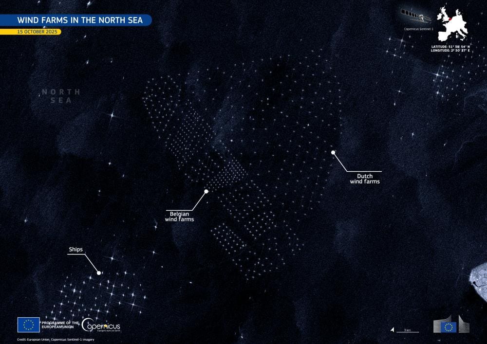
Image of the day: Renewable energy sites in the North Sea
Full article
Image of the day: Renewable energy sites in the North Sea
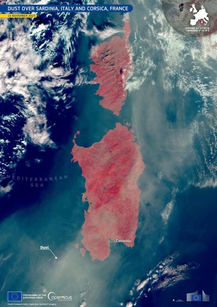
Image of the day: Saharan dust over Sardinia and Corsica
Full article
Image of the day: Saharan dust over Sardinia and Corsica
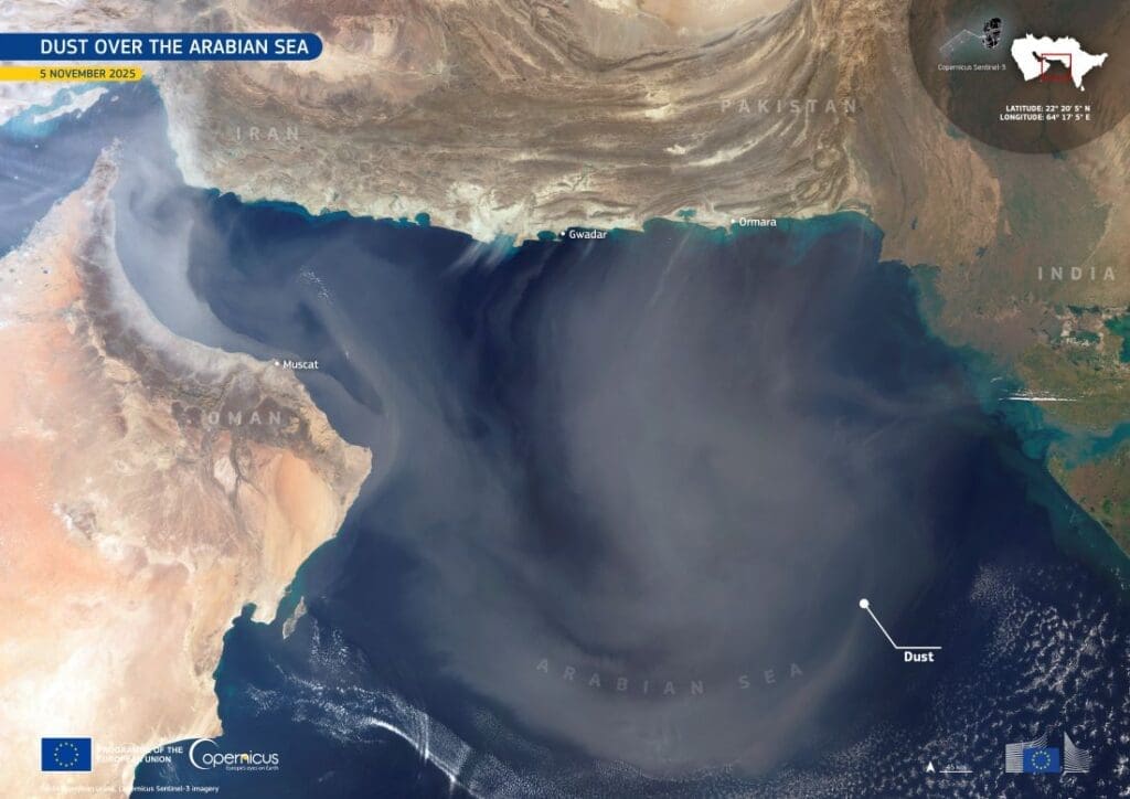
Image of the day: Dust drifting over the Arabian Sea
Full article
Image of the day: Dust drifting over the Arabian Sea
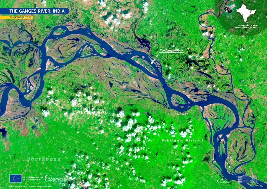
Image of the day: Ganges River in eastern India
Full article
Image of the day: Ganges River in eastern India
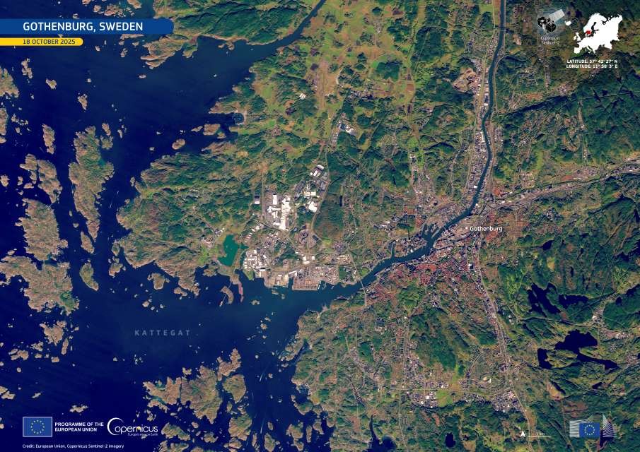
Image of the day: Gothenburg toward climate neutrality
Full article
Image of the day: Gothenburg toward climate neutrality
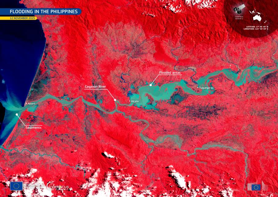
Image of the day: Floodwaters spread across Cagayan Valley, the Philippines
Full article
Image of the day: Floodwaters spread across Cagayan Valley, the Philippines
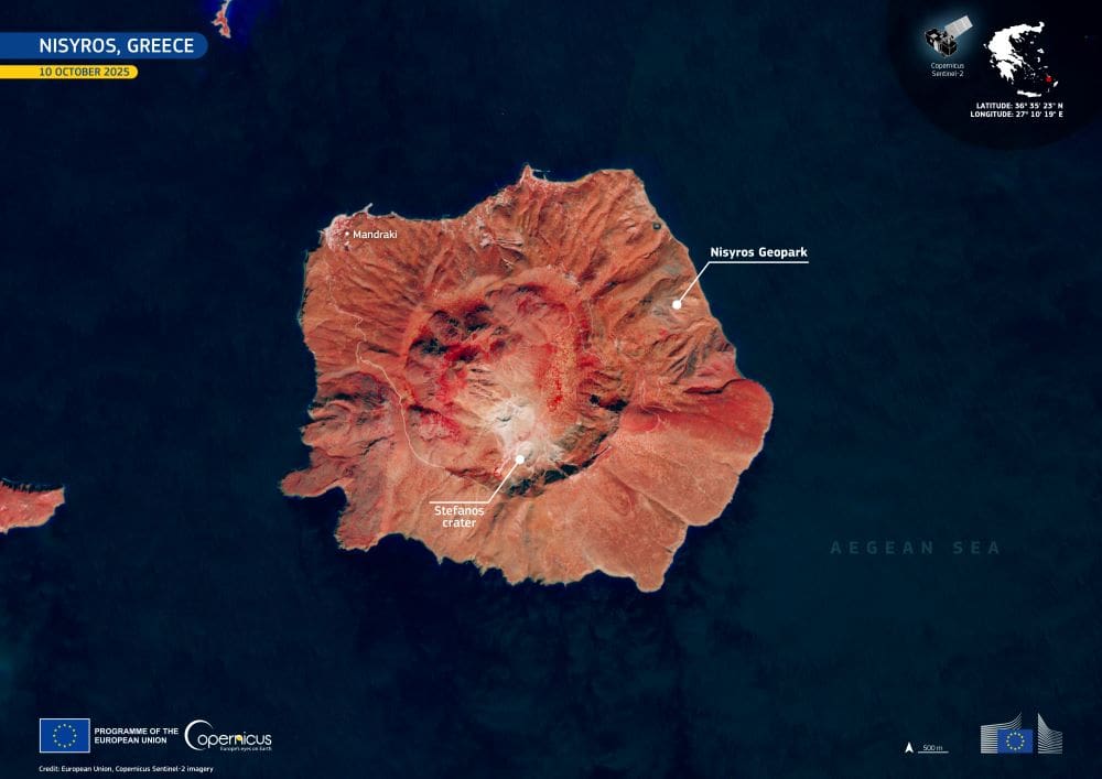
Image of the day: Nisyros island’s volcanic landscape
Full article
Image of the day: Nisyros island’s volcanic landscape
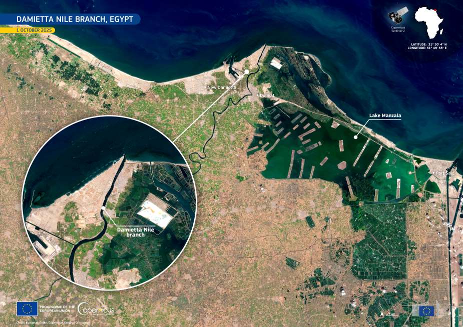
Image of the day: Nile Delta’s Damietta reach unfolds
Full article
Image of the day: Nile Delta’s Damietta reach unfolds
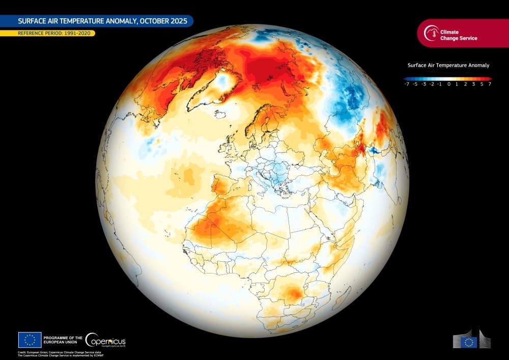
Image of the day: October 2025 stands among the warmest on record
Full article
Image of the day: October 2025 stands among the warmest on record

Image of the day: Belém, Brazil hosts COP30
Full article
Image of the day: Belém, Brazil hosts COP30
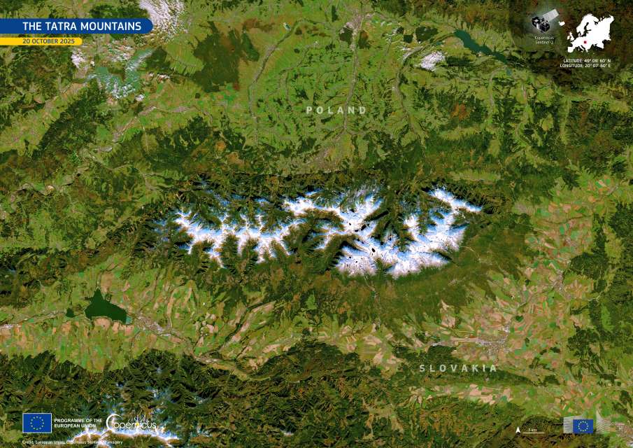
Image of the day: The Tatra Mountains
Full article
Image of the day: The Tatra Mountains
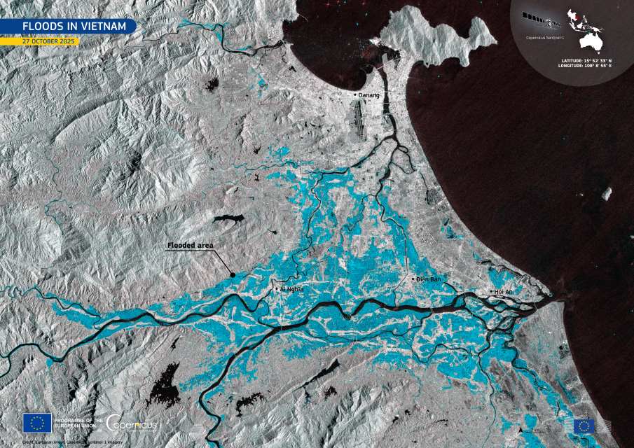
Image of the day: October’s floods in Vietnam
Full article
Image of the day: October’s floods in Vietnam
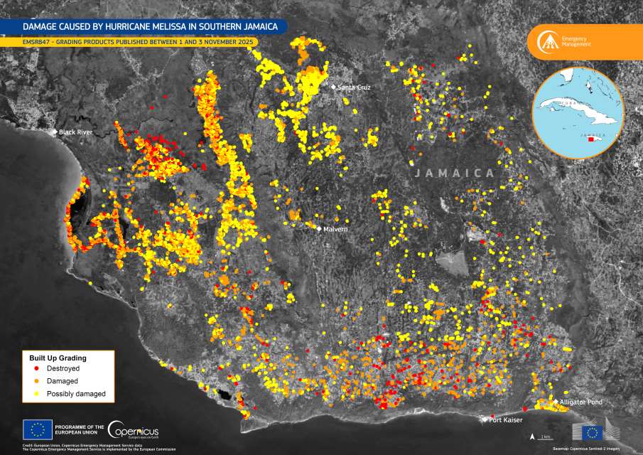
Image of the day: Hurricane Melissa’s devastation mapped by Copernicus EMS
Full article
