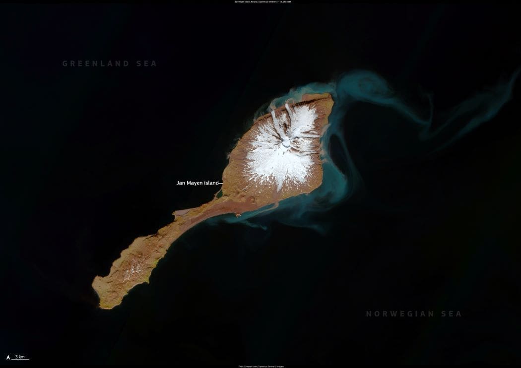
Jan Mayen, a volcanic island in the North Atlantic, is one of Norway’s most isolated territories. Situated about 600 km northeast of Iceland and 950 km west of mainland Norway, the island spans 373 km2 and is dominated by Beerenberg, the world’s northernmost active volcano above sea level. Towering at 2,277 meters, Beerenberg is often shrouded in ice and clouds, making it a striking yet formidable landmark.

The island’s Arctic environment is defined by extreme conditions — cold temperatures, relentless winds, and a landscape largely devoid of vegetation. Despite these challenges, Jan Mayen is an important site for scientific research. The island hosts meteorological and climate-monitoring stations, as well as one of the Ground Sensor Stations of the EU Space Programme, contributing to global efforts in environmental observation and climate science.
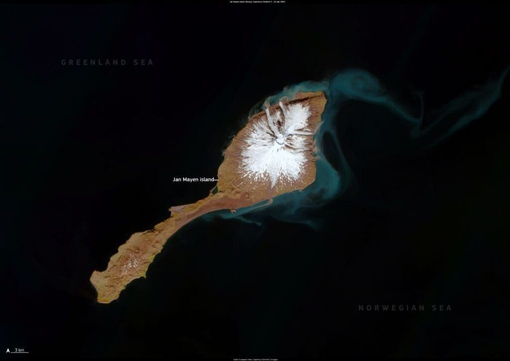
Satellite image: Jan Mayen island, Norway (s. climate change, wildlife, volcano)
Jan Mayen island, Norway. Credit: European Union, Copernicus Sentinel-2 imagery

Jan Mayen is visible in this Copernicus Sentinel-2 image, acquired on 16 July 2024.

Sentinel satellites are crucial for monitoring Arctic regions, providing data that helps researchers and policymakers track climate change, assess glacial movements, and develop strategies to protect vulnerable ecosystems. These observations are particularly important as rising global temperatures accelerate changes in the Arctic, affecting ice coverage, ocean currents, and local wildlife.

Featured image credit: European Union, Copernicus Sentinel-2 imagery

Plants defy odds, thriving in some of the world’s harshest climates
Plants defy odds, thriving in some of the world’s harshest climatesScience

Plants defy odds, thriving in some of the world’s harshest climates

Study sheds new light on the capacity of plants to respond to climate change. By Katie Spenceley | University of Sydney The study is an…
SourceSourceAugust 9, 2024 Full article
New data for risk assessment of submarine landslides
Image: The airgun bundles towed behind the SONNE generate short, strong sound pulses that penetrate the sea floor and are reflected by geological layers. Seismometers on the sea floor record these signals in order to analyze the structure of the subsurface
New data for risk assessment of submarine landslidesNews

New data for risk assessment of submarine landslides

Kiel | GEOMARExploring active and passive continental slopesComprehensive Survey and Drilling Programme How dangerous are submarine landslides in deep-sea canyons? To answer this question, the…
SourceSourceFebruary 20, 2025 Full article
US to withdraw from Paris Agreement, expand drilling
Oil pumps work rhythmically against the backdrop of dusky sky
US to withdraw from Paris Agreement, expand drillingNews

US to withdraw from Paris Agreement, expand drilling

Washington, United States | AFP President Donald Trump on Monday announced the United States would withdraw from the Paris Agreement for a second time, a…
SourceSourceJanuary 20, 2025 Full article