
Image of the day: Cyprus drought pushes Kouris reservoir to historic low Full article
Image of the day: Cyprus drought pushes Kouris reservoir to historic low

Image of the day: Snow-covered Tromsø after the polar night
Full article
Image of the day: Snow-covered Tromsø after the polar night

Image of the day: Northeastern Morocco turns green after a year of drought
Full article
Image of the day: Northeastern Morocco turns green after a year of drought

Image of the day: Scotland blanketed in snow during Arctic outbreak
Full article
Image of the day: Scotland blanketed in snow during Arctic outbreak
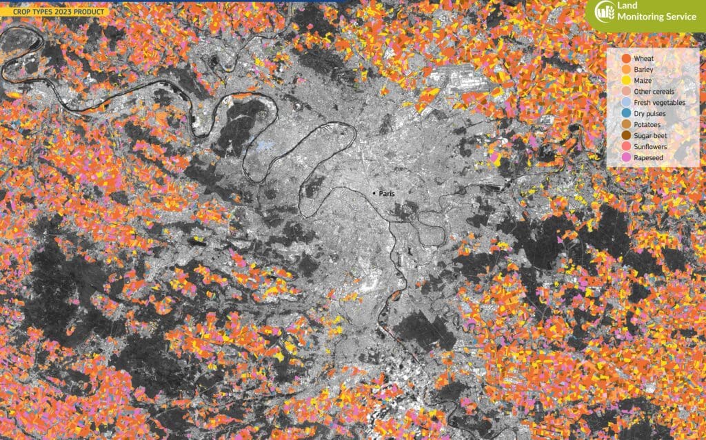
Image of the day: Farmland patterns around Paris
Full article
Image of the day: Farmland patterns around Paris
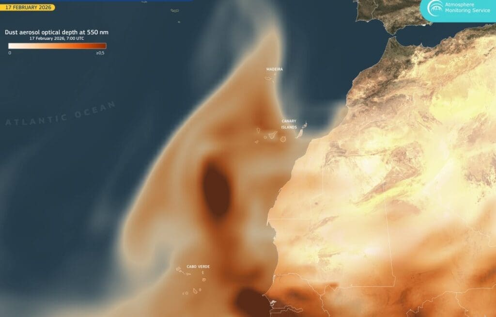
Image of the day: Dust from the Sahara sweeps over the Atlantic
Full article
Image of the day: Dust from the Sahara sweeps over the Atlantic
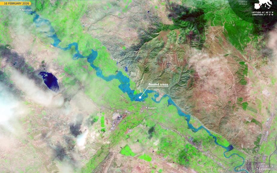
Image of the day: Ebro River surge tests Aragón’s floodplains, Spain
Full article
Image of the day: Ebro River surge tests Aragón’s floodplains, Spain
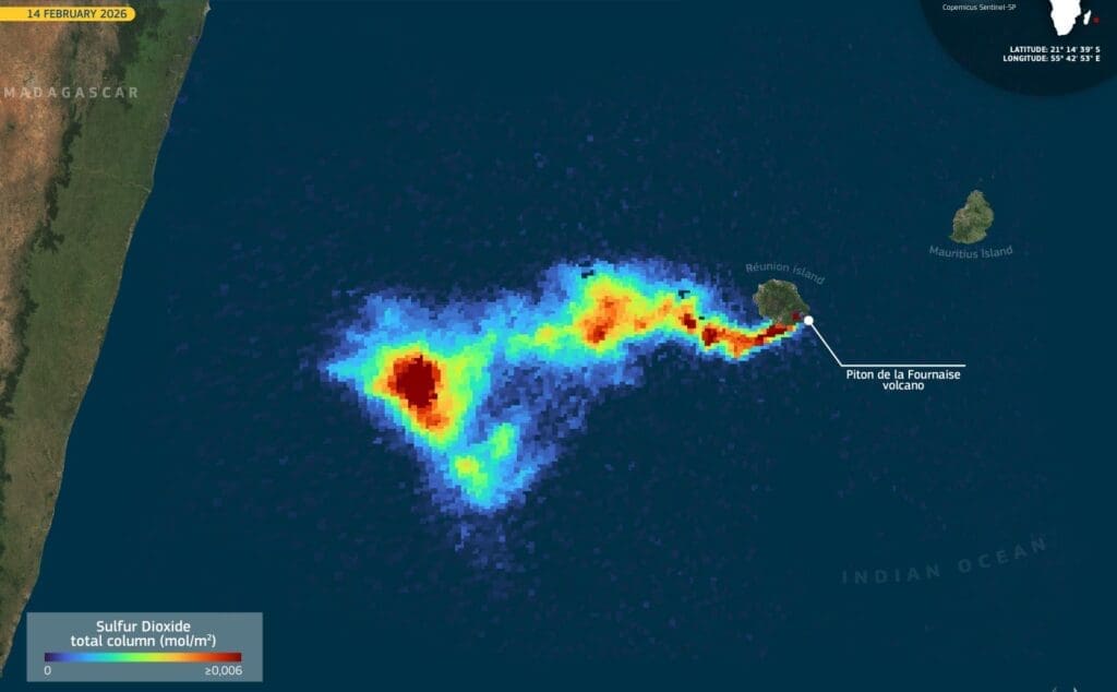
Image of the day: Piton de la Fournaise volcano erupts again
Full article
Image of the day: Piton de la Fournaise volcano erupts again
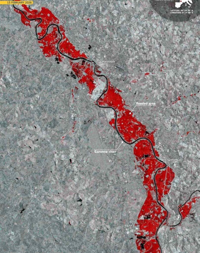
Image of the day: Floods along the Garonne after Storm Nils in France
Full article
Image of the day: Floods along the Garonne after Storm Nils in France
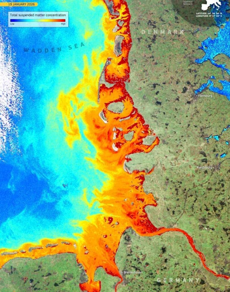
Image of the day: Wadden Sea along the Danish and German coasts
Full article
Image of the day: Wadden Sea along the Danish and German coasts
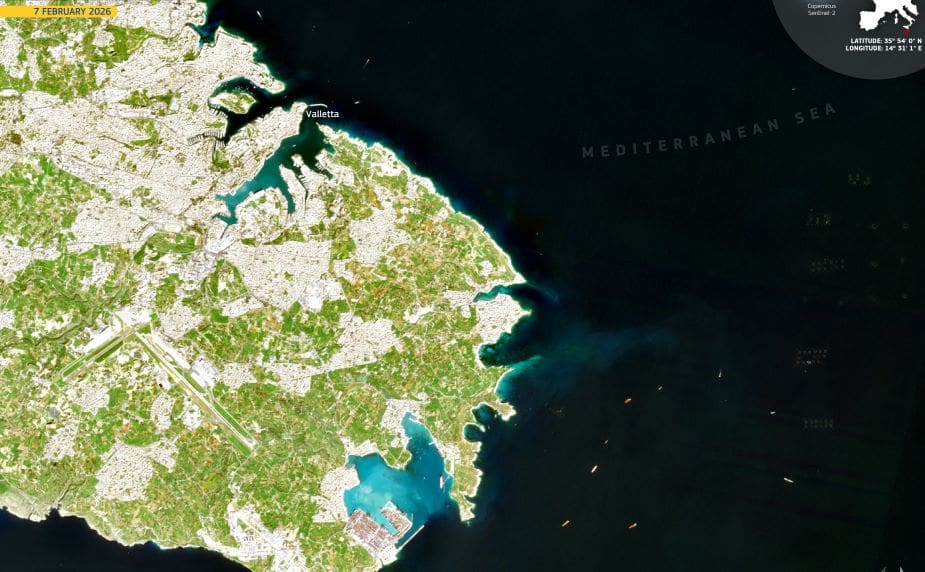
Image of the day: Valletta, a Renaissance city carved into Malta’s coastline
Full article
Image of the day: Valletta, a Renaissance city carved into Malta’s coastline
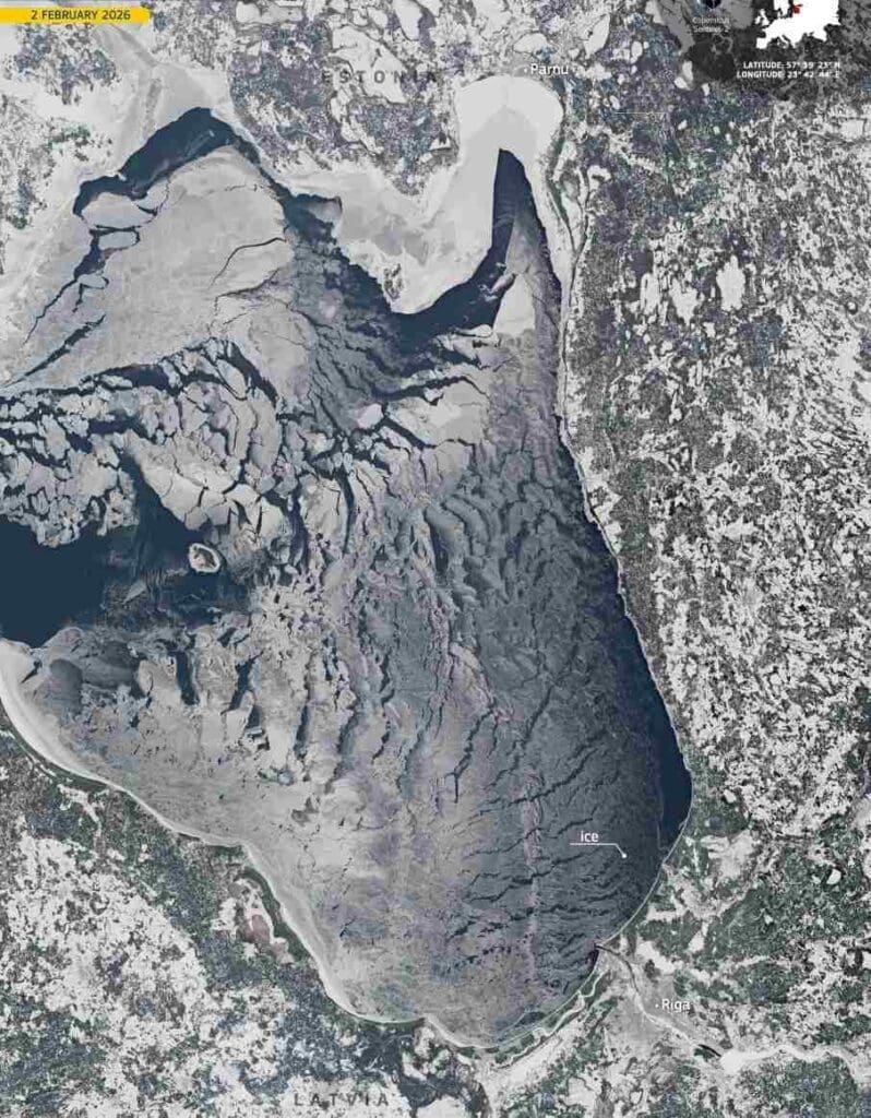
Image of the day: Gulf of Riga frozen after Baltic cold snap
Full article
Image of the day: Gulf of Riga frozen after Baltic cold snap
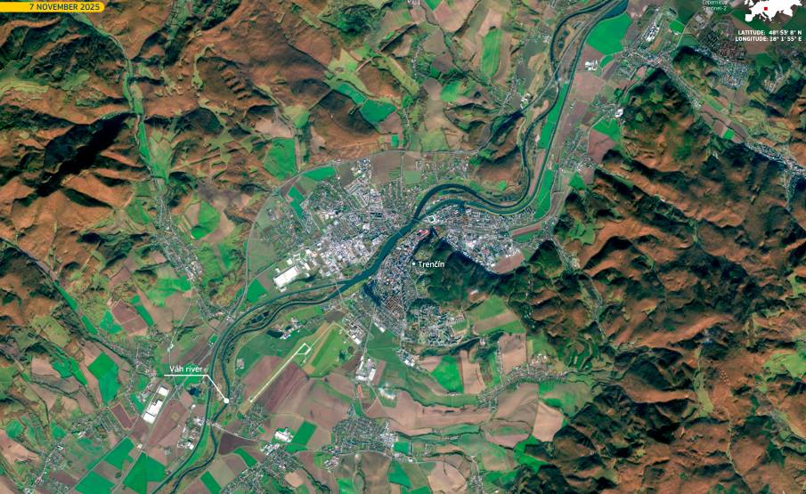
Image of the day: Trenčín marks its year as European Capital of Culture 2026
Full article
Image of the day: Trenčín marks its year as European Capital of Culture 2026
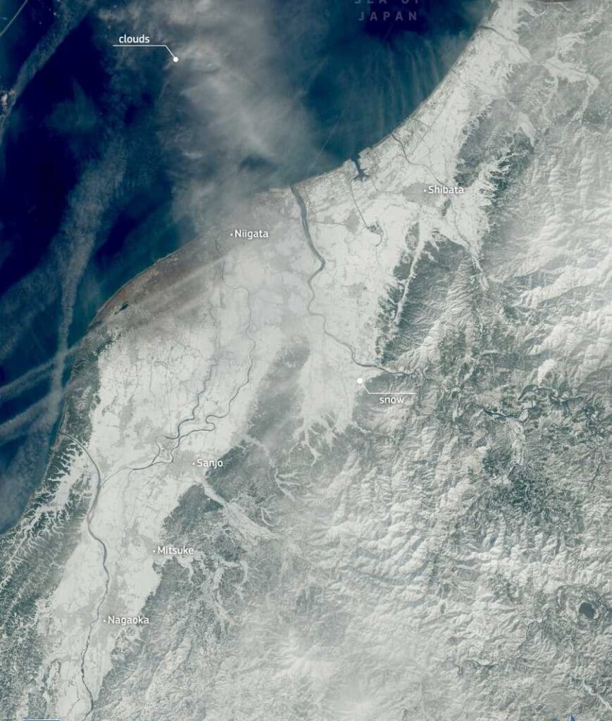
Image of the day: Record snowfall grips Japan
Full article
Image of the day: Record snowfall grips Japan
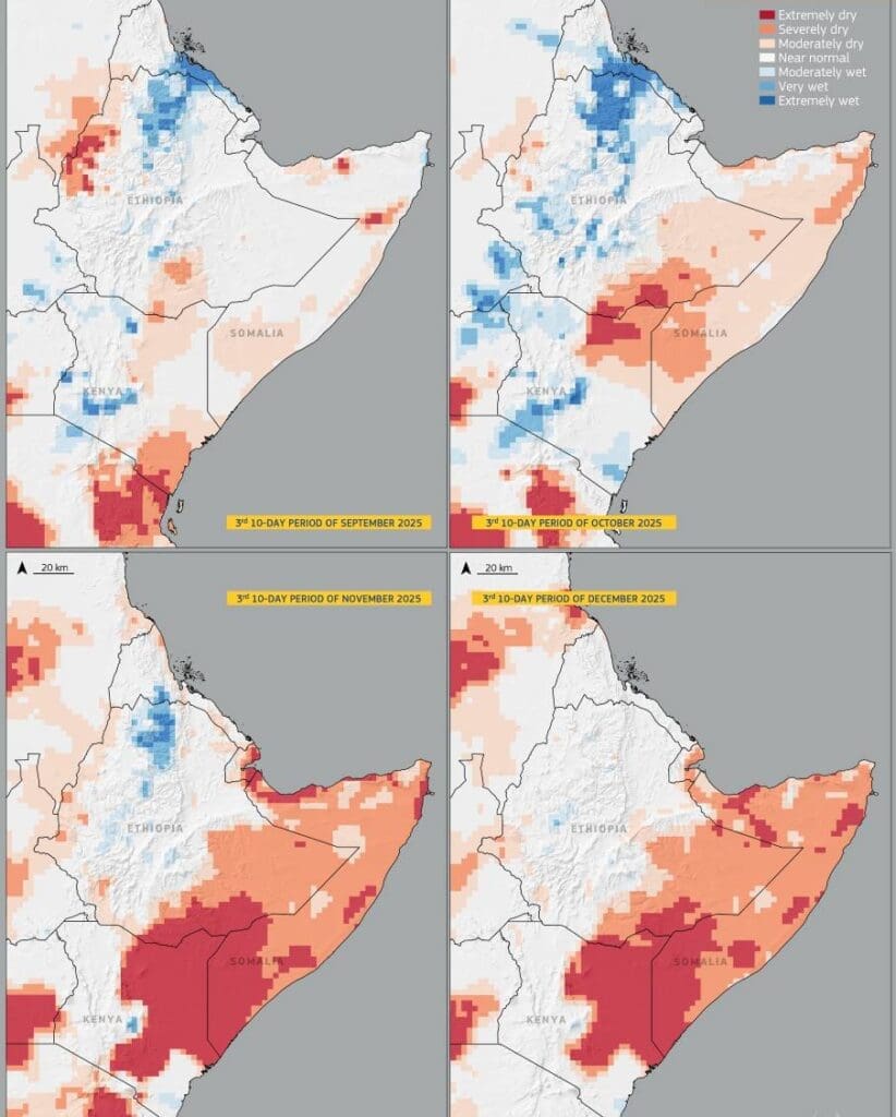
Image of the day: East Africa’s drought at the end of 2025
Full article
Image of the day: East Africa’s drought at the end of 2025
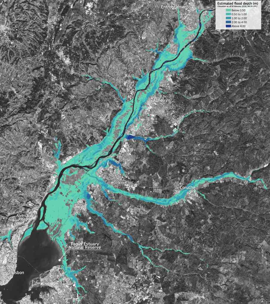
Image of the day: Floodwaters along the Tagus River, Portugal
Full article
Image of the day: Floodwaters along the Tagus River, Portugal
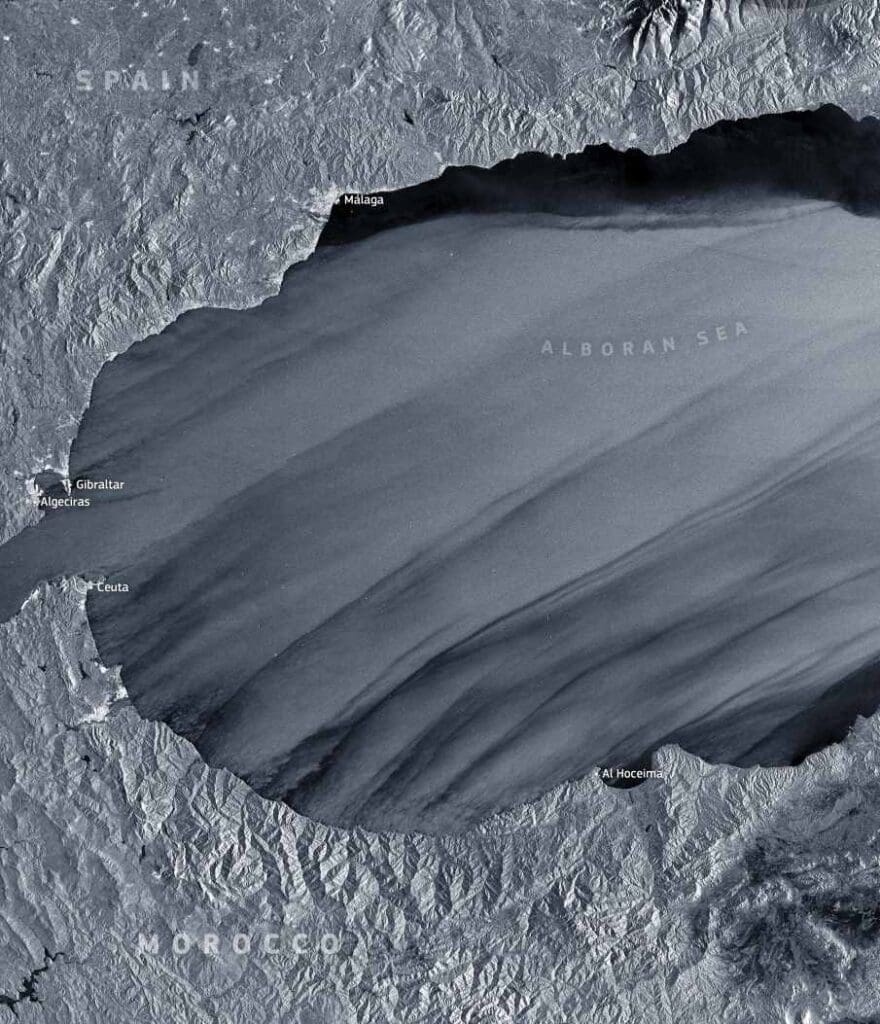
Image of the day: Winds carve Storm Leonardo into the Alboran Sea
Full article
Image of the day: Winds carve Storm Leonardo into the Alboran Sea
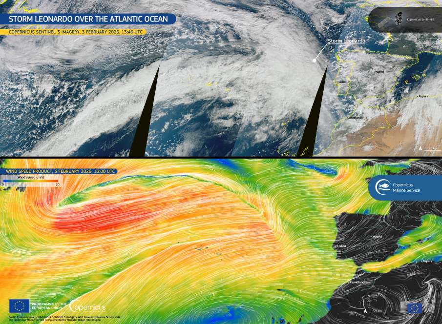
Image of the day: Storm Leonardo advances across the Atlantic toward Iberia
Full article
Image of the day: Storm Leonardo advances across the Atlantic toward Iberia
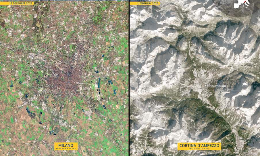
Image of the day: Milano and Cortina ahead of the 2026 Olympic Winter Games
Full article
Image of the day: Milano and Cortina ahead of the 2026 Olympic Winter Games
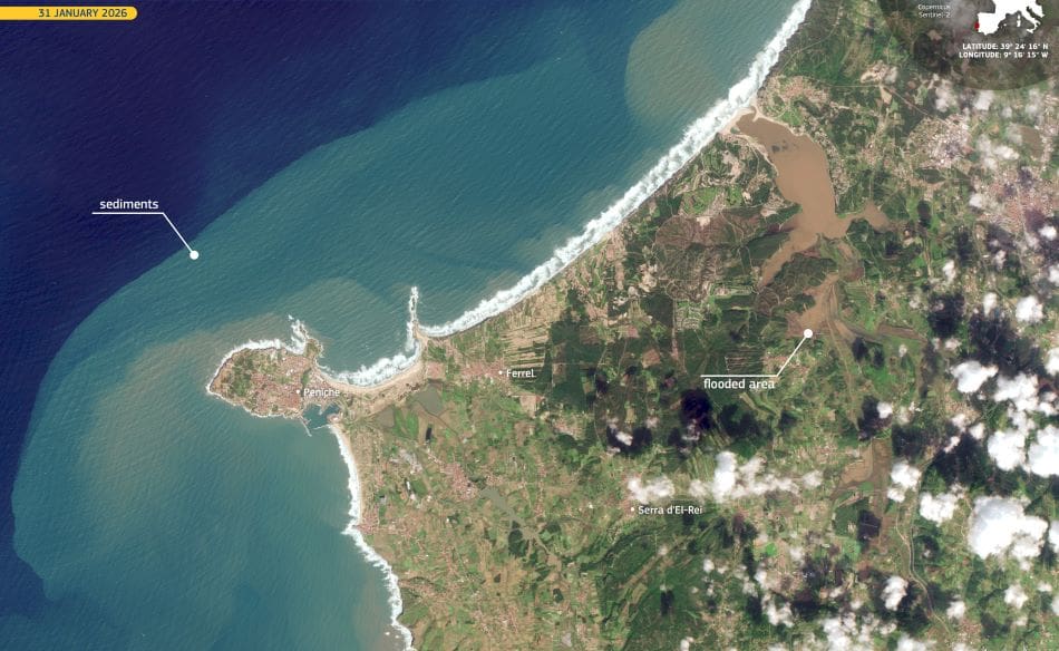
Image of the day: Flooding and coastal impacts in Portugal after Storm Kristin
Full article
Image of the day: Flooding and coastal impacts in Portugal after Storm Kristin
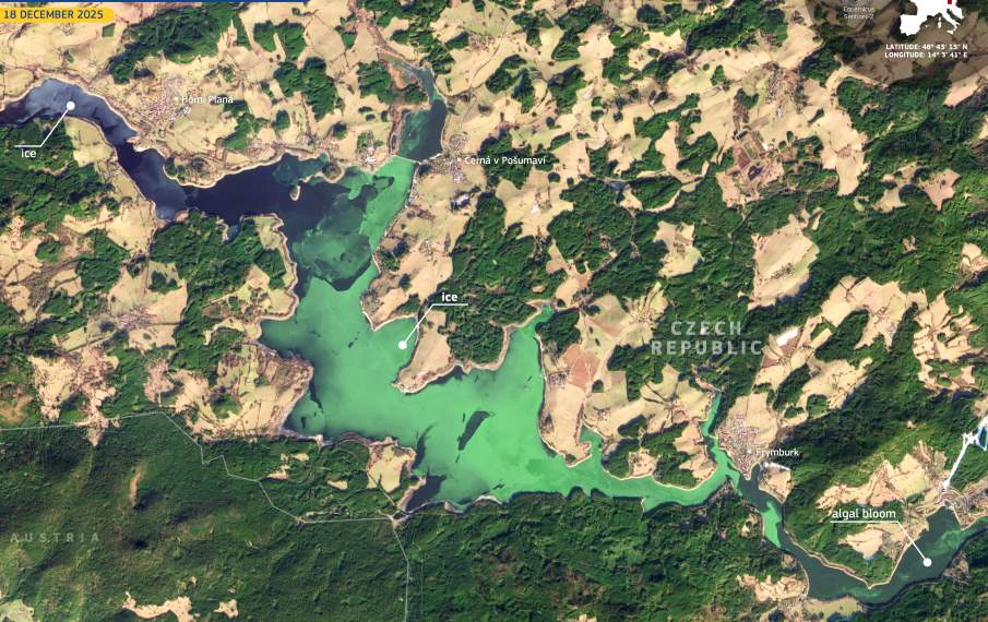
Image of the day: Winter bloom paints Lake Lipno green
Full article
Image of the day: Winter bloom paints Lake Lipno green
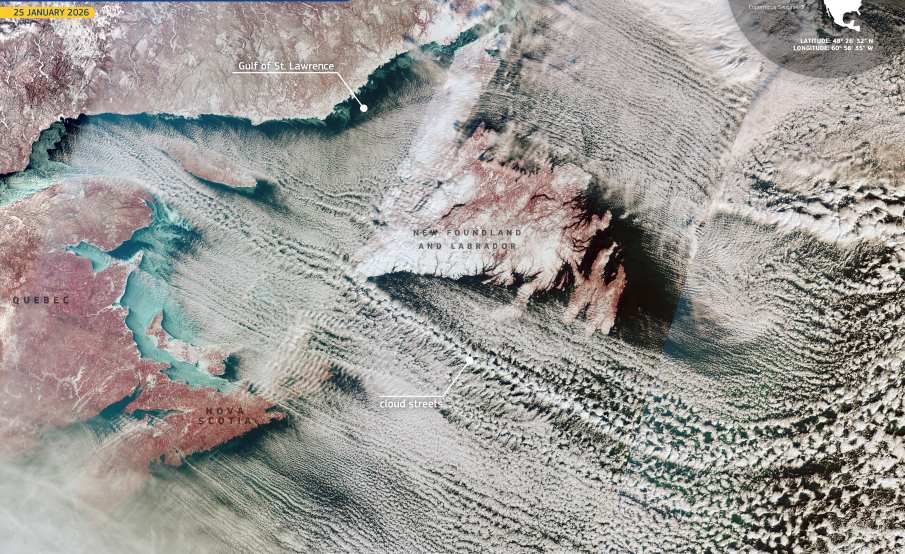
Image of the day: Winter rolls line the Atlantic sky
Full article
Image of the day: Winter rolls line the Atlantic sky
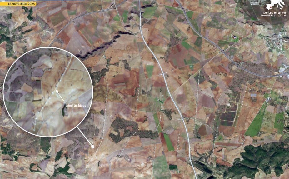
Image of the day: Turbines across Cuenca’s agricultural heartland
Full article
Image of the day: Turbines across Cuenca’s agricultural heartland
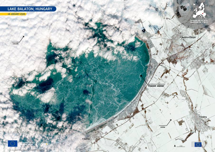
Image of the day: Lake Balaton freezes after nine-year gap
Full article