
Satellite images reveal links between sea ice and penguin diets Full article
Satellite images reveal links between sea ice and penguin diets

France launches biodiversity mapping project using satellites and AI Full article
France launches biodiversity mapping project using satellites and AI

Image of the day: A changing planet through the lens of satellites
Full article
Image of the day: A changing planet through the lens of satellites

Image of the day: Monaco’s Mediterranean coastline
Full article
Image of the day: Monaco’s Mediterranean coastline
Canada’s protected areas miss key regions as climate shifts ecosystems
Full article
Canada’s protected areas miss key regions as climate shifts ecosystems
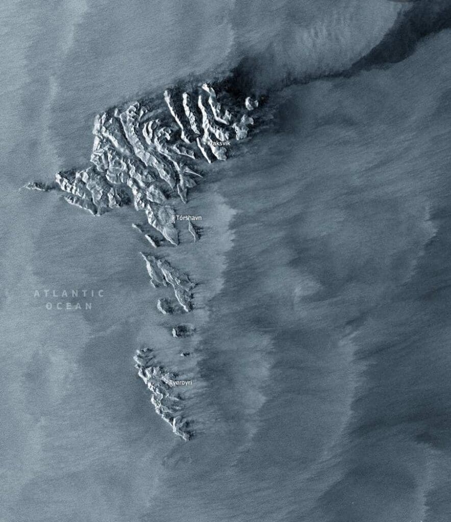
Image of the day: Faroe Islands and wind patterns in the North Atlantic
Full article
Image of the day: Faroe Islands and wind patterns in the North Atlantic
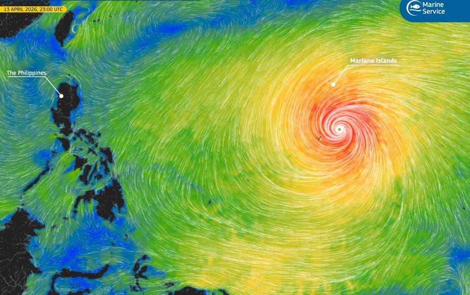
Image of the day: Super Typhoon Sinlaku near the Mariana Islands
Full article
Image of the day: Super Typhoon Sinlaku near the Mariana Islands
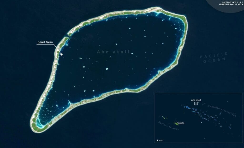
Image of the day: Pearl farming patterns in Ahe Atoll lagoon
Full article
Image of the day: Pearl farming patterns in Ahe Atoll lagoon
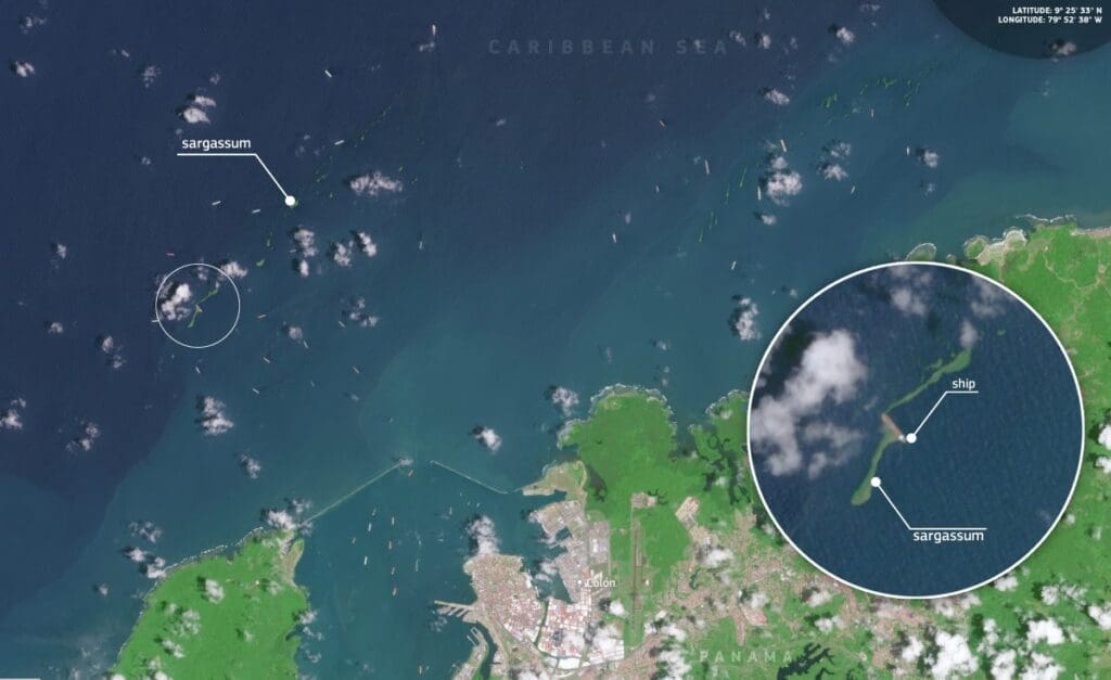
Image of the day: Sargassum streaks near Colón, Panama
Full article
Image of the day: Sargassum streaks near Colón, Panama
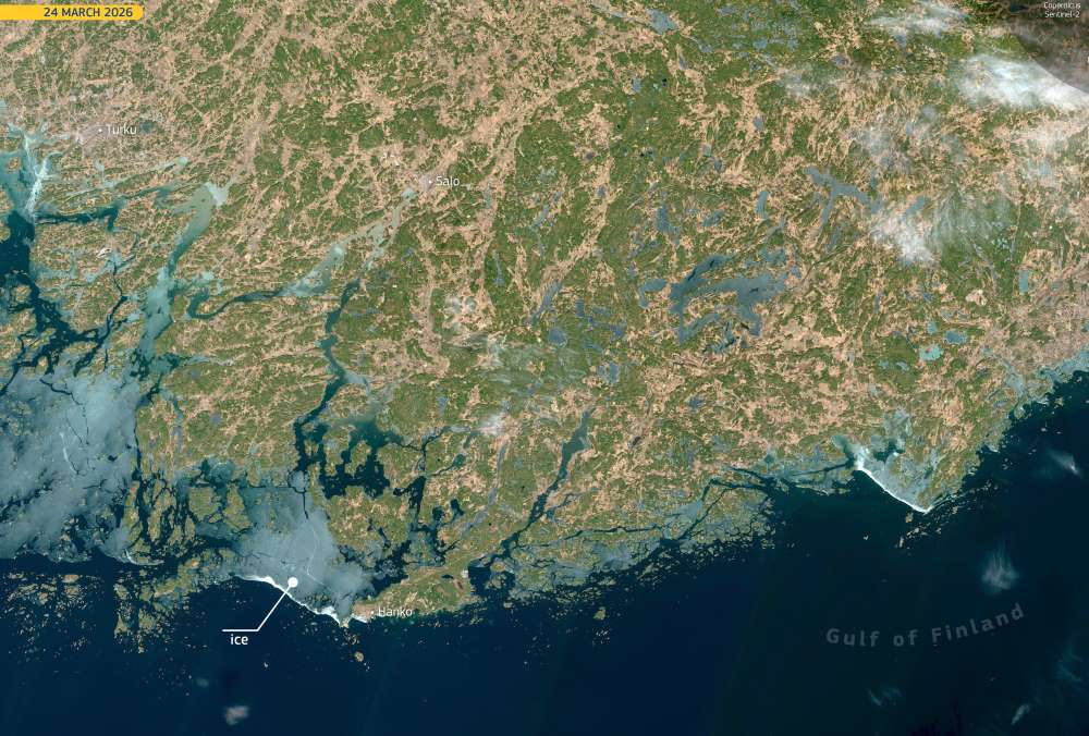
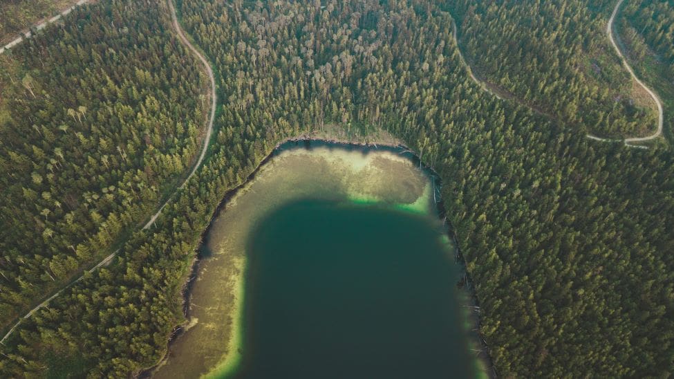
Image of the day: Ice retreat begins in the Gulf of Finland
Full article
Image of the day: Ice retreat begins in the Gulf of Finland
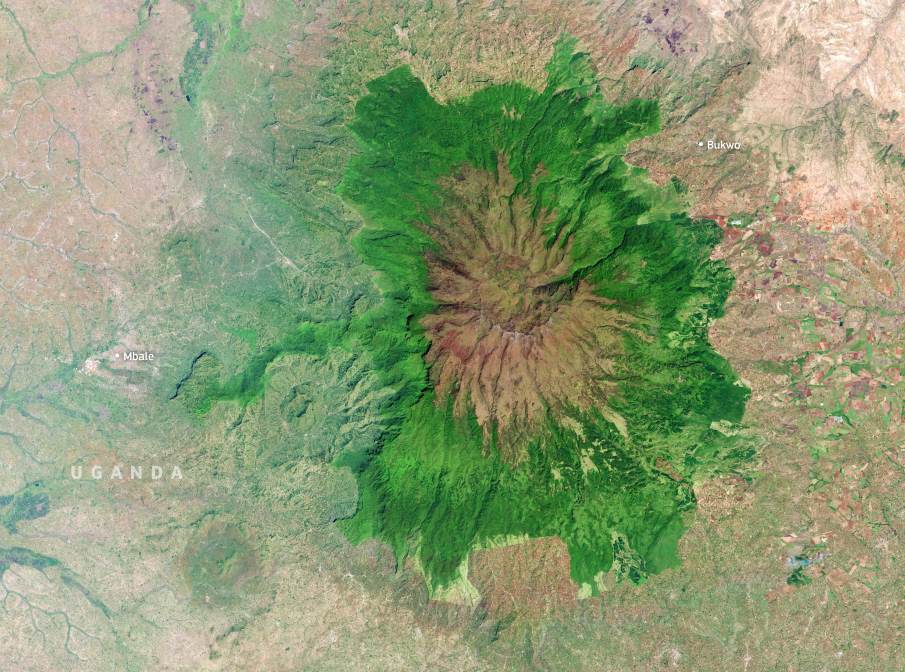
Image of the day: Mount Elgon’s caldera and forested slopes
Full article
Image of the day: Mount Elgon’s caldera and forested slopes
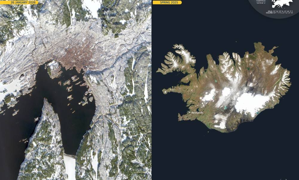
Image of the day: Snow-covered Oslo and Iceland’s volcanic landscape
Full article
Image of the day: Snow-covered Oslo and Iceland’s volcanic landscape
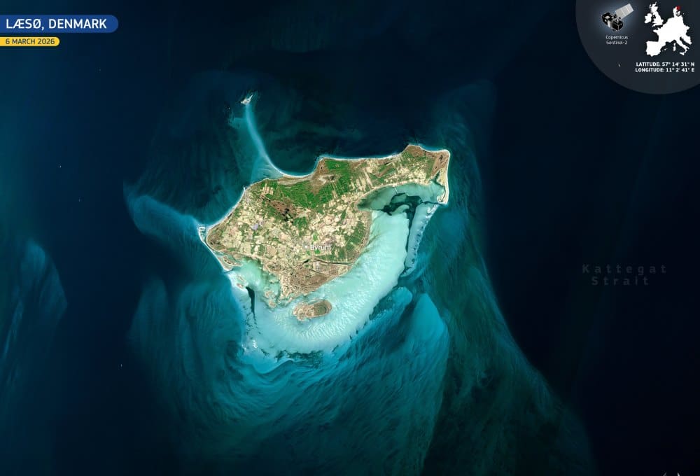
Image of the day: Læsø island’s evolving coastline in Denmark
Full article
Image of the day: Læsø island’s evolving coastline in Denmark
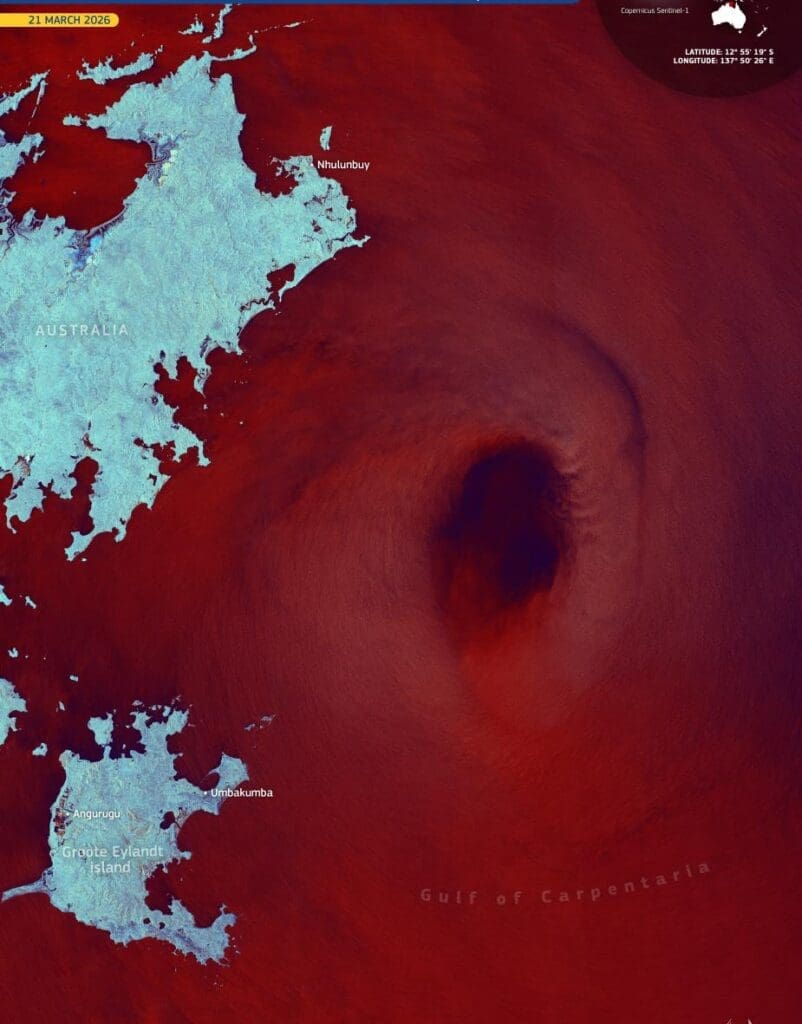
Image of the day: Cyclone Narelle crosses Australia and rebuilds over the Gulf
Full article
Image of the day: Cyclone Narelle crosses Australia and rebuilds over the Gulf
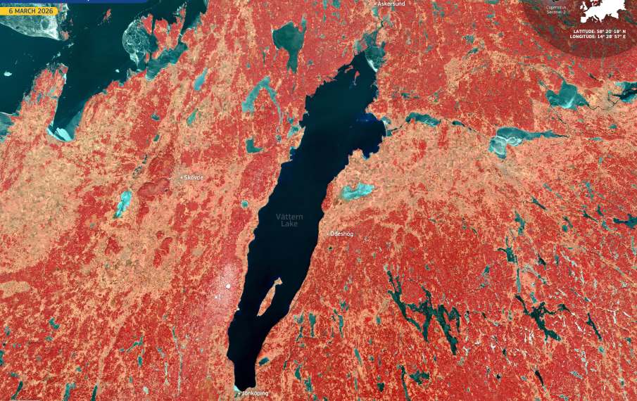
Image of the day: Lake Vättern on World Water Day
Full article
Image of the day: Lake Vättern on World Water Day
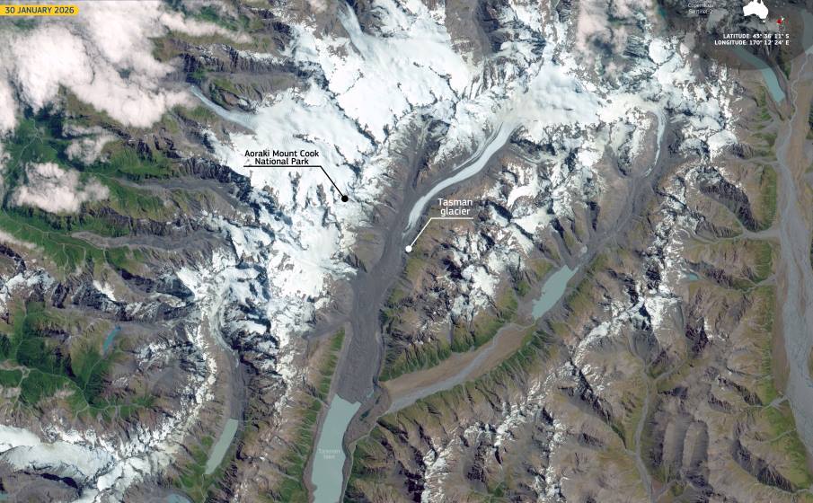
Image of the day: Tasman Glacier on World Day for Glaciers
Full article
Image of the day: Tasman Glacier on World Day for Glaciers
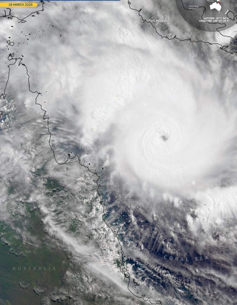
Image of the day: Cyclone Narelle before landfall in Cape York, Australia
Full article
Image of the day: Cyclone Narelle before landfall in Cape York, Australia
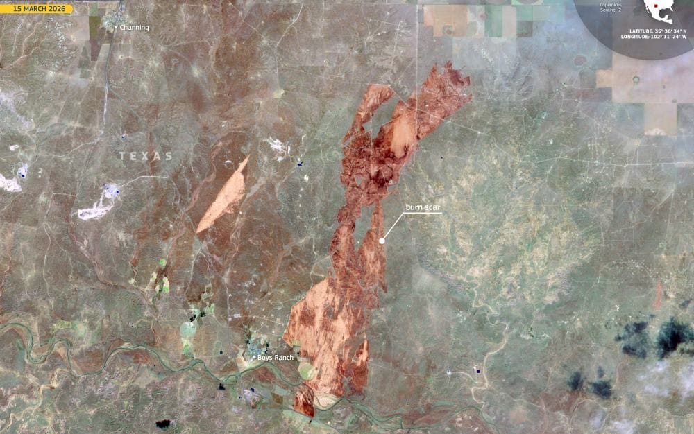
Image of the day: Wildfires sweep across the Texas Panhandle in March 2026
Full article
Image of the day: Wildfires sweep across the Texas Panhandle in March 2026
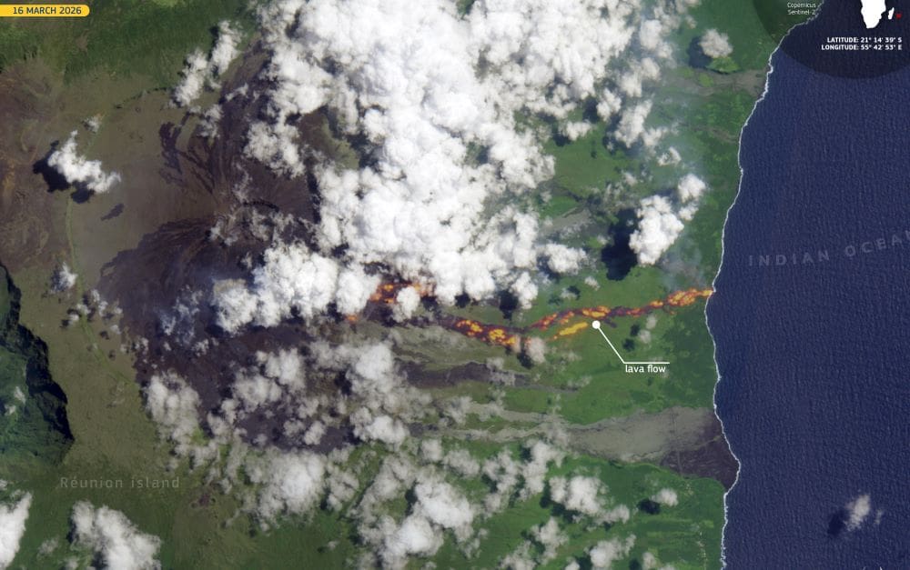
Image of the day: Lava reaches the Indian Ocean on Réunion Island
Full article
Image of the day: Lava reaches the Indian Ocean on Réunion Island
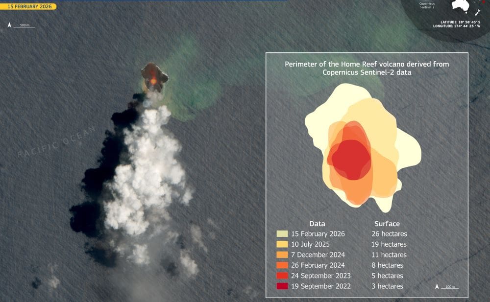
Image of the day: Home Reef volcano in Tonga grows a new island
Full article
Image of the day: Home Reef volcano in Tonga grows a new island
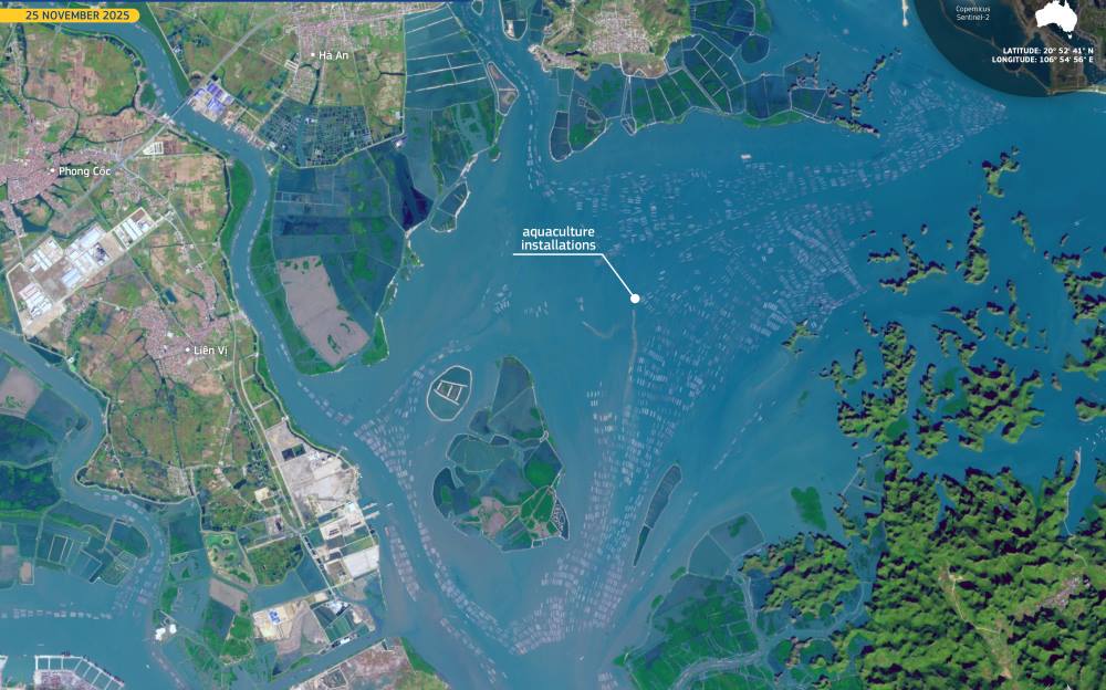
Image of the day: Aquaculture farms across Hạ Long Bay, Vietnam
Full article
Image of the day: Aquaculture farms across Hạ Long Bay, Vietnam
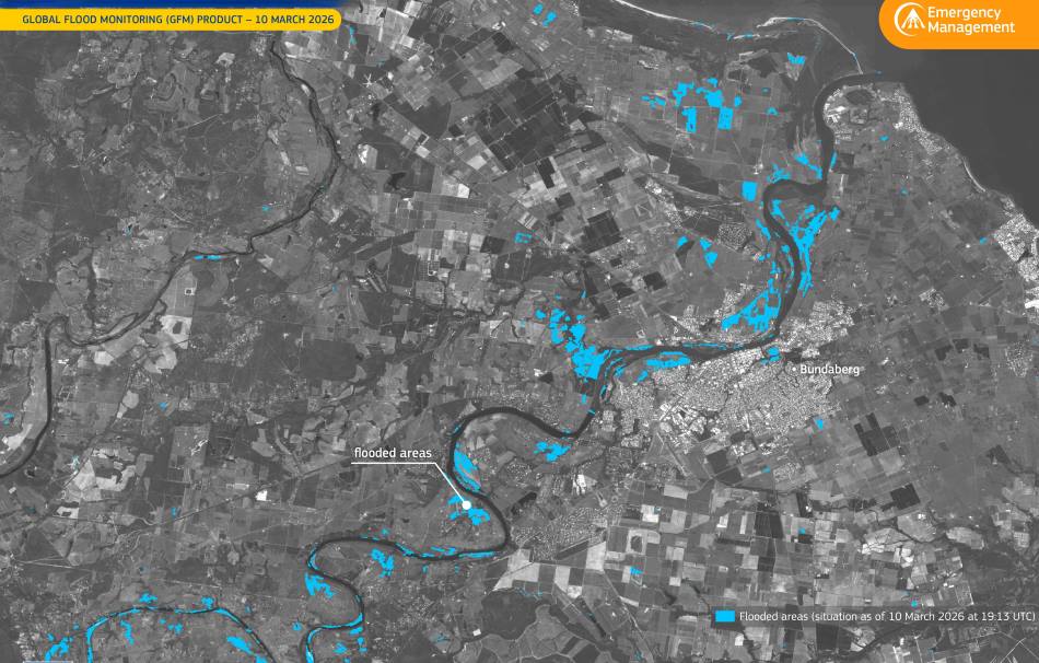
Image of the day: Burnett River flooding near Bundaberg, Australia
Full article
Image of the day: Burnett River flooding near Bundaberg, Australia

Image of the day: Early spring around Stockholm captured from space
Full article
Image of the day: Early spring around Stockholm captured from space

Image of the day: Lubāna Wetland Complex in Latvia
Full article
