
Image of the day: Tañon Strait coastal waters on World Seagrass Day Full article
Image of the day: Tañon Strait coastal waters on World Seagrass Day

Image of the day: Vinson Massif, Antarctica
Full article
Image of the day: Vinson Massif, Antarctica

Image of the day: Estonia endures one of its coldest winters in decades
Full article
Image of the day: Estonia endures one of its coldest winters in decades

Satellite images reveal new threat to emperor penguins in Antarctica Full article
Satellite images reveal new threat to emperor penguins in Antarctica
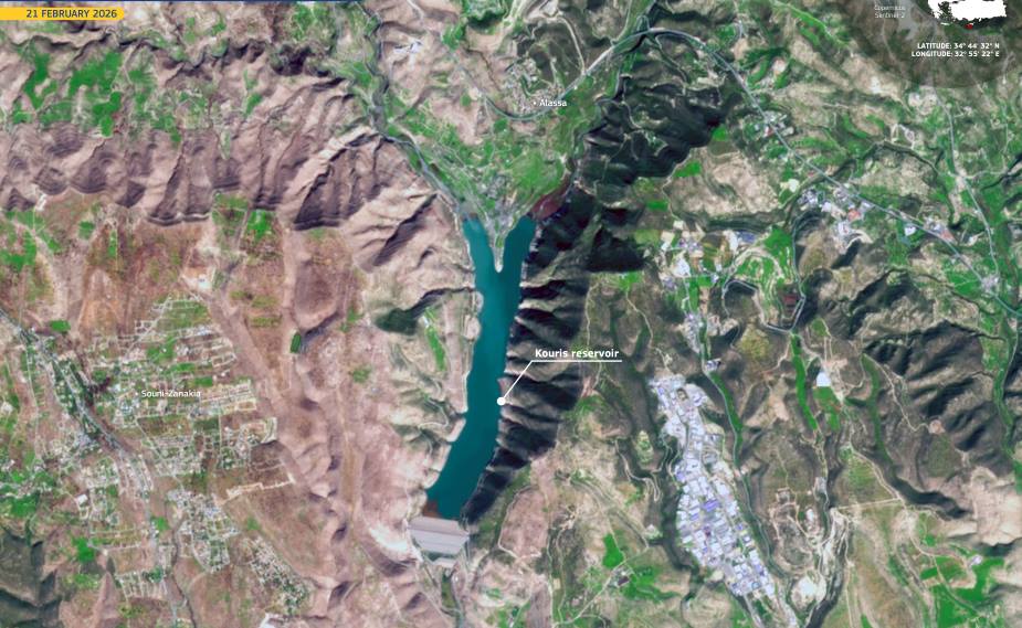
Image of the day: Cyprus drought pushes Kouris reservoir to historic low
Full article
Image of the day: Cyprus drought pushes Kouris reservoir to historic low
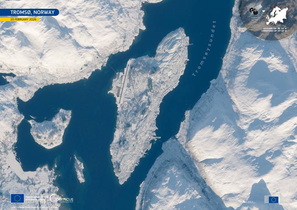
Image of the day: Snow-covered Tromsø after the polar night
Full article
Image of the day: Snow-covered Tromsø after the polar night
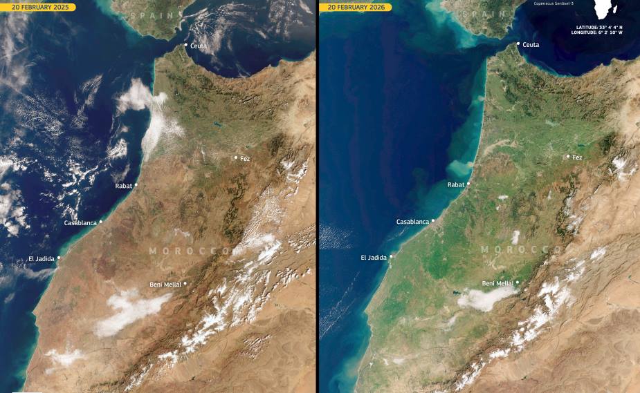
Image of the day: Northeastern Morocco turns green after a year of drought
Full article
Image of the day: Northeastern Morocco turns green after a year of drought
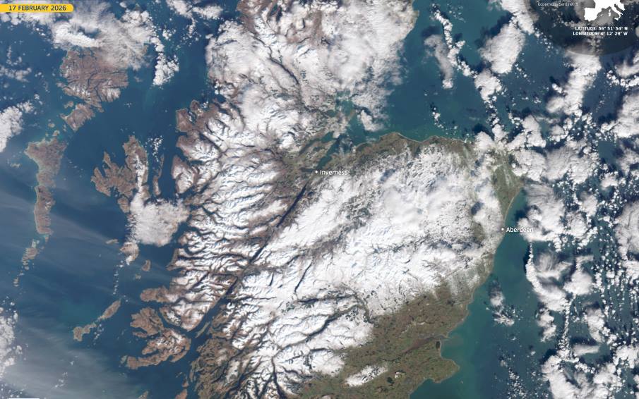
Image of the day: Scotland blanketed in snow during Arctic outbreak
Full article
Image of the day: Scotland blanketed in snow during Arctic outbreak
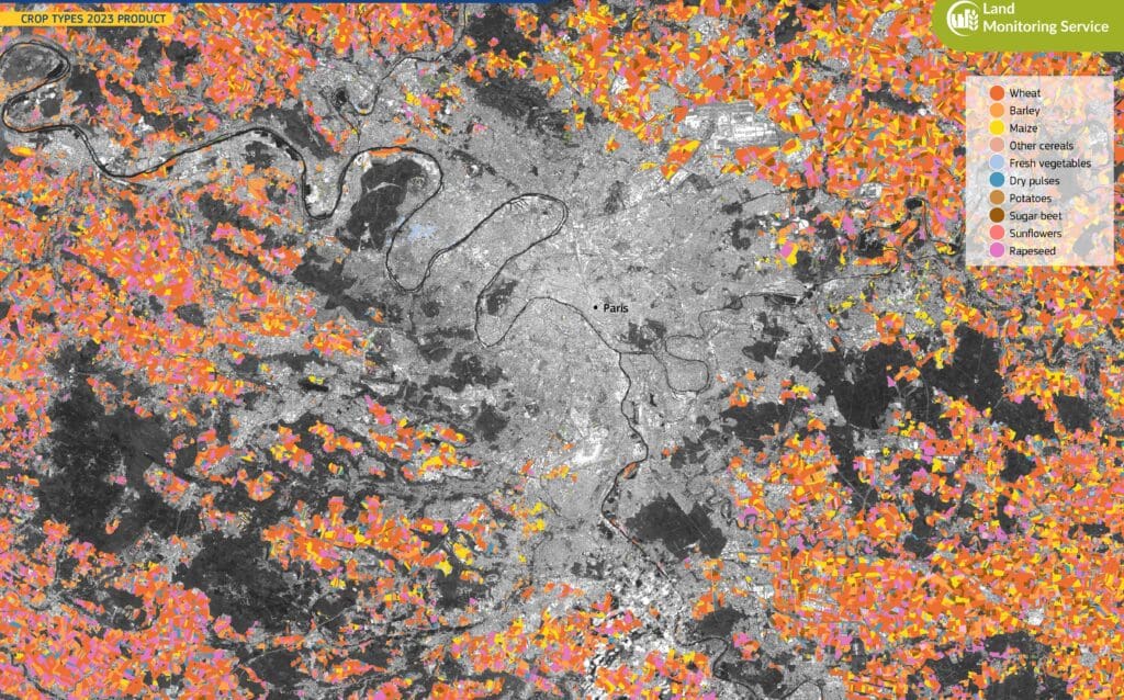
Image of the day: Farmland patterns around Paris
Full article
Image of the day: Farmland patterns around Paris
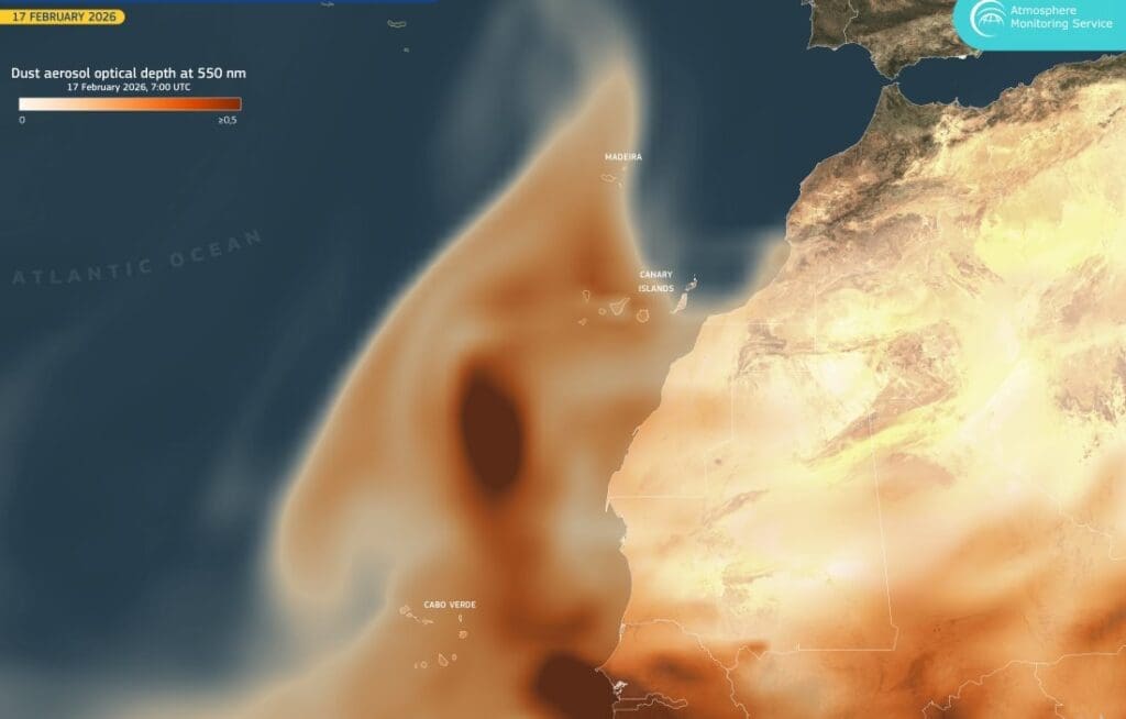
Image of the day: Dust from the Sahara sweeps over the Atlantic
Full article
Image of the day: Dust from the Sahara sweeps over the Atlantic
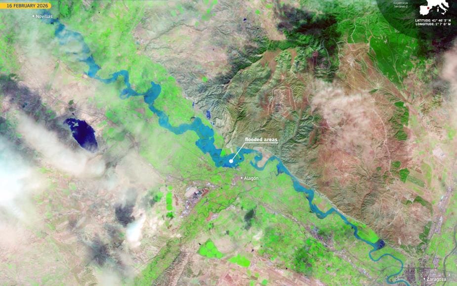
Image of the day: Ebro River surge tests Aragón’s floodplains, Spain
Full article
Image of the day: Ebro River surge tests Aragón’s floodplains, Spain
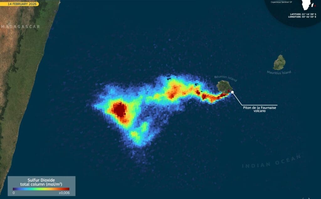
Image of the day: Piton de la Fournaise volcano erupts again
Full article
Image of the day: Piton de la Fournaise volcano erupts again
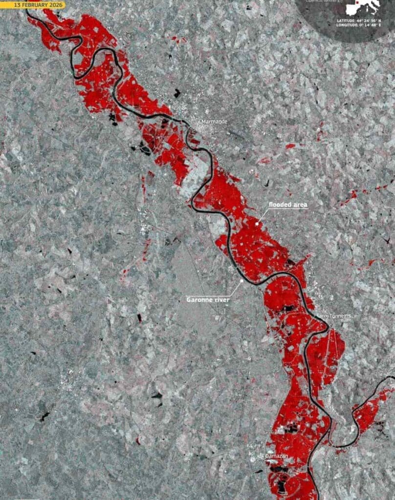
Image of the day: Floods along the Garonne after Storm Nils in France
Full article
Image of the day: Floods along the Garonne after Storm Nils in France
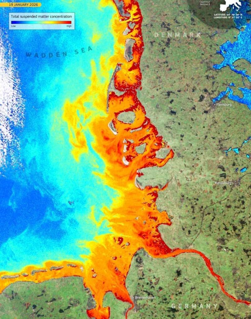
Image of the day: Wadden Sea along the Danish and German coasts
Full article
Image of the day: Wadden Sea along the Danish and German coasts
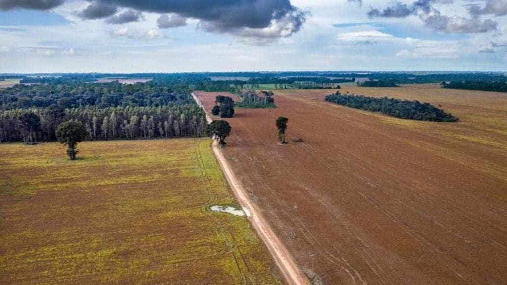
Amazon deforestation tied to fewer rainy days and higher surface temperatures
Full article
Amazon deforestation tied to fewer rainy days and higher surface temperatures
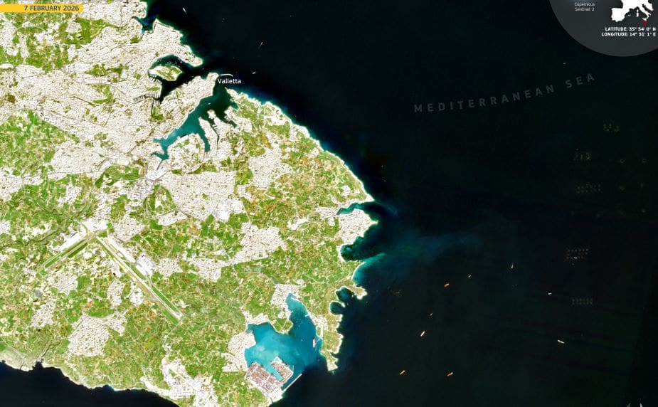
Image of the day: Valletta, a Renaissance city carved into Malta’s coastline
Full article
Image of the day: Valletta, a Renaissance city carved into Malta’s coastline
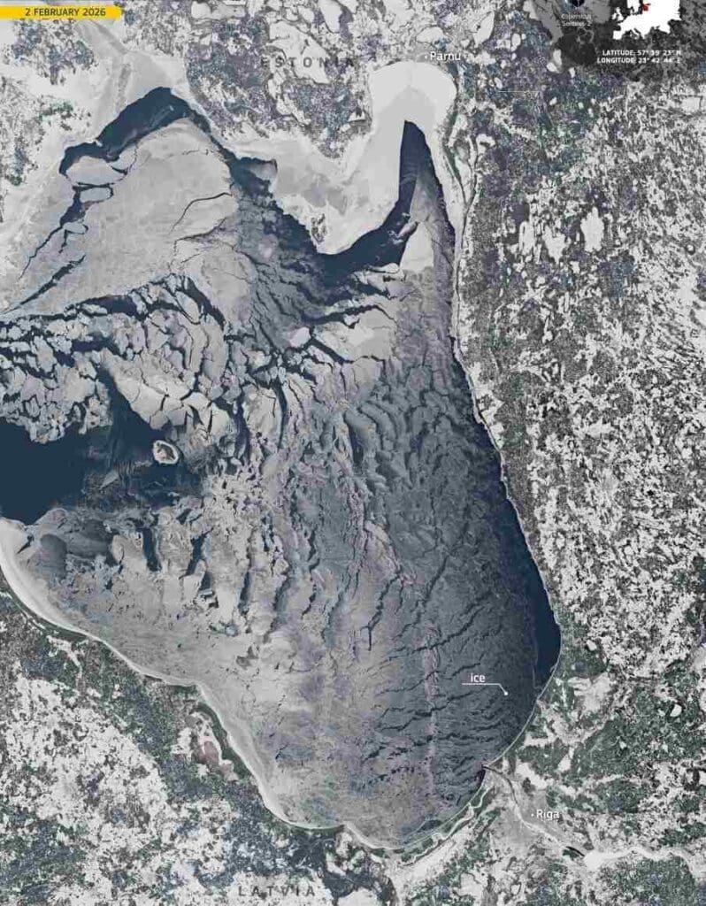
Image of the day: Gulf of Riga frozen after Baltic cold snap
Full article
Image of the day: Gulf of Riga frozen after Baltic cold snap
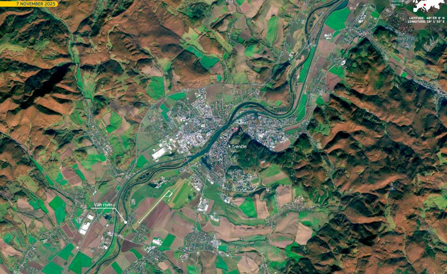
Image of the day: Trenčín marks its year as European Capital of Culture 2026
Full article
Image of the day: Trenčín marks its year as European Capital of Culture 2026
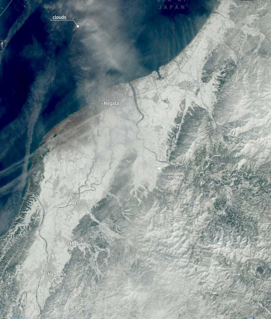
Image of the day: Record snowfall grips Japan
Full article
Image of the day: Record snowfall grips Japan
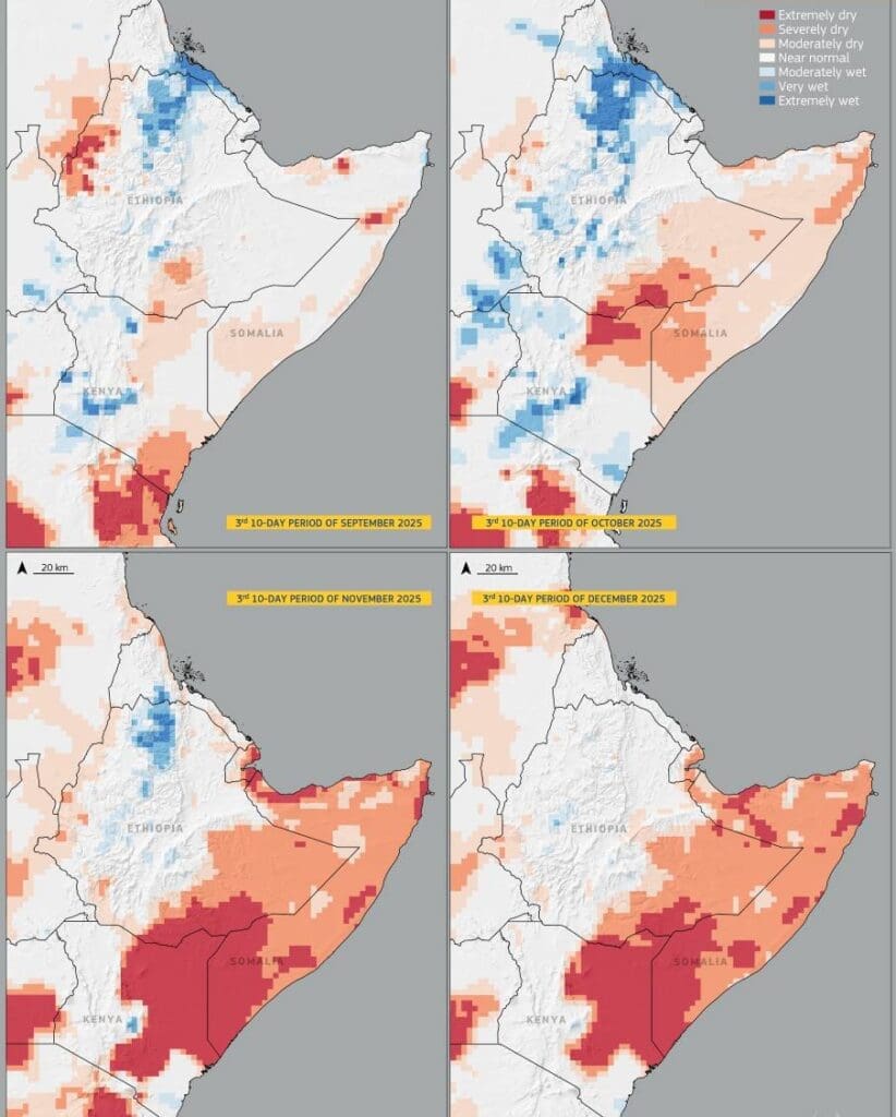
Image of the day: East Africa’s drought at the end of 2025
Full article
Image of the day: East Africa’s drought at the end of 2025
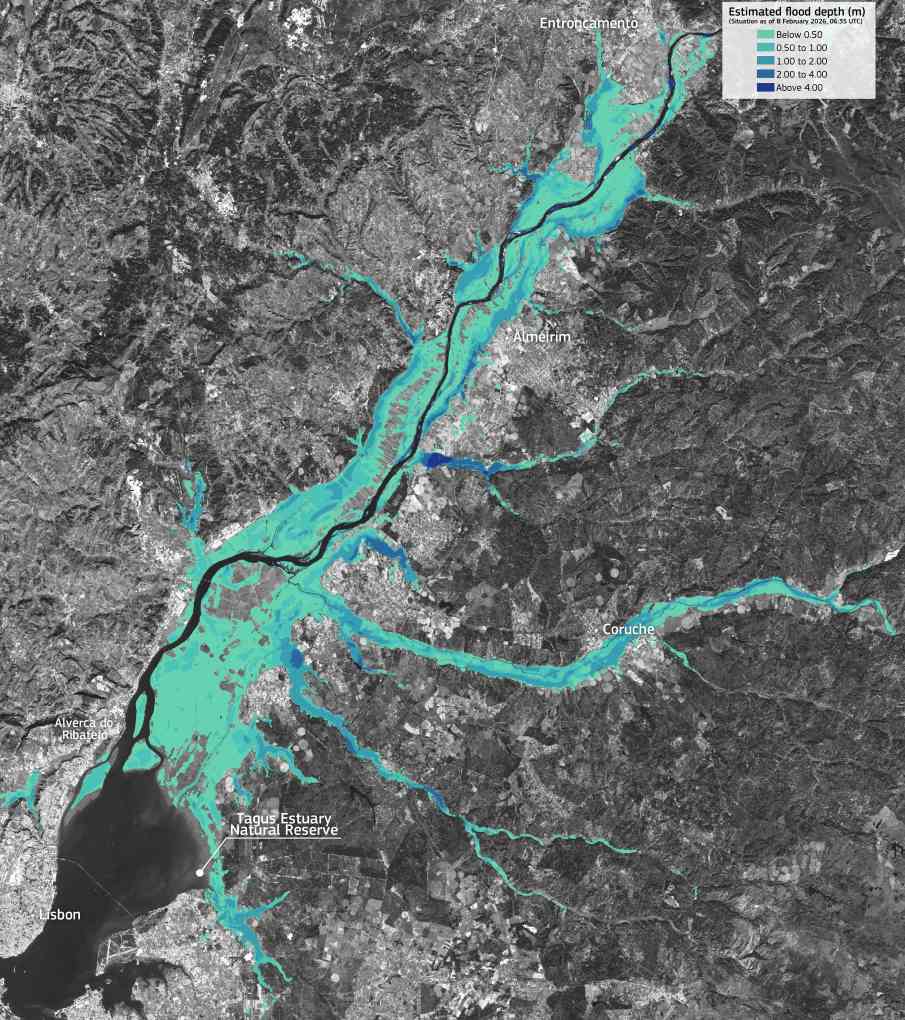
Image of the day: Floodwaters along the Tagus River, Portugal
Full article
Image of the day: Floodwaters along the Tagus River, Portugal
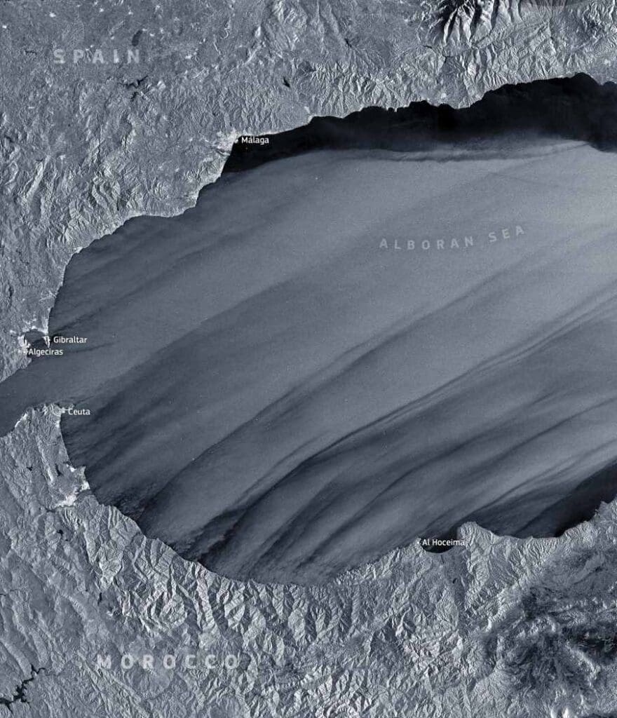
Image of the day: Winds carve Storm Leonardo into the Alboran Sea
Full article
Image of the day: Winds carve Storm Leonardo into the Alboran Sea
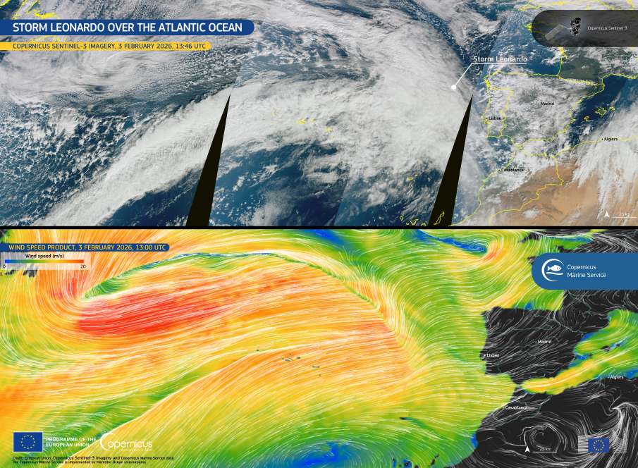
Image of the day: Storm Leonardo advances across the Atlantic toward Iberia
Full article
Image of the day: Storm Leonardo advances across the Atlantic toward Iberia
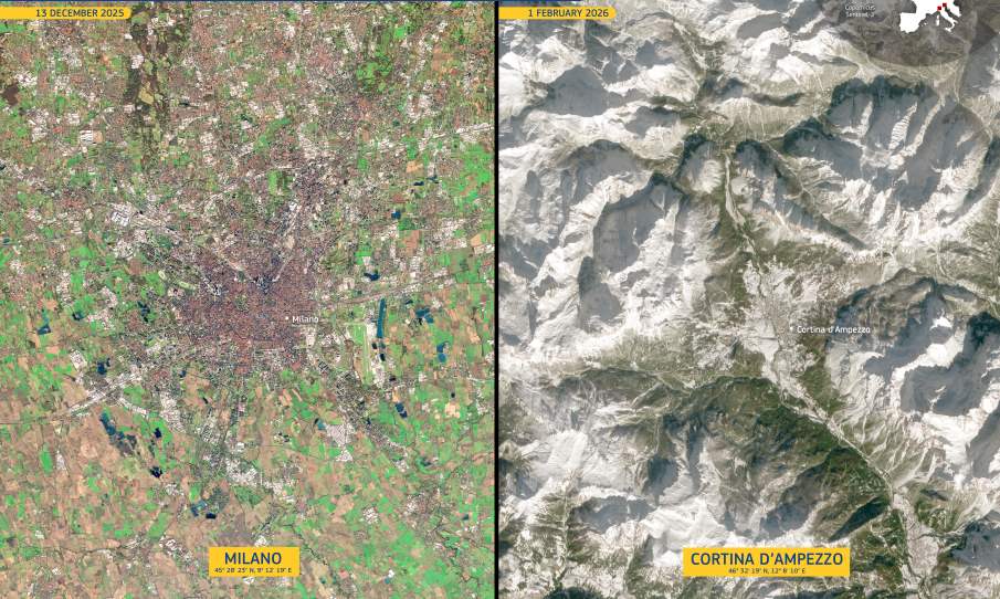
Image of the day: Milano and Cortina ahead of the 2026 Olympic Winter Games
Full article