
ASU–Science prize honors research helping farmers adapt to climate change Full article
ASU–Science prize honors research helping farmers adapt to climate change

Image of the day: Flooding and coastal impacts in Portugal after Storm Kristin Full article
Image of the day: Flooding and coastal impacts in Portugal after Storm Kristin

AI to track icebergs adrift at sea in boon for science
Full article
AI to track icebergs adrift at sea in boon for science

Image of the day: Winter bloom paints Lake Lipno green
Full article
Image of the day: Winter bloom paints Lake Lipno green
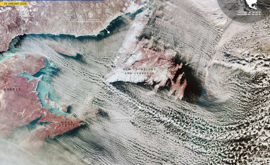
Image of the day: Winter rolls line the Atlantic sky
Full article
Image of the day: Winter rolls line the Atlantic sky
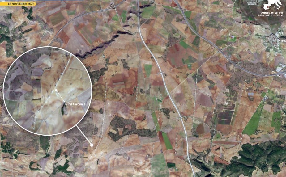
Image of the day: Turbines across Cuenca’s agricultural heartland
Full article
Image of the day: Turbines across Cuenca’s agricultural heartland
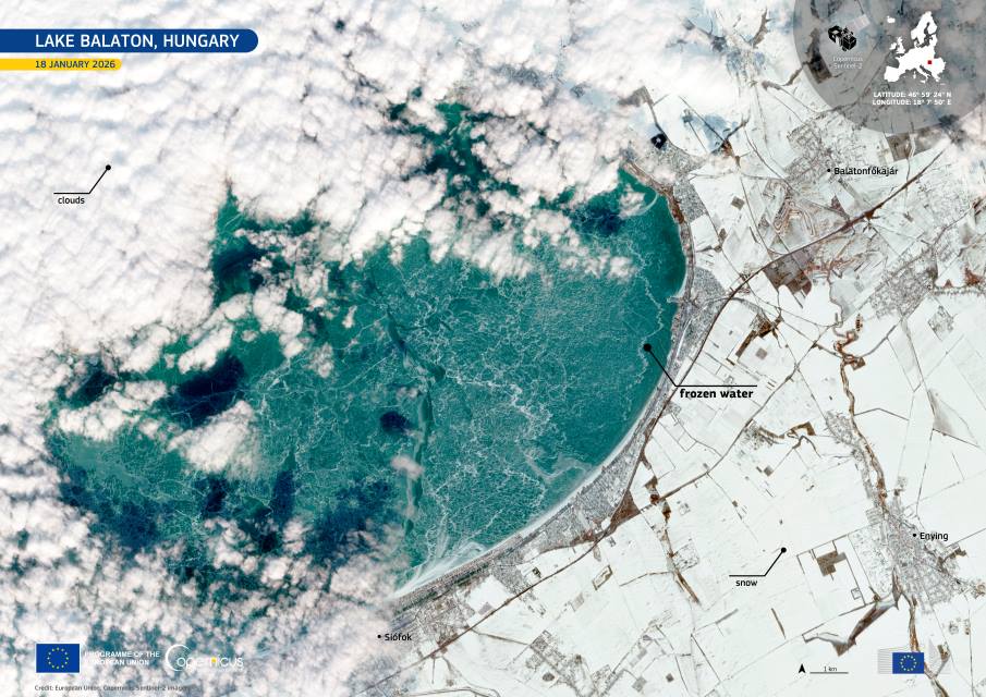
Image of the day: Lake Balaton freezes after nine-year gap
Full article
Image of the day: Lake Balaton freezes after nine-year gap
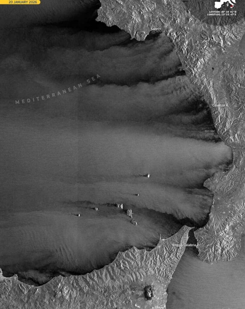
Image of the day: Storm Harry’s wind signature over the Tyrrhenian Sea
Full article
Image of the day: Storm Harry’s wind signature over the Tyrrhenian Sea
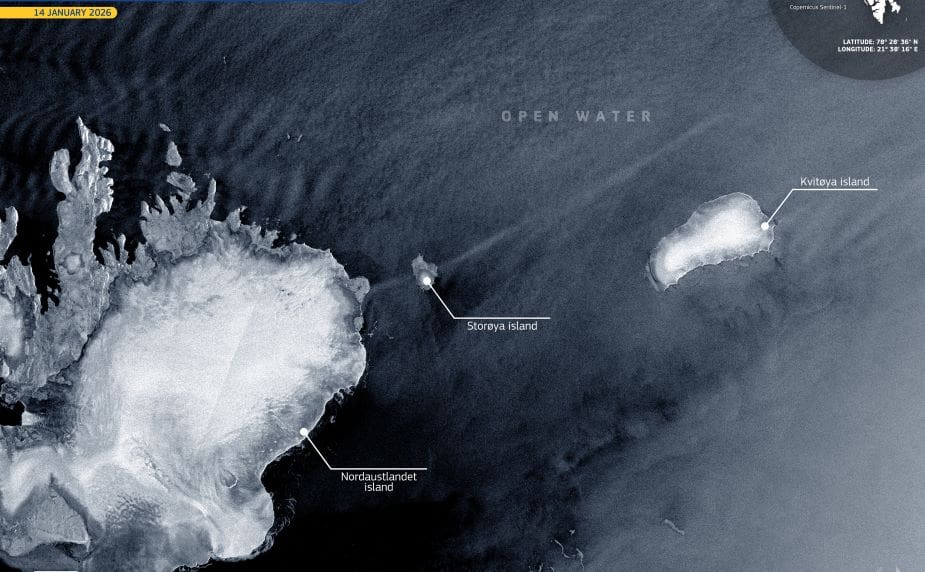
Image of the day: Arctic winter without sea ice near Svalbard
Full article
Image of the day: Arctic winter without sea ice near Svalbard
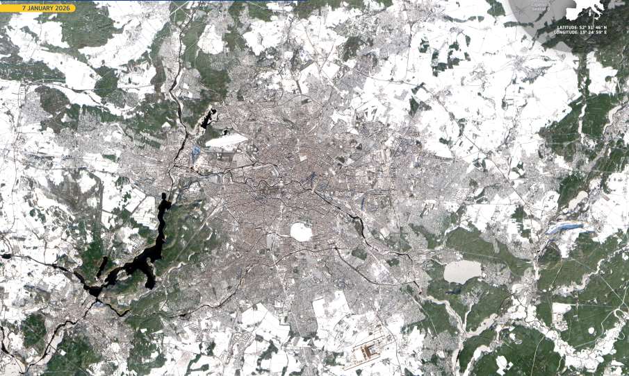
Image of the day: Berlin hosts Green Week’s centenary edition
Full article
Image of the day: Berlin hosts Green Week’s centenary edition
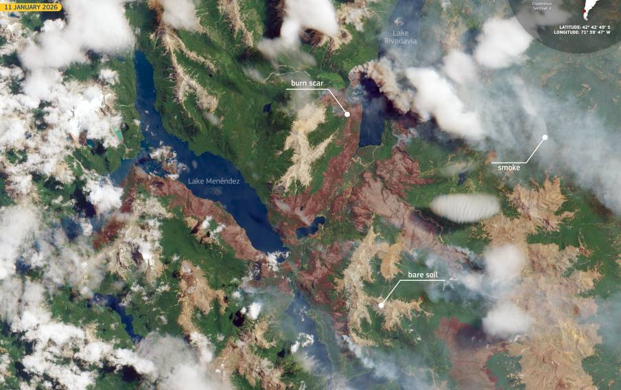
Image of the day: Wildfires advancing across Argentina’s Chubut region
Full article
Image of the day: Wildfires advancing across Argentina’s Chubut region
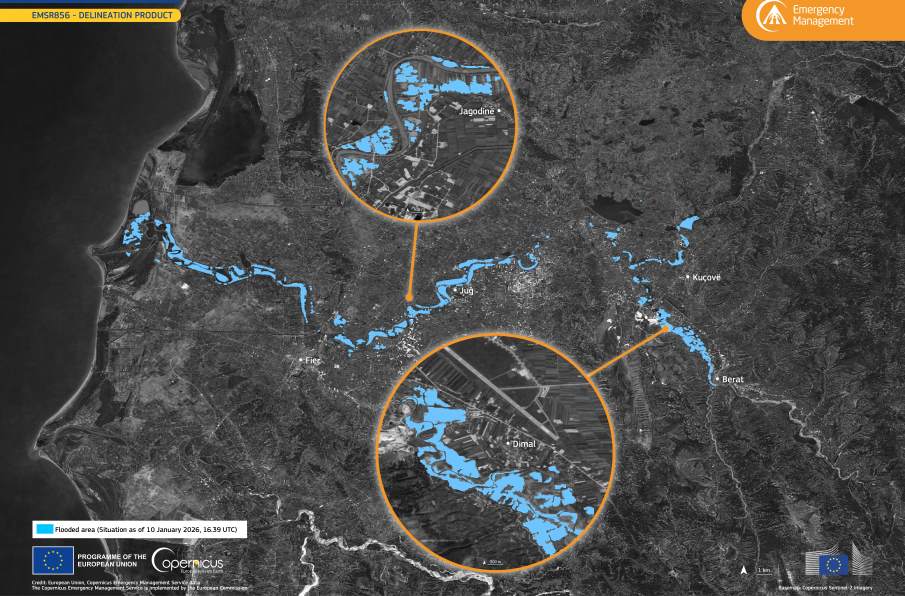
Image of the day: Floods across central and western Albania
Full article
Image of the day: Floods across central and western Albania
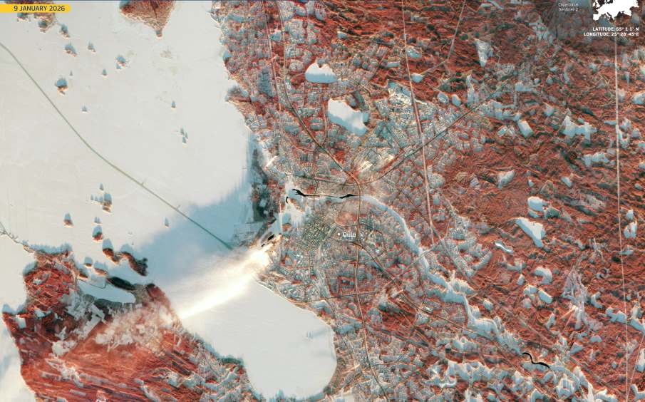
Image of the day: A northern European city at the heart of culture in 2026
Full article
Image of the day: A northern European city at the heart of culture in 2026
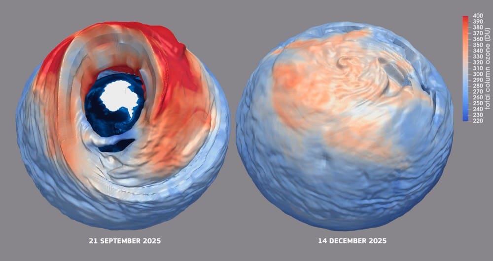
Image of the day: The smallest Antarctic ozone hole in five years
Full article
Image of the day: The smallest Antarctic ozone hole in five years
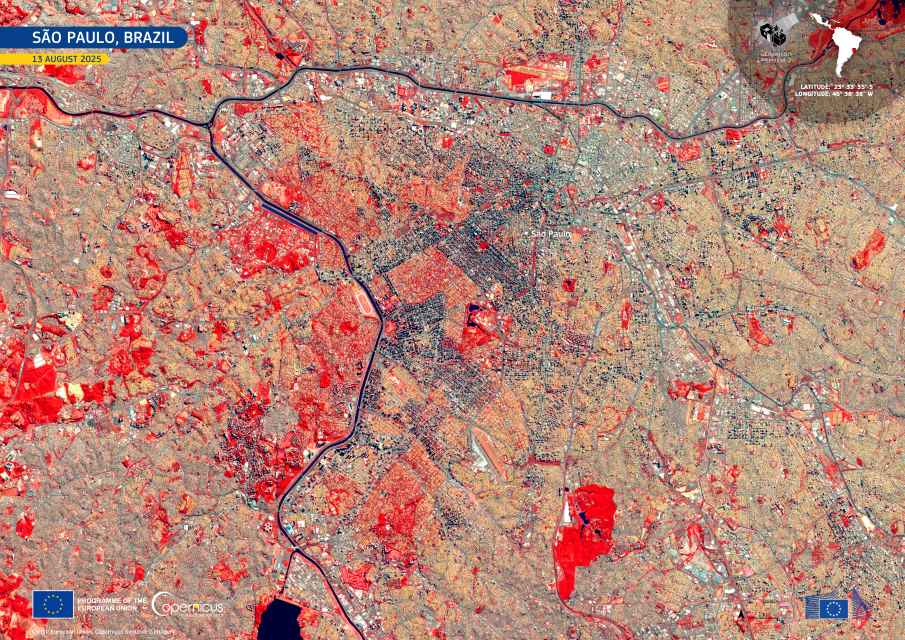
Image of the day: São Paulo, Brazil
Full article
Image of the day: São Paulo, Brazil
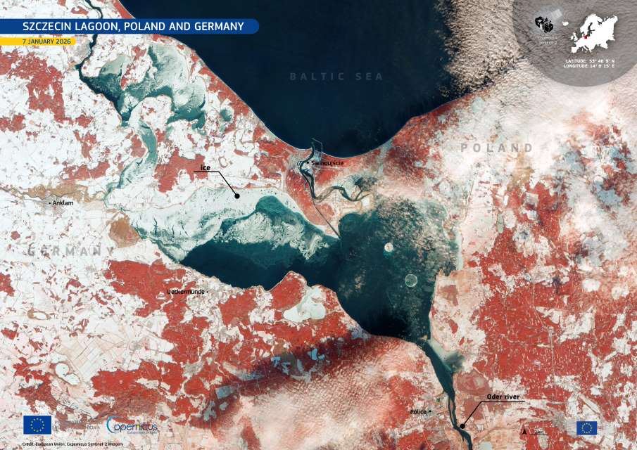
Image of the day: Ice and snow settle over the Szczecin Lagoon
Full article
Image of the day: Ice and snow settle over the Szczecin Lagoon
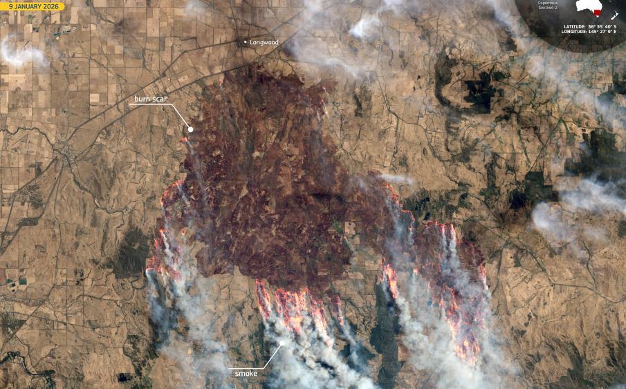
Image of the day: Wildfires scar northern Victoria as emergency deepens
Full article
Image of the day: Wildfires scar northern Victoria as emergency deepens
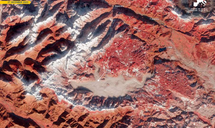
Image of the day: Winter fog and snow shape the Julian Alps in Triglav National Park
Full article
Image of the day: Winter fog and snow shape the Julian Alps in Triglav National Park
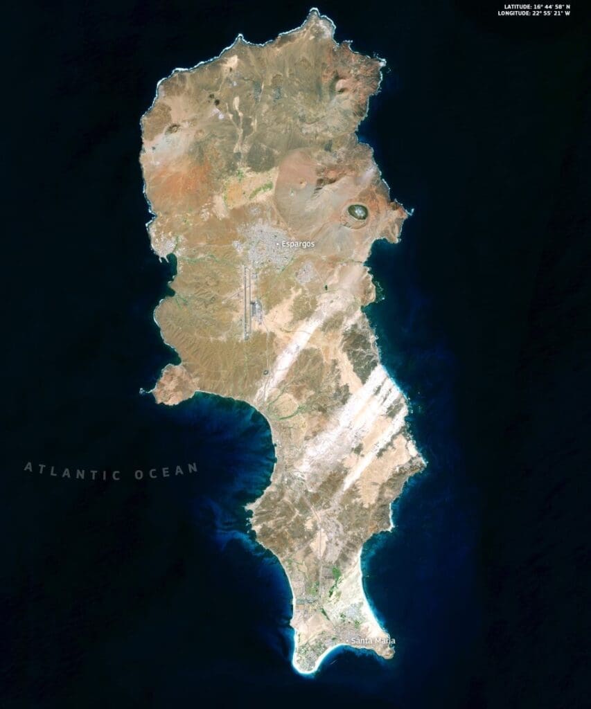
Image of the day: Sal Island, Cape Verde, from orbit
Full article
Image of the day: Sal Island, Cape Verde, from orbit

Image of the day: Flooding along the Aniene River near Tivoli
Full article
Image of the day: Flooding along the Aniene River near Tivoli
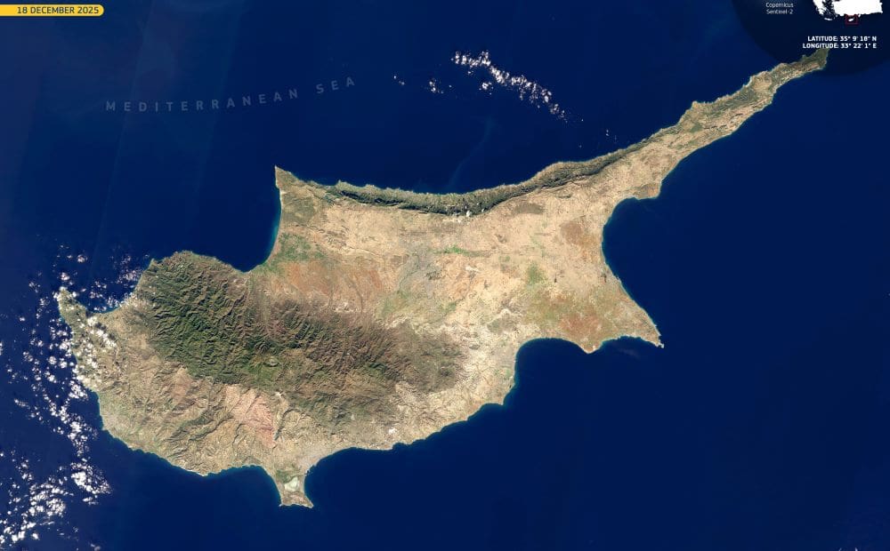
Image of the day: Cyprus seen across the eastern Mediterranean
Full article
Image of the day: Cyprus seen across the eastern Mediterranean
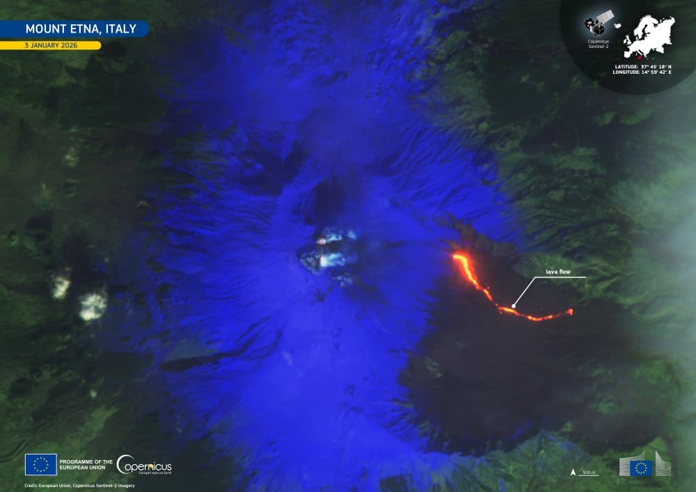
Image of the day: Mount Etna opens 2026 with a new lava flow
Full article
Image of the day: Mount Etna opens 2026 with a new lava flow
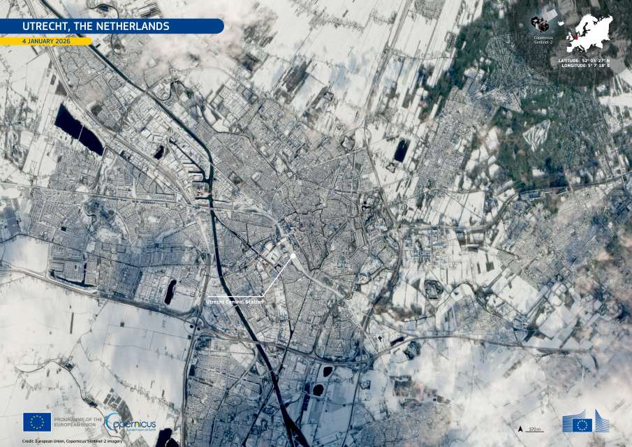
Image of the day: Snow disrupts travel across the Netherlands
Full article
Image of the day: Snow disrupts travel across the Netherlands
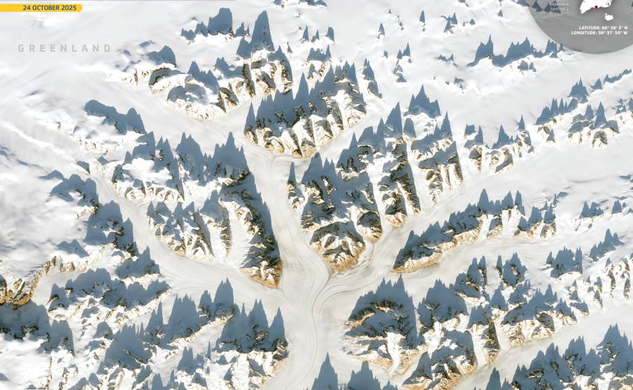
Image of the day: Greenland’s mountains shape glaciers and climate
Full article