Sal Island, Cape Verde, lies in the eastern Atlantic Ocean and is known for its flat, arid terrain shaped by volcanic origins and constant trade winds. With limited rainfall and sparse vegetation, the island presents a stark contrast to some of the greener islands in the archipelago. These environmental conditions have long influenced settlement patterns and economic activity, anchoring daily life to the sea and to carefully managed natural resources.
The wider history of Cape Verde is closely tied to geography. The islands were uninhabited until Portuguese sailors arrived in the 15th century, after which the archipelago became an important stop in transatlantic shipping and the slave trade. Over time, African and European influences blended into a distinct Creole culture, expressed through language, music, and strong diasporic connections. On Sal, periods of isolation, drought, and economic hardship gradually gave way to salt extraction and, later, tourism. Since independence in 1975, the island has developed into one of Cape Verde’s main gateways for international visitors.

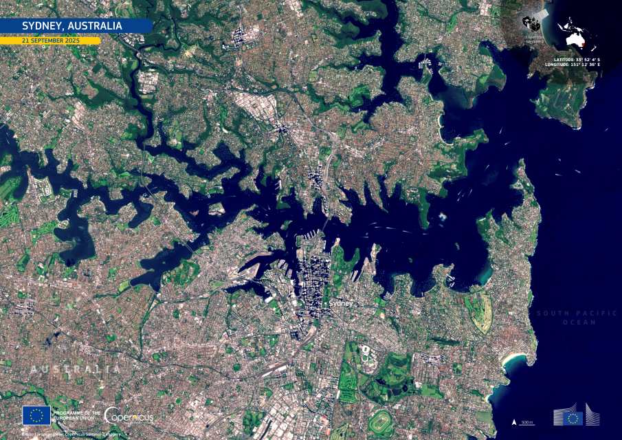
In the image acquired by one of the Copernicus Sentinel-2 satellites on 8 December 2025, Sal’s interior is dominated by beige and light brown tones, revealing sandy expanses and exposed volcanic ground. Vegetation appears only in scattered, muted green patches. Salt flats and shallow coastal waters form pale fringes along parts of the shoreline, while the surrounding Atlantic shows darker blue tones that lighten over reefs and nearshore areas. Urban centres such as Espargos and Santa Maria stand out as compact light-grey clusters against the largely undeveloped landscape.
Sal is also a key site for marine biodiversity. Each summer, thousands of loggerhead sea turtles (Caretta caretta) nest on its beaches, making the island home to Cabo Verde’s second-largest loggerhead rookery. Research indicates that the country accounts for around 15% of global loggerhead nesting. On Sal alone, more than 25,000 nests were recorded in 2023, with counts exceeding 36,500 in 2024.
Copernicus satellite data supports monitoring of land cover, coastal change, and environmental pressure on Sal. For a small, resource-limited island, this information is essential for balancing tourism, conservation, and long-term development.
Featured image credit: European Union, Copernicus Sentinel-2 imagery