Geneva, Switzerland | AFP | Muser NewsDesk
Switzerland’s Federal Institute of Technology Zurich (ETH) university announced the move late last week, saying its researchers had copied around 100 petabytes of NASA data to the Swiss National Supercomputing Centre (CSCS) in the southern city of Lugano.
“The sheer amount is impossible to visualise,” Reto Knutti, professor of climate physics and head of ETH’s Center for Climate Systems Modeling (C2SM), told AFP.
It had taken approximately a year to copy the roughly six billion files, he said — the equivalent of around 20 million feature-length films, in terms of data volume.
And going forward, the researchers are also planning to copy large quantities of datasets from the US National Oceanic and Atmospheric Administration (NOAA).
The datasets, gathered over decades, contain vital information about Earth systems, including greenhouse gases, clouds, precipitation and ice sheets.
They will be used to help train AI models capable of swift and reliable forecasting in areas like weather, climate and natural hazards.

US cuts
Though it was not the main driver for the move, the researchers said their mission was partly motivated by concern over the impact of dramatic US funding cuts for the scientific community.
ETH professor and former NASA chief scientist Thomas Zurbuchen, who initiated the data transfer, highlighted in a statement the key role the United States had played in Earth observation for decades.
Without the extensive measurement programmes run by NASA and NOAA, the world “would know far less about our planet today”, he said.
But since his return to office last year, US President Donald Trump has pursued deep cuts to federal climate science and Earth-observation funding, including programmes that contribute data to international monitoring networks.
Knutti pointed out that “so far, the US has not restricted access to the data”.
“But we also know that decisions in the US administration are sometimes quick, and not completely obvious.”
All the data copied so far had been publicly available, he stressed.
“It’s not a secret.”
Add Muser Press as a preferred Google source
With only one click, you can select which sources you want to see prioritized in your Google search. This allows you to quickly see what’s truly relevant to you. Select Muser Press as a preferred source on Google now.
Data is ‘gold’
“Data is the new gold,” Knutti said.
He pointed out that data-driven forecasting models — known as foundation models — were already beating the traditional models, which use mathematical equations to simulate the complex processes taking place in the oceans and atmosphere.
“Some of the foundation models are getting really, really good in terms of prediction skill,” Knutti said, adding that they could also be “1,000 times faster than the physics-based models”.
Instead of the hours it traditionally took, “you can run a global weather forecast for multiple days — the whole globe — in a minute or so”, he said.
Speeding up the process can be life-saving, with such forecasts being essential for everything from agriculture and hydropower to protecting people from natural hazards like floods, storms and landslides.
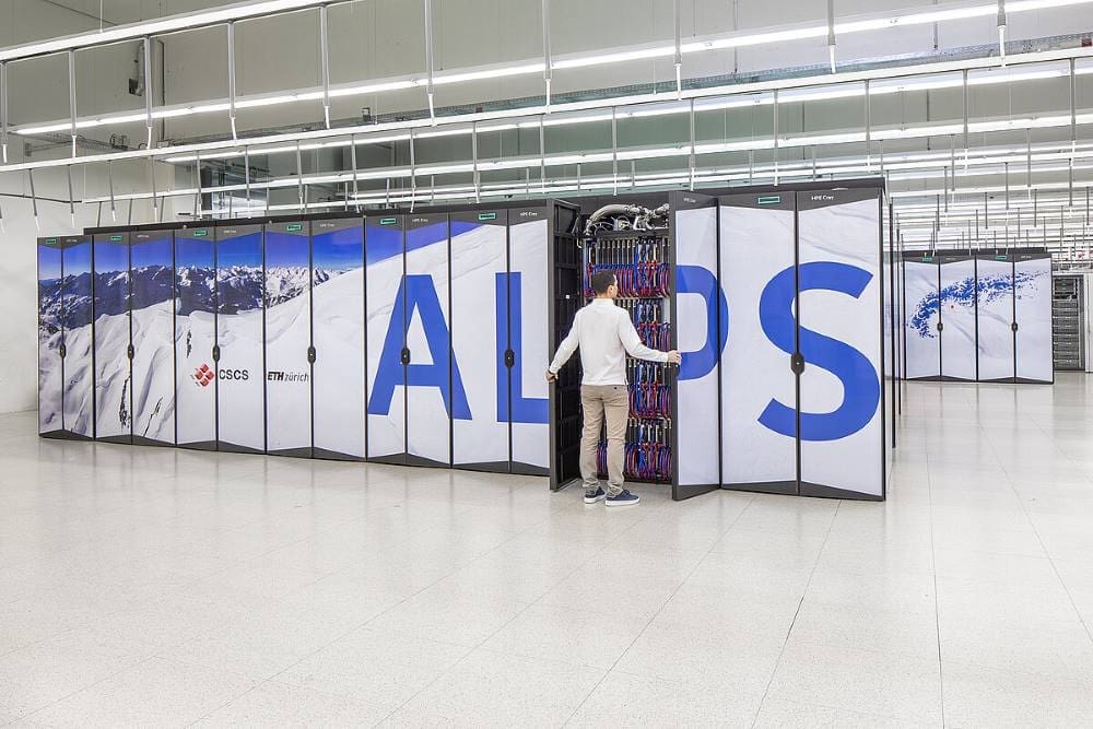
The copied data is being stored in the massive data storage facilities at the CSCS, which is also home to Alps, one of the world’s most powerful supercomputers.
Read also: Machine learning tool boosts climate model accuracy for extreme events
ETH said the aim was to closely integrate the massive trove of data with the giant computing power of Alps to ensure researchers can analyse it using AI-based methods, in addition to training new AI models.
“It’s going to be a heavy job,” Knutti acknowledged, but insisted it was well worth the effort.
“If we collect so much data and nobody is able to make sense of it, then that’s kind of a waste of resources.”
The massive computing power could make it easier to monitor the impacts of climate change over time and make more accurate predictions going forward.
With the new advances in AI and machine learning-based tools “on the computing side, plus the availability of data, we can be faster, more efficient in recognising important patterns”, Knutti said.
nl/rjm/rlp
© Agence France-Presse
Article Source:
Press Release/Material by Nina Larson | AFP
Featured image credit: Marco Abram | CSCS | CC BY-SA